

Typhoon Soudelor becomes world's most powerful storm as it trashes through Northern Marianas. Posted Super Typhoon Soudelor developed into the world's most powerful storm of the year as it took aim at Japan, Taiwan and China after trashing the Northern Marianas.
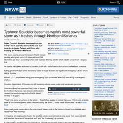
The storm roared across the western Pacific Ocean packing wind gusts up to 220 miles per hour (354 kilometres per hour), according to the Joint Typhoon Warning Centre which rated it a maximum category five. No deaths have been attributed to Soudelor, but it left a trail of destruction across the Northern Marianas. Acting governor Ralph Torres declared a "state of major disaster and significant emergency" after it struck late on Sunday.
At least 1,500 people were being given emergency food assistance while 500 were living in emergency shelters. Soudelor ripped roofs off houses and left residents without power, water and wastewater services. Cyclone in July: Weather bureau declares Raquel poses no threat to Queensland. By Andree Withey Updated Queensland forecasters have named Raquel as their first ever recorded July cyclone, which has formed this morning north of the Solomon Islands.
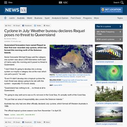
Senior forecaster Michael Knepp said the category one system was about 2,000 kilometres north-east of Cairns early this morning and it posed no threat to Queensland. "I don't think it's going to develop into a strong system so maybe a category two at the max which can pull a punch," he said. "Even if it didn't develop into a tropical cyclone the main threat was always going to be rain with this system - especially if it moves slowly. "Queensland has nothing to do ... no threat at all to Queensland. Explainer: the wild storms that lash Australia's east coast. Over the past 24 hours, the Sydney, Central Coast, and Hunter regions of New South Wales have experienced very heavy rain, gale-force winds with gusts over 100 km per hour, and waves of more than 10 m in height.
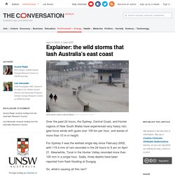
For Sydney it was the wettest single day since February 2002, with 119.4 mm of rain recorded in the 24 hours to 9 am on April 21. Meanwhile, Tocal in the Hunter Valley recorded more than 100 mm in a single hour. Sydney weather: storms, heavy rain and winds pound NSW for third day. NSW wild weather: Residents warned of flood threat in Hunter, parts of Sydney after storms kill three people in Dungog. Updated New South Wales authorities say they are dealing with the largest storm operation in a decade after three people were killed in "cyclonic" conditions that have battered parts of the state for hours.
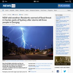
Residents in the Hunter region were told to brace for more flash flooding overnight, while authorities door-knocked some Sydney residents to warn they may need to evacuate. Conditions described as "cyclonic" have wrought havoc on the Hunter, Sydney, Central Coast and Illawarra regions, with rescue crews called to more than 1,000 storm-related incidents and more than 200,000 properties losing power.
Behind the News - 17/02/2009: Queensland Floods. While Victorians try to rebuild their lives after the fires, Queenslanders are cleaning up after a natural disaster left parts of their state underwater.

It's the wet season in the north of Australia so cyclones and monsoonal rain are expected, but not this bad. It's the worst floods in the region's history. Catherine finds out more and takes a look at how floods happen. CATHERINE ELLIS, REPORTING: The rain started falling on the first of January and just kept coming. Eventually more than half the state was affected by floods- an area the size of South Australia! Whole towns were swamped, major roads blocked, homes, businesses and farms destroyed and animals killed. Queensland floods 2009 - ABC Wide Bay Qld - Australian Broadcasting Corporation. Floods: 10 of the deadliest in Australian history. THE DEVASTATING NATURE OF recent floods in Australia have meant that they often hit the headlines.
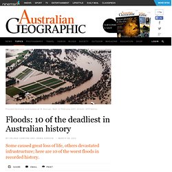
While Australia is described as the driest inhabited continent on Earth, right now it might seem hard to believe. Between 1852 and 2011, at least 951 people were killed by floods, another 1326 were injured, and the cost of damage reached an estimated $4.76 billion dollars. Floods can devastate local communities, but they also impact the entire economy - examples include the flood levy imposed in taxes following the south-east Queensland floods in 2010/2011, and also inflated banana prices after the same floods destroyed 75 per cent of the crop. Professor Jonathan Nott, a palaeohazards expert at James Cook University in Cairns, says part of the problem is that we "continue to build in the path of floods," regardless of history, and allow populations to increase in low-lying floodplains. Hurricane forecast accuracy is improving, but don't overly focus on the skinny black line.
This article is part of The Conversation’s series this month on hurricanes.
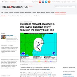
You can read the rest of the series here. “Don’t focus on the skinny black line” was the trademark admonition of former National Hurricane Center (NHC) director Max Mayfield dating back to the 1990s. It’s advice that media and residents of southwest Florida would have done well to heed when Hurricane Charley crossed Cuba in August 2004. Too much attention was paid to a track forecast depicting landfall near Tampa, and too few appreciated that Port Charlotte, only 70 miles to the south, was also under a hurricane warning. Although tropical cyclone forecasts had improved dramatically over the years, they were still far from perfect, as residents of Port Charlotte would soon find out. Click to enlarge.