

658996?Search=yes&resultItemClick=true&searchText=stone&searchText=man&searchText=cave&searchUri=/action/doBasicSearch?Query=stone+man+cave&filter=iid%3A10. Accept Terms and Conditions on JSTOR. John C. Merriam. Born in 1869 in Hopkinson, Iowa, John C.

Merriam started his paleontological career in the usual way, collecting the fossils found near his home — specifically, Paleozoic invertebrates. He received a bachelor's degree from Lenox College in Iowa, and then came to the University of California to study geology and botany. As was usual for American scientists at the time, he finished his education in Europe, studying under the famous paleontologist Karl von Zittel in Munich. The Exploration of the Potter Creek Cave - William John Sinclair - Google Books. Travelin' in Time: Samwel Cave has cultural significance. By Dottie Smith Contributing Writer.
Fsm9 008571. Cavern%20Geology%20Lesson%20Plan%201. Caving In: How Bill Steele Follows His Passion for Going Underground — Blueprint Earth. There are many ways that people make critical contributions to science.
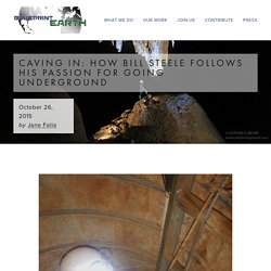
One is having the courage to explore places that aren’t easy to get to. Another is to understand how to round up the right people to do the work, acquire the funding, organize the expeditions, and then share the information in a way that is meaningful. Bill Steele is one such contributor. A lifelong cave explorer, he has traveled throughout the United States and to Mexico, Belize, Guatemala, and China over the last 50 years. He has written two books chronicling his explorations: Yochib: The River Cave and Huautla: Thirty Years in One of the World’s Deepest Caves. We were interested in hearing about Steele’s passion for cave exploring and learning more about caves as an important piece of our planet’s puzzle. Why caves? I entered my first cave at age 4; it’s my first distinct memory.
Viewcontent. Caving - Steve Boga. Cave_Air_Basics.pdf. Travelin' in Time: George Silverthorne, pioneer - Redding. George W.
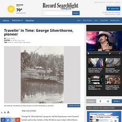
Silverthorne's property and his businesses were located beside and in the vicinity of the Pit River near today's Silverthorn Resort. The International Portal for Researchers in the field of Karst and Cave with Speleogenesis and Evolution of Karst Aquifers in it's core. Viewcontent. RECENT CAVE EXPLORATION IN CALIFORNIA1 - MERRIAM - 2009 - American Anthropologist. Report.pdf. Proceedings.11Sundahl.pdf. An Acidophilic Bacterial-Archaeal-Fungal Ecosystem Linked to Formation of Ferruginous Crusts and Stalactites - Geomicrobiology Journal - Volume 31, Issue 5. Kartchner Caverns Microbial Observatory Research,Non- Culture-Based Research, The University of Arizona. Research Intra-speleothem Variability To examine intra-speleothem variability in bacterial community structure, three stalactites were chosen as sampling objects in an undisturbed area of the cave.
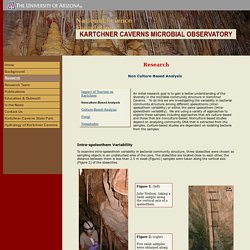
The stalactites are located close to each other, the distance between them is less than 2.5 m swab (Figure1) samples were taken along the vertical axis (Figure 2) of the stalactites. Total community genomic DNA was extracted from the different samples. The 16S rRNA gene was amplified using polymerase chain reaction (PCR)( link to PCR graphic). The DGGE profiles that we obtain from Kartchner samples are analyzed using software called Quantity One ® . An analysis of DGGE profiles from two stalactites shows that bacterial community structure profiles taken along the length of a stalactite are more similar to each other then to community profiles from different stalactites (see figure 3).
Figure 4. The gel shows the microbial community profiles on the F, W, and H formations. Www.climategeology.ethz.ch/publications/2006_Baskar_et_al.pdf. Www.im.microbios.org/09march00/06 Laiz.pdf. 12-08-15 SLB.pdf. The International Portal for Researchers in the field of Karst and Cave with Speleogenesis and Evolution of Karst Aquifers in it's core. Caves, caverns appeal to story tellers. Shasta Caverns 50th Anniversary photo essay: A look back. Pubs.usgs.gov/wri/1982/4081/report. Bureau of Reclamation Historic Dams and Water Projects. Northern California’s Shasta Dam is a keystone of the Bureau of Reclamation’s huge Central Valley Project, which involves 35 of California's counties and two major watersheds: those of the Sacramento River on the north and the San Joaquin River on the south.
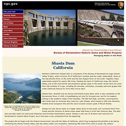
Together, these watersheds extend for nearly 500 miles, feeding the heart of California’s long, flat Central Valley, one of the most fertile and productive garden spots in the world. Grown here are more than 250 varieties of crops, including the almonds, artichokes, avocados and wine grapes that make California famous for more than movie stars.
Shasta Dam, dwarfed only by Hoover and Grand Coulee dams when it was completed on the Sacramento River in 1945, is breathtaking not only for its great size, but for its majestic setting in the southern range of the Cascades. Tapping these primary rivers and their many tributaries for irrigation began in earnest in the 1850s when private interests built canals to serve areas near the rivers. United States Google Satellite Maps. Original name: Shasta Lakegeographical location: Shasta County, California, United States, North Americageographical coordinates: 40° 40' 50" North, 122° 22' 11" West detailed map of Shasta Lake and near places Welcome to the Shasta Lake google satellite map!
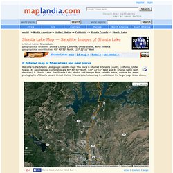
This place is situated in Shasta County, California, United States, its geographical coordinates are 40° 40' 50" North, 122° 22' 11" West and its original name (with diacritics) is Shasta Lake. See Shasta Lake photos and images from satellite below, explore the aerial photographs of Shasta Lake in United States. Wayback Machine, Shasta Caverns, Ca 1991.
Natural Air Conditioner at Shasta Caverns. Www.shastalake.net/pdf/SpelunkersGuidetoSamwelCave.pdf.
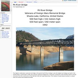
Lake Shasta CA History & Area. Cave Geology. Pit River Bridge - HighestBridges.com. From HighestBridges.com Pit River Bridge Veterans of Foreign Wars Memorial Bridge Shasta Lake, California, United States 500 feet high / 152 meters high 630 foot span / 192 meter span 1942.
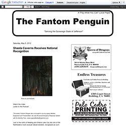
Lake Shasta Caverns. The Fantom Penguin: Shasta Caverns Receives National Recognition. Just to the north of Redding and Shasta Lake City lies one of the Northstate’s most unusual natural wonders, recognized as such recently by the National Park Service.
YellowBook - VideoScapes. Shasta Caverns. The Pittsburgh Press - Google News Archive Search. Eugene Register-Guard - Google News Archive Search. Lake Shasta Caverns. The Lake Shasta Caverns are a network of caves located near the McCloud arm of Shasta Lake in California.
It was formerly named Chalk Cave and Baird Cave, named after Spencer Fullerton Baird. History[edit] The caverns are dated at least 200 million years, and were formed by flowing water. Over the years this water drained leaving the caverns seen today. The caves are made entirely of limestone, and feature every type of possible formation, including stalactites, stalagmites, soda straws, columns, and flowstone. Until 1964, Lake Shasta Caverns were seen each year by only a handful of hardy spelunkers who inched their way through steep, restricted natural fissures to view its startling formations. Blogs: Dottie Smith's blog. Lake Shasta Caverns – 45 years of Public Service, Millions of Years in the Making.
Bruce and I took a journey to Lake Shasta Caverns last month in Lakehead after we accepted an invitation to attend media day by Matt Doyle, the Caverns general manager. Sad for the Caverns, Bruce and I were the only media folks who showed up. Lucky for us we got a private tour. Caverns.pdf. Lake Shasta Caverns - Lakehead.