

El Nino and Predictions for the Winter - Growing Wisdom. Many of you have heard there is going to be an El Nino developing later this fall and continuing through winter.

This meteorological phenomenon is somewhat predictable and will impact on not only our weather, but weather around the world. Simply put, El Nino is warmer than average water temperatures off the coast of South America, west of Peru. When El Niño isn’t occurring, the trade winds blow in a westerly direction along the equator. You might not realize it, but these winds pile up warm surface water in the western Pacific, so the sea surface is as much as 18 inches higher in the western Pacific than in the eastern. You can learn more by watching this video from NOAA. Tropical Depression Beryl Spins Inland. Beryl Forecast Path Beryl became a post-tropical cyclone late Wednesday as it began to move east off the coast of North Carolina.
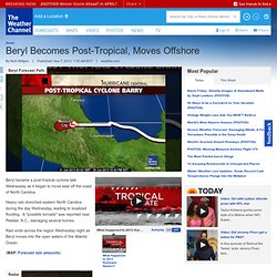
Heavy rain drenched eastern North Carolina during the day Wednesday, leading to localized flooding. A "possible tornado" was reported near Peletier, N.C., damaging several homes. Rain ends across the region Wednesday night as Beryl moves into the open waters of the Atlantic Ocean. (MAP: Forecast rain amounts) Radar. First tropical storm of season forms in Atlantic - Weather Wisdom. Alberto is this years first tropical storm and radar is already picking up some rain off the southeast coast.
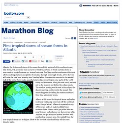
(image below). Alberto is expected to stay off the coast and not make landfall. Some moisture from Alberto could get pulled into our area Monday and enhance our showers just a bit. Anytime you get a tropical system involved with another low pressure area, the rainfall from the non-tropical storm can be higher. Most of the heaviest rain should stay off the coast Monday night.
Marketing vs. science While listening to one of the morning talk shows today, I heard the on-air weather person mention how early it was for a tropical system to form. Take a look at the chart below, tropical systems have formed in the Atlantic basin in every month of the year, at some point, since 1851. So, what's my point? Back to the weather Ok, I am stepping off my soap box now to let you know the rest of the day will be mainly sunny and warm. Why The Weather Channel is Naming Winter Storms. During the upcoming 2012-13 winter season The Weather Channel will name noteworthy winter storms.
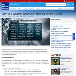
Our goal is to better communicate the threat and the timing of the significant impacts that accompany these events. The fact is, a storm with a name is easier to follow, which will mean fewer surprises and more preparation. Naming Winter Storms Hurricanes and tropical storms have been given names since the 1940s. In the late 1800s, tropical systems near Australia were named as well. Naming a storm raises awareness.Attaching a name makes it much easier to follow a weather system’s progress.A storm with a name takes on a personality all its own, which adds to awareness.In today’s social media world, a name makes it much easier to reference in communication.A named storm is easier to remember and refer to in the future.
(MORE: Check Out the New Storm Names for the 2012-2013 Season) The question then begs to ask “Why aren’t winter storms named?” Tom Niziol. Climate Impacts in the Northeast. Key Points More frequent heat waves in the Northeast are expected to increasingly threaten human health through heat stress and by affecting air pollution.
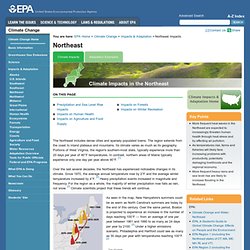
As temperatures rise, farms and fisheries will likely face increasing problems with productivity, potentially damaging livelihoods and the regional economy. More frequent heavy rains and sea level rise are likely to increase flooding in the Northeast. Related Links Other: The Northeast includes dense cities and sparsely populated towns. Over the last several decades, the Northeast has experienced noticeable changes in its climate. As seen in the map, New Hampshire's summers could be as warm as North Carolina's summers are today by the end of this century. Top of page Precipitation and Sea Level Rise Impacts Overall, the amount of precipitation throughout the Northeast is projected to increase.
For more information on climate change impacts on coastal resources, please visit the Coastal page. Impacts on Human Health Impacts on Forests. Page - Chautauqua Lake Central SD. First, you will need to print out the Weather WebQuest note-taking sheet.
Click on here to open this form. The file will open in a new window. You will take notes directly on this form as you explore the links for each category. The final part of this project is to complete a weather PowerPoint presentation. You will complete a presentation containing seven slides.