
Archipelagos and Island Groups of French Polynesia. Geography of French Polynesia. This article describes the geography of French Polynesia.
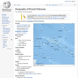
Map of French Polynesia Location Oceania, archipelago in the South Pacific Ocean, about half way between South America and Australia Geographic coordinates. French Polynesia. French Polynesia ( i/ˈfrɛntʃ pɒlɨˈniːʒə/; French: Polynésie française, pronounced: [pɔlinezi fʁɑ̃sɛz]; Tahitian: Pōrīnetia Farāni) is an overseas country (pays d'outre-mer) of the French Republic.
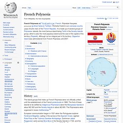
It is made up of several groups of Polynesian islands, the most famous island being Tahiti in the Society Islands group, which is also the most populous island and the seat of the capital of the territory (Papeetē). Although not an integral part of its territory, Clipperton Island was administered from French Polynesia until 2007. History[edit] The island groups that make up French Polynesia were not officially united until the establishment of the French protectorate in 1889.