

HAARP. Floods in eastern Pakistan. Solar eclipse tip: Journey to Path of Totality, or go online. Photo: Travis Heying / Associated Press This picture taken on November 3, 2013 shows a rare hybrid solar eclipse through clouds from the Canary Island of Tenerife.

A rare solar eclipse swept across parts of Africa, Europe and the United States today as the moon blocks the sun either fully or partially, depending on the location. The width of the shadow of the eclipse was 58 km and the maximum duration of totality, the maximum time that the moon covered the sun completely, was 1m 40s, on the Spanish Canary island of Tenerife. AFP PHOTO/ DESIREE MARTINDESIREE MARTIN/AFP/Getty Images Photo: DESIREE MARTIN, Getty A partial solar eclipse is seen in a break in the clouds from Wichita, Kan., on Oct. 23, 2014. A partial solar eclipse is seen in a break in the clouds from... The Path of Totality, seen here, is the area where a total solar eclipse will be visible early Friday. Photo: Courtesy / NASA.
Hubble space telescope captures new shot of Pillars of Creation. The Hubble space telescope has captured an incredible new hi-def version of its most iconic photo – the Pillars of Creation, showing three light-year-long columns of cold gas in a distant galaxy bathed in the light of a cluster of young, massive stars.
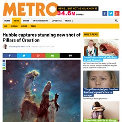
The original image, shot in 1995, became a cult hit, and has appeared in films and TV shows, as well as being made into T-shirts, pillows and postage stamps. The new image shows how the dust cloud has changed in nearly two decades, as well as offering a sharper definition (courtesy of upgrades Hubble has received in the past two decades) and a wider view. Hubble also shot a ‘bonus’ image in infrared – allowing a peek inside the famous pillars of gas and dust, showing newborn stars being ‘born’ inside.
H.A.A.R.P. pearls. H.A.A.R.P. Remote sensing. Remote sensing is the acquisition of information about an object or phenomenon without making physical contact with the object and thus in contrast to in situ observation.
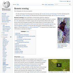
In modern usage, the term generally refers to the use of aerial sensor technologies to detect and classify objects on Earth (both on the surface, and in the atmosphere and oceans) by means of propagated signals (e.g. electromagnetic radiation). It may be split into active remote sensing, when a signal is first emitted from aircraft or satellites)[1][2] or passive (e.g. sunlight) when information is merely recorded.[3] Overview[edit] Passive sensors detect natural radiation that is emitted or reflected by the object or surrounding areas. Reflected sunlight is the most common source of radiation measured by passive sensors. Illustration of Remote Sensing Remote sensing makes it possible to collect data on dangerous or inaccessible areas. Data acquisition techniques[edit] Applications of remote sensing data[edit]
= Telerilevamento. Da Wikipedia, l'enciclopedia libera.
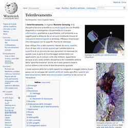
Il telerilevamento, in inglese Remote Sensing, è la disciplina tecnico-scientifica o scienza applicata con finalità diagnostico-investigative che permette di ricavare informazioni, qualitative e quantitative, sull'ambiente e su oggetti posti a distanza da un sensore mediante misure di radiazione elettromagnetica (emessa, riflessa o trasmessa) che interagisce con le superfici fisiche di interesse. L'osservazione della terra dallo spazio ha viaggiato e viaggia tuttora di pari passo con lo sviluppo dei satelliti artificiali (nello specifico i satelliti per telerilevamento), delle telecomunicazioni satellitari e dei sensori di rilevazione. Space colonization. Space colonization (also called space settlement, or extraterrestrial colonization) is permanent human habitation that is not on Earth.
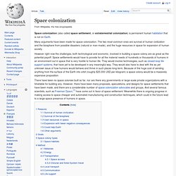
Many arguments have been made for space colonization. The two most common ones are survival of human civilization and the biosphere from possible disasters (natural or man-made), and the huge resources in space for expansion of human society. However right now the challenges, both technological and economic, involved in building a space colony are as great as the potential payoff. Space settlements would have to provide for all the material needs of hundreds or thousands of humans in an environment out in space that is very hostile to human life. Commercialization of space. History[edit] The first commercial use of satellites may have been the Telstar 1 satellite, launched in 1962, which was the first privately sponsored space launch, funded by AT&T and Bell Telephone Laboratories.
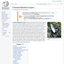
Telstar 1 was capable of relaying television signals across the Atlantic Ocean, and was the first satellite to transmit live television, telephone, fax, and other data signals.[2][3] Two years later, the Hughes Aircraft Company developed the Syncom 3 satellite, a geosynchronous communications satellite, leased to the Department of Defense. Commercial possibilities of satellites were further realized when the Syncom 3, orbiting near the International Date Line, was used to telecast the 1964 Olympic Games from Tokyo to the United States.[4][5] Between 1960 and 1966, NASA launched a series of early weather satellites known as Television Infrared Observation Satellites (TIROS).
Subscription satellite services[edit] Transponder leasing[edit] Space law. Space law is an area of the law that encompasses national and international law governing activities in outer space.
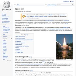
International lawyers have been unable to agree on a uniform definition of the term "outer space", although most lawyers agree that outer space generally begins at the lowest altitude above sea level at which objects can orbit the Earth, approximately 100 km (60 mi). The inception of the field of space law began with the launch of the world's first artificial satellite by the Soviet Union in October 1957.
Hyperlink. Space exploration. Saturn V rocket, used for the American manned lunar landing missions The Moon as seen in a digitally processed image from data collected during a spacecraft flyby While the observation of objects in space, known as astronomy, predates reliable recorded history, it was the development of large and relatively efficient rockets during the early 20th century that allowed physical space exploration to become a reality. Common rationales for exploring space include advancing scientific research, uniting different nations, ensuring the future survival of humanity and developing military and strategic advantages against other countries.
Space exploration has often been used as a proxy competition for geopolitical rivalries such as the Cold War. Meteora di Čeljabinsk. Da Wikipedia, l'enciclopedia libera.
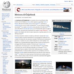
La meteora di Čeljabinsk è un evento che si è verificato nella mattina del 15 febbraio 2013, nella regione a sud degli Urali, in Russia, alle ore 9:13 locali, UTC+6 (3:13 UTC)[2][3], quando un meteoroide di circa 15 metri di diametro[4] e una massa di 10.000 tonnellate[4] ha colpito l'atmosfera alla velocità di 54.000 km/h[5][6], circa 44 volte la velocità del suono, e si è frantumato sopra la città di Čeljabinsk. Una parte dei frammenti ha colpito il lago Čebarkul'[7], dal quale il 16 ottobre del 2013 è stato ripescato un grosso pezzo di circa 300 kg di peso[8].
Libri interessanti, Astronomia & Spazio.
SPACE on Y. SPACE. Sergedemontreal. Friends & links W0W0W0W. Space videos. Solar System Scope. Cool stuff. Tempo & Spazio. What Is the Rhyme to Remember the Planets - Ask.com - Cyberfox. Alt 9 planets rhyme. “The Scale Of The Universe 2″ Animation Made By 14-Year-Olds Is Mind Blowing. The "Scale Of The Universe 2" is an awesome Flash animation packed with info.
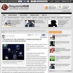
*UPDATE: Cary Huang, creator of “Scale Of The Universe 2″, answers some questions for the Hub. See his comments below.* An interactive Flash animation titled “Scale Of The Universe 2“, covering everything in the universe from the fabric of space-time to the estimated size of the universe, was posted earlier this year, and it is awesome.
While it is an incredible personal feat for the twins, the animation is also a testament to the creative and educational possibilities afforded by modern technology, and all the implications that that means for parents, educators, and publishers. To get a sense of how cool “Scale Of The Universe 2″ is, check out the YouTube video that shows off the animation:
Vita extra-_-terrestre ?!? Margherita Hack prende le distanze dal CICAP (geoingegneria, HAARP e scie chimiche) Margherita Hack prende le distanze dal CICAP (geoingegneria, HAARP e scie chimiche) CICAP anche detto [Comitato Italiano di Controllo delle Affermazioni sulle Pseudoscienze] Da Wikipedia, l'enciclopedia libera.
![CICAP anche detto [Comitato Italiano di Controllo delle Affermazioni sulle Pseudoscienze]](http://cdn.pearltrees.com/s/pic/th/cicap-wikipedia-70745919)
CICAP - Home Page [Comitato Italiano di Controllo delle Affermazioni sul Paranormale] Amenità. I trucchi di Gianni Golfera, l’uomo con più memoria al mondo. Striscia la notizia ha recentemente dedicato due servizi a Gianni Golfera (qui e qui), un personaggio che negli ultimi anni ha avuto un certo successo negli ambienti dei corsi motivazionali grazie a una serie di dimostrazioni di memoria presentate nell’ambito di molte manifestazioni e trasmissioni televisive, anche autorevoli come Superquark. Tecniche di memoria, MnemoTecniche. Impararearicordare, subfolder. Mars Science Laboratory, the Next Mars Rover.
Linea di Kármán. Da Wikipedia, l'enciclopedia libera. Strati dell'atmosfera[1](non in scala) L'atmosfera terrestre non termina a tale quota, che colloca nella termosfera, ma tale linea di demarcazione viene accettata per gli scopi pratici dalla Fédération Aéronautique Internationale (FAI). La FAI definisce aeronautico un volo effettuato fino alla linea di Kármán, e astronautico un volo oltre tale linea.[2] Prende il nome dal fisico e ingegnere ungherese naturalizzato statunitense Theodore von Kármán.
Faccia nascosta della Luna. Da Wikipedia, l'enciclopedia libera. Carta topografica della Luna, con la faccia visibile a sinistra e la faccia nascosta sulla destra. La faccia nascosta della Luna è l'emisfero del satellite della Terra non osservabile dal pianeta. In realtà, per il fenomeno detto librazione, la superficie interessata non raggiunge la metà di questo corpo celeste ma è solo del 41%, pari a 15,5 milioni di km². Mai nessun essere umano poté ammirare la vista di questo lato fino al 10 ottobre 1959, quando la cosmonave sovietica Luna 3 lo fotografò per la prima volta durante il suo passaggio. Se le prime foto sono state merito dell'Unione Sovietica, è stato grazie agli Stati Uniti con l'Apollo 8 e il suo equipaggio composto dagli astronauti Frank Borman, William A.
Luna. Da Wikipedia, l'enciclopedia libera. Universcale. Stars & Planets Scale Comparison. A Humbling Perspective"Things are not what they seem, nor are they otherwise. " This scale comparison shows "the true place" of Earth and our Sun among the various giants of the universe. It is simultaneously sobering and mind-boggling experience.First series of images opens with the Death Star compared to Mimas, one of Saturn's moons. Note the similarities between the two :) Earth is small enough to be swallowed by an average sunspot:(picture credt) The Scale of the Universe. 4 Astronomia, astrofisica ed esplorazioni spaziali - Waterfox. Libri consigliati da "Wonderland" RAI.tv.
10 cose sulla vita da astronauti a bordo della Iss. Polluce Notizie: Sulla Stazione Spaziale, internet va (davvero) alla velocità della luce. Hyperlink. Accessibilità Web.