

Ciencia y Tecnología - El terremoto cambió de lugar a Concepción. Chile terremoto 27 febrero - Buscar con Google. Chile Earthquake 2010: News, Photos, Engineering & Maps. Massive earthquake strikes Chile. The earthquake destroyed many roads A massive earthquake has hit central Chile and killed at least 214 people, the interior minister says.
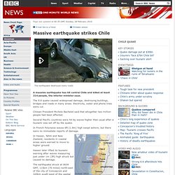
The 8.8 quake caused widespread damage, destroying buildings, bridges and roads in many areas. Electricity, water and phone lines were cut. Chilean President Michele Bachelet said that altogether two million people had been affected. Several Pacific countries were hit by waves higher than usual after a tsunami was set off by the quake. In French Polynesia waves 6ft (1.8m) high swept ashore, but there were no immediate reports of damage.
In Hawaii, Tahiti and New Zealand, residents in coastal areas were warned to move to higher ground. Hawaii later lifted its tsunami warning after waves measuring just under 1m (3ft) high struck but caused no damage. The earthquake struck at 0634 GMT, 115km (70 miles) north-east of the city of Concepcion and 325km south-west of the capital Santiago. Aftershocks Two aid ships are reported to be on their way. Ola sismos en Chile son réplicas tardías terremoto 2010, dice experto. La serie de al menos 16 sismos que han sacudido desde anoche el sur de Chile, son réplicas tardías del terremoto del 27 de febrero de 2010, afirmó hoy un experto del Centro Sismológico Nacional (CSN).
"Cualquier sismo que ocurra dentro del área de ruptura del terremoto del 27 de febrero de 2010 (entre las ciudades de San Antonio y la Península de Arauco), posterior al terremoto y con magnitud menor, es considerada una réplica hasta varios años después", dijo Mario Pardo, científico del CSN. Al menos 16 temblores se han registrado en esa zona desde poco antes de la medianoche del martes hasta este miércoles, con un epicentro dentro del área de ruptura del terremoto, próximo a la localidad de Cobquecura, en la región del Biobío.
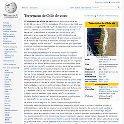
Terremoto de Chile de 2010. El sismo es considerado como el segundo más fuerte en la historia del país y el sexto más fuerte registrado por la humanidad.
Magnitude 8.8 OFFSHORE MAULE, CHILE. Ciencia y Tecnología - Terremoto de Chile cambió el eje de la Tierra. América Latina - ¿Qué se necesita en Chile? Moment magnitude scale. Historical context[edit] The Richter scale; a former measure of earthquake magnitude[edit] In 1935, Charles Richter and Beno Gutenberg developed the local magnitude ( ) scale (popularly known as the Richter scale) with the goal of quantifying medium-sized earthquakes (between magnitude 3.0 and 7.0) in Southern California.
This scale was based on the ground motion measured by a particular type of seismometer (a Wood-Anderson seismograph) at a distance of 100 kilometres (62 mi) from the earthquake's epicenter.[3] Because of this, there is an upper limit on the highest measurable magnitude, and all large earthquakes will tend to have a local magnitude of around 7.[4] Further, the magnitude becomes unreliable for measurements taken at a distance of more than about 600 kilometres (370 mi) from the epicenter. The modified Richter scale[edit] Although the Richter scale represented a major step forward, it was not as effective for characterizing some classes of quakes.
El terremoto y tsunami del 27 de febrero en Chile: Crónicas y lecciones aprendidas en el sector salud. Introducción.

Chile: Earthquake - Feb 2010. 2010 Chile earthquake. The partially collapsed 21-story O'Higgins Tower, Concepción The earthquake triggered a tsunami which devastated several coastal towns in south-central Chile and damaged the port at Talcahuano.
Tsunami warnings were issued in 53 countries,[10] and the wave caused minor damage in the San Diego area of California[11] and in the Tōhoku region of Japan, where damage to the fisheries business was estimated at ¥6.26 billion (US$66.7 million).[12] The earthquake also generated a blackout that affected 93 percent of the Chilean population and which went on for several days in some locations.[13] President Michelle Bachelet declared a "state of catastrophe" and sent military troops to take control of the most affected areas.
According to official sources, 525 people lost their lives, 25 people went missing[4] and about 9% of the population in the affected regions lost their homes.[14] Location[edit] Seismology and geology[edit] USGS shake map of the earthquake.