

GeoVisor ANH v2.0. Digital Geography. Citilabs Inc - Esri Partner Directory. Citilabs helps customers discover and implement high-value solutions that generate rapid, meaningful, and measurable results.
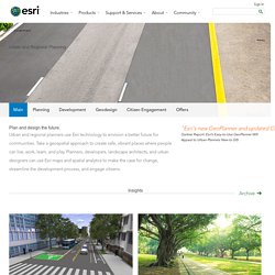
Implementation of Citilabs Software Products. An Error Occurred Setting Your User Cookie. CISBAT MEU Rager. Use of ICT Tools for Integration of Energy in Urban Planning Projects. GIS for Urban and Regional Planning. Government Urban and Regional Planning Main Planning Development Geodesign Citizen Engagement Offers Main.
Aesop acsp2013 mcosta. Gis for smart cities. ArcGIS Online for Local Government. The Benefits of Green Infrastructure in Cities. Cities Alive is the new branding for construction firm Arup's integrated idea of sustainable cities that incorporate nature as green infrastructure, which they have launched in a new report and book: Cities Alive: Rethinking Green Infrastructure.
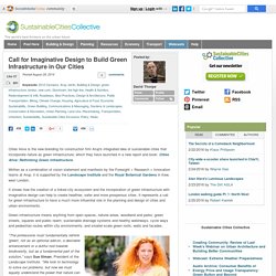
Written as a combination of vision statement and manifesto by the Foresight + Research + Innovation teams at Arup, it is supported by the Landscape Institute and the Royal Botanical Gardens in Kew, west London. It shows how the creation of a linked city ecosystem and the incorporation of green infrastructure with imaginative design can help to create healthier, safer and more prosperous cities. GE Panametrics PT878 Ultrasonic Flow Meter. The Panametrics PT878 clamp-on ultrasonic flow meter is universally regarded as the best portable ultrasonic flow meter and can be used to measure a wide range of clean and dirty liquids, even with some gas bubbles or solids.
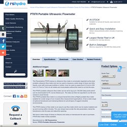
It can be used on pipes from 0.5 inch to 300 inch (12.7mm to 7.6m) on all metals and most plastics without the need to cut into the pipe. The PT878 portable ultrasonic flow meter can be set to log up to 100,000 data points which can be downloaded to PC via its infrared port . The data can then be exported to csv file and viewed in excel format. The PT878 portable flow meter is a compact transit time (time of flight) portable flow meter suitable for a wide range of non invasive flow measurement applications. This DIY monitor measures water usage throughout your house. While we may not be able to fix the drought, one Maker has set out to change how we use water at home.
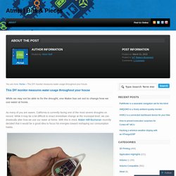
As many of you are aware, California is currently facing one of the most severe droughts on record. While it may be a bit difficult to enact immediate change at the municipal level, we can drastically alter how we use our water at home. With this in mind, Maker Will Buchanan recently decided that it would be a good idea to focus his energies toward reshaping our consumption habits. Water Watcher: a new way to monitor residential water use. California is in the midst of its worst drought in 500 years.
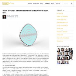
In February, Governor Jerry Brown declared a state of emergency and asked California residents to voluntary reduce their water use by 20%. An admirable goal, but how does that translate to people’s daily lives and routines? What does 20% really mean? Designers in our San Francisco studio decided to help by designing a product that effectively influences residential conservation, reduces residential water consumption, and adds meaningful value to people’s daily conservation efforts. But first, we started by talking to people about how they think about water. Our relationship to water. Ibarra (Ecuador) La calidad de vida y la baja delincuencia del país principalmente en la Sierra ecuatoriana, y aún más en el norte del país (eje de desarrollo en 2011, 2012, 2013 y 2014); una tasa de desempleo estable, y salud gratuita en niveles óptimos (aunque tardíos en cobertura), resultaron en una atracción migratoria ideal para los colombianos; llegando en oleadas crecientes e inmensas a ciudades del norte del Ecuador, principalmente Ibarra.
Paisaje de la Laguna de Yaguarcocha en la Ciudad de Ibarra Tras esto quedaron unos pocos bastiones de resistencia. En las distintas crónicas se dice que a causa de la matanza brutal las aguas de la laguna se hicieron rojas por la sangre y esto llevó a que se le cambiara el nombre, de Cochacaranqui, según Espinosa Soriano,[3] o de Otavalo[5] al de Yahuarcocha que en quechua significa lago de sangre.[3] Sin embargo, estas no coinciden ni en el número de muertos ni en como fallecieron.
Sobre el número de muertos las variaciones son impresionantes. Editorial SystemTM.
Sostenibilidad Creativa. ReGreening The Urban Streetscape. Absolutely FREE videos by Geoff Lawton, World Renowned Permaculture Teacher, Designer and Consultant.
How one man with a sledge hammer, changed a city. From a dry, dusty street, into green, suburban abundance landscape. Brad Lancaster has freed the way water is harvested off suburban roads. Its now the compulsory Permaculture way to harvest rain water in Tucson, Arizona. Vancouver's VanDusen Botanical Garden Shows the Power of Regenerative Design. It’s probably too harsh to say that green building has jumped the shark, but triple-glazed glass, natural ventilation, and low off-gassing carpeting are no longer news.
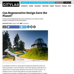
In a sense, green building is the victim of its own success—so ubiquitous that it’s almost impossible for any major developer not to incorporate its principles in building design. Like unleaded gasoline, it’s simply the accepted standard. 10 Cities That Are Shaping The Future Of Urban Living. Cities are frequently at the front line of innovation when it comes to addressing the changing problems of urban life.
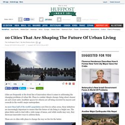
Plans to combat climate change, bring about cleaner air and create safer, healthier spaces for citizens are all being executed by mayors and councils in the world's major metropolises. Here's What You Can Do with Google Maps' New Data Layers. Google is adding new features to Data Layers in its JavaScript Maps API, which will allow developers to build a new breed of interactive apps that collect geographical data input from users.
With the revised API, you can now use interactive Data Layers to collect user reviews on the best places to visit in an area, and display heatmaps showing the popularity of various locations. Google also gives the example of building a tool for realtors, which allows users to draw polygons on a map to mark which areas they want to live in. The input from these layers can be collected in GeoJSON format. Google has launched a GeoJSON editor to allow developers to import, edit and export this data. PlantLab: Urban Farms 40 Times More Productive than Open Fields. A Dutch firm on the cutting edge of indoor agriculture estimates that producing food for the entire world could take place in a space far smaller than the area occupied by Holland, using just 10% of the water needed by traditional farms.
Maps and Measurments of the Expansion of Cities. Rethinking Urban Poverty: A Look at Community Gardens. Challenging western visions of the global: The geopolitics of theory and north‐south relations - The European Journal of Development Research - Volume 7, Issue 2. Kingship and the Gods: A Study of Ancient Near Eastern Religion as the ... - Henri Frankfort. Nature: Thinking the natural. Traces on the Rhodian Shore: Nature and Culture in Western Thought from ... - Clarence J. Glacken. Class Relations and Tourism Urbanization: The Regeneration of the Petite Bourgeoisie and the Emergence of a New Urban Form - MULLINS - 2009 - International Journal of Urban and Regional Research. Preserving Nature in the National Parks: A History : with a New Preface and ... - Richard West Sellars. The Culture of Nature: North American Landscape from Disney to the Exxon Valdez - Alexander Wilson.
Traces on the Rhodian Shore: Nature and Culture in Western Thought from ... - Clarence J. Glacken. Urban Poverty and the Underclass - Enzo Mingione. The Myth of Marginality: Urban Poverty and Politics in Rio de Janeiro - Janice E. Perlman. Urban Poverty and the Underclass - Enzo Mingione. The Myth of Marginality: Urban Poverty and Politics in Rio de Janeiro - Janice E. Perlman. The Age of Migration: International Population Movements in the Modern World - American Foreign Policy Interests - Volume 27, Issue 6. The attentive observer of globalization is at least intuitively aware of the centrality of the issue of migration. Migration plays a major role in the complex (and unclear) process of change in the international political order we are experiencing now. It impacts states and regions, their societies, economies, and polities. The Castles and Miller book provides an agile introduction to this issue area along several analytical dimensions. 1.
Cities of Tomorrow: An Intellectual History of Urban Planning and Design ... - Peter Hall. Why a 'Walkable' City Is Good for Your Mental Health. Typological to Evolutionary: A New Theory of Cities. Urban Form Affects Physical Activity Levels. Help25:Extensions Module Manager Language Switcher. How to Access To 'add' a new Language Switcher module or 'edit' an existing Language Switcher module, navigate to the Module Manager: Select Extensions → Module Manager Click the 'New' button and click on Language Switcher in the modal popup window. To 'Edit' an existing Language Switcher module, in the Module Manager click on an Language Switcher Modules Title or click the Language Switcher modules check box and then click the Edit button in the Toolbar.
Description This module allows you to switch between available Content languages. Screenshot Details and Options Details Title. Basic Options Pre-text: Enter the text that appears before the Language SwitcherPost-text: Enter the text that appears below the Language Switcher.Use Dropdown. Advanced Options Alternative Layout. The Cultural Landscape Foundation. HENRY CHARLES BECK, MATERIAL CULTURE AND THE LONDON TUBE MAP OF 1933 - Amodern. Apmodels.wikispaces. Quote by Reif Larsen: “A map does not just chart, it unlocks and formu...” 5 Easy Tips on Visual Branding on Social Media. Open Green Map. Open Green Map. Green Map. Green Maps are locally created environmentally themed maps with a universal symbol set and map-making resources provided by the non-profit Green Map System.
Based on the principles of cartography a Green Map plots the locations of a community's natural, cultural and sustainable resources such as recycling centers, heritage sites, community gardens, toxic waste sites and socially conscious businesses. Tagline[edit] The Green Map tagline is “Think Global, Map Local!”. It’s a play on the familiar think global - act local, and implies the same depth of local involvement for positive change. Green Icons[edit] All Green Maps use a set of globally designed Green Icons, developed collaboratively by the network of local project leaders. REACH The Future. SDK.
Before installing Android Studio or the standalone SDK tools, you must agree to the following terms and conditions. Downloads. Introduction to Android. Welcome to the Android developer guides. These documents teach you how to build Android apps using APIs in the Android framework and other libraries. Videos. Getting Started. L Developer Preview. JavaScript.
12-Step Guide to Building Your Very First Mobile App: Part 1. Dribbble - Popular. Wireframe UX Prototyping Tool. Online Vector Based Mockup & Wireframing Tool - Moqups. Balsamiq. Rapid, effective and fun wireframing software.