

Technology and The Commons. Two key concepts explored.
A lot of rhetoric about the commons seems to treat them as if they have some inherent property that determines whether a resource should be a commons or not. Herein, I want to suggest that our resource classifications are challenged and made fluid by technology. By way of a “for example,” lets revisit some key concepts. Two key concepts in commons theory are subtractability (or rivalrousness) and excludability: * Subtractability refers to the degree to which one person’s use of a resource diminishes others’ use. Historically, when resources are non-excludable they are classified as commons (or public goods), and more specifically when commons are subtractable they are classified as “common pool resources,” or CPRs. So, here are some concrete examples of how technology changes the possibilities for resource classification: Dr James Cheshire — UCL Department of Geography. Books and Book Chapters 2014 London: The Information Capital.
Penguin. (J A Cheshire, O Uberti) 2013 GIS Ostrava – Geoinformatics for City Transformations. (Editors: I Ivan, P Longley, J Horák, D Fitsch, J A Cheshire, T Inspektor). 2014 Spatial Visualization With R. 2013 CyberGIS for Analysing Urban Data. Refereed Publications 2014 Invited Review: Surnames and Spatial Analysis. 2014 Inequalities in the London Bicycle Sharing System revisited: impacts of extending the scheme to poorer areas but then doubling prices. 2014 Health Effects of the London Bicycle Sharing System: health impact modeling study. 2013 Mining Bicycle Sharing Data for Generating Insights into Sustainable Transport Systems. About – Po Ve Sham – Muki Haklay's personal blog. I am a Professor of Geographic Information Science in the Department of Civil, Environmental and Geomatic Engineering, University College London.
I am also the Director of the UCL Extreme Citizen Science group, which is dedicate to allow any community, regardless of their literacy, to use scientific methods and tools to collect, analyse, interpret and use information about their area and activities. Research My research interests include Public access and use of Environmental Information; Human-Computer Interaction (HCI) and Usability Engineering aspects of GIS; and Societal aspects of GIS use – in particular, participatory mapping and Citizen Science. Since 2001, I have secured over £7.8 million in research funding, from research councils, the public, private and third sectors. EPSRC project ‘Design for Wellbeing: Ageing and Mobility in the Built Environment’ – understanding community severance impact on older people.Challenging Risk, funded by EPSRC. Teaching Consultancy. S03E01 Sheela Patel - The federation model of community organizing.
Elinor Ostrom - Prize Lecture: Beyond Markets and States: Polycentric Governance of Complex Economic Systems. Ostrom lecture slides. Connecter la ville numérique au territoire : l’apport des sciences sociales. La multiplication de dispositifs technologiques liés à la production et la gestion de données numériques fait apparaître de nouveaux enjeux stratégiques et méthodologiques pour les professionnels de la gestion des territoires [1].
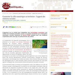
Ces technologies numériques visent, par exemple, à rendre plus performants les services urbains de la gestion de l’eau, de l’assainissement, des déchets ou encore de l’énergie. Le domaine de la mobilité est aussi très riche de nouvelles applications d’optimisation des déplacements en termes de logistique urbaine, de temps de transport ou de confort. Ces technologies peuvent également avoir comme objectif de fournir des services dématérialisés innovants (consommation, échanges de services, domotique) ou de développer des modèles de mobilier urbain interactif.
Elles peuvent enfin être développées dans le cadre de projets urbains localisés dans lesquels les smart grids (gestion intelligente des consommations d’électricité) prennent une place croissante. Reading Marx's Capital Vol 1 - Class 1, Introduction. The page numbers Professor Harvey refers to are valid for both the Penguin Classics and Vintage Books editions of Capital.
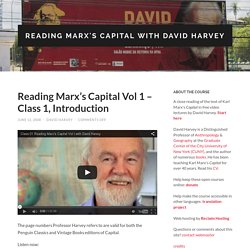
Listen now: Class 1 Files: Video MOV (308.9 MB) M4V (657.7 MB) | Audio MP3 (76.3 MB) OGG (72.7 MB). (To download on a PC right-click on an above file and click ‘Save as’ or ‘Download to’. On a Mac Control-click instead of right-click.) Problems viewing or downloading files? These lectures were the inspiration for the book: A Companion to Marx’s Capital published by Verso in 2010. © 2012 David Harvey Reading Marx’s Capital by David Harvey is licensed under a Creative Commons Attribution-Noncommercial-Share Alike 3.0 United States License.
Go to Class 2, Chapters 1-2. Towards a regional democracy? Dossier : Penser la ville avec Marx Postmetropolis, the crises and a new regional model of urbanization Frederic Dufaux: Edward Soja, you are a distinguished Professor of Urban Planning at UCLA, and a critical Geographer.
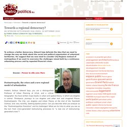
You have written major books in urban and spatial theory, in which Los Angeles is central: Thirdspace, Journeys to Los Angeles and other real and imagined Places; Postmetropolis; The City: Los Angeles and Urban Theory at the End of the Twentieth Century; and, very recently, Seeking Spatial Justice. Can you describe what you analyze as the “Postmetropolitan Transition” and its challenges? What are its links to what you see as the turn from crisis-generated restructuring processes to “a new era of restructuring-generated crises”? Towards a Regional Democracy? But what I have been feeling recently is that now I think I understand what has been happening in a more specific way. And so Metropolitics, and Métropolitiques, in a way, should be regional Metropolitic. The Geography of Financial Crisis. Dossier : Penser la ville avec Marx Video 1: Space, Marx and Paris Duration: 3:26 Question 1: You propose a spatial reading of Marx’s critique of capitalism.
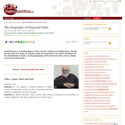
Could you tell us how his work has helped you elaborate your own thought? Question 2: Walter Benjamin read in Paris’ 19th century architecture the prehistory of modern capitalism. Has Paris inspired you in similar ways ?