

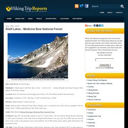
Shelf Lakes Hiking of Medicine Bow National Forest. The clear waters of South Gap Lake nestle up to the side of Medicine Bow Peak Hike of the Week: The Shelf Lakes Highlights: A high alpine lark from lake to lake – seven in all — cutting through and along the great white granite of the Snowy Range.
Location: West of Centennial near the high point of Hwy. 130 in the Medicine Bow National Forest. Elevations: Trailhead, 10,785’; The Gap, 11,040’; 4th Shelf Lake, 10,860’ Distance: Approximately 2 miles each way. Maps: Medicine Bow National Forest (Snowy Range inset is excellent), free Forest Service pamphlet “Snowy Range Trails”, USGS quads Medicine Bow Peak, Sand Lake Guide: Marc Smith’s Hiking Wyoming’s Medicine Bow National Forest Trailhead: Take I-80 west through Laramie to exit 311. Lost Lake Trail -Just Trails. The Basics The Lost Lake Trail is open all year but can be very hard to get to in the winter.
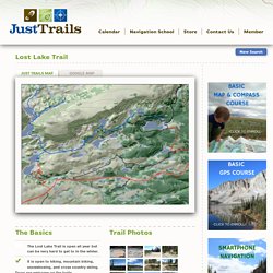
It is open to hiking, mountain biking, snowshoeing, and cross country skiing. Dogs are welcome on the trails. There is a fee to park at Brooklyn Lake, but there is a fee of $5 per vehicle for each day to park in the Sugar Loaf Recreation Area (near Lewis or Libby Lake). Easy scenic hikes in the Snowy Range. -Just Trails. Whether you don’t have time to walk a long trail out and back or you just don’t want to, we want to help.
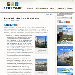
Here are some places to visit that offer some great scenery with little, and sometimes no effort beyond driving. In these areas you don’t have to walk the entire length of a trail. Just sit and enjoy a peaceful lake or take a stroll and turn around whenever you want. Medicine Bow Peak. Overview Medicine Bow Peak is located in the rugged, beautiful mountains of the Snowy Range in central southern Wyoming west of Laramie.
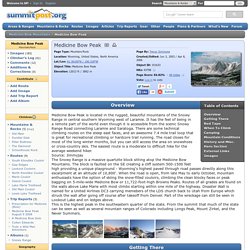
It has the feel of being in a remote part of the world even though it is accessible from the scenic Snowy Range Road connecting Laramie and Saratoga. There are some technical climbing routes on the steep east faces, and an awesome 7.4 mile trail loop that is great for recreational climbing or hardcore trail running. Medicine Bow Peak. Overview Medicine Bow Peak is located in the rugged, beautiful mountains of the Snowy Range in central southern Wyoming west of Laramie.
It has the feel of being in a remote part of the world even though it is accessible from the scenic Snowy Range Road connecting Laramie and Saratoga. There are some technical climbing routes on the steep east faces, and an awesome 7.4 mile trail loop that is great for recreational climbing or hardcore trail running. The road closes for most of the long winter months, but you can still access the area on snowshoes or cross-country skis. The easiest route is a moderate to difficult hike for the average weekend hiker.
Getting There From Interstate-80 in Southeast Wyoming, drive to Wyoming Highway 130, which heads west from Laramie (Laramie is west of Cheyenne). Hiking trails in the Medicine Bow Mountains of southern Wyoming: Snowy Range Hiking. Medicine Bow Trail - Wyoming. Medicine Bow Peak Trail -Just Trails. The Basics Medicine Bow Peak is open all year but it is difficult to get to from winter to mid summer.
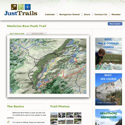
It is open to hiking. Dogs are welcome. Mountain biking and horseback riding. There is a fee of $5 per vehicle for each day if you park in the Sugar Loaf Recreation Area (near Lewis and Libby Lake). The are 3 easy trails totaling 2.6 miles. There are 3 moderate trails totaling 7.9 miles. There are 2 difficult trails totaling 6.1 miles. Trail Photos Go to Flickr for more photos. Video Description The Medicine Bow Peak is the highest peak in the Snowy Range at 12,013 feet. There are several different trailheads that will take you to the summit. The Lake Marie Trailhead offers a generally more gradual, but longer climb (3.6 miles) which is just as scenic. No matter your route you will hike through some very steep sections and very rocky sections but there is hardly a spot on the trail that doesn’t offer a stunning view. Guides. Medicine Bow National Forest Campgrounds. The Medicine Bow National Forest is comprised of 1,093,618 acres.
It is located in the southeast quarter or Wyoming. There are thirty-four developed campgrounds of which twenty-five meet our selection criteria. In the "Journal of Western Travel," John McTurk Gibson wrote: "June 13, 1859 - Sighted Laramie's Peak, covered with snow, contrasting strongly with the suffocating heat we have endured all day. " Like those distance days, the mountain peaks of Medicine Bow National Forest are a welcoming sight. Besides the promise of relief from summer heat, these mountains offer a wide variety of recreational opportunities. Weather in Great Basin National Park. Maps - Lassen Volcanic National Park. Hiking - Lassen Volcanic National Park. Calendar - Great Basin National Park.
Trail Conditions - Rocky Mountain National Park. 5/27/15 Bear Lake to Nymph, Dream & Emerald LakesAs the weather warms there is a lot of melt going on but still significant snow above 9,500 feet.
Current Conditions - Great Basin National Park - Great Basin National Park. Frequently Asked Questions - Lassen Volcanic National Park. Travel Time between Cities. What is Travel Time Calculator?

Q) I want to know how long it will take to travel between any two cities or any two locations. Where will I find a travel time calculator? Q) I want to estimate time required to travel between two addresses. Where can I find travel time information? Q) I want to check the duration of my trip. A) Ever wondered how many hours you actually spend on travelling? Estimate exact time required using Time Calculator!
Travel time is a critical factor in one’s journey. *Note that we only provide an approximate ESTIMATE travel time, although the accuracy of our Travel Time calculations tends to be very high!