Zoom
Trash

Unifly Launchpad. Opensource software drone photogrammetry - Recherche Google. Image Processing: Is there a PIX4D open source like software? OpenDroneMap. Login - WebODM Demo. WebODM Documentation. WebODM is a free, user-friendly, extendable application and API for drone image processing.
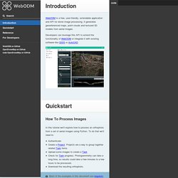
It generates georeferenced maps, point clouds and textured 3D models from aerial images. Developers can leverage this API to extend the functionality of WebODM or integrate it with existing software like QGIS or AutoCAD. How To Process Images In this tutorial we’ll explore how to process an orthophoto from a set of aerial images using Python. To do that we’ll need to: AuthenticateCreate a Project. First, we authenticate with WebODM. Then we need to create a Project. We can then create a Task. We periodically check for the Task status using a loop. Our orthophoto is ready to be downloaded. Congratulations! Authentication Authentication Basics Get authentication token: Use authentication token: Use authentication token via querystring (less secure):
A Beginner's Guide to Drone Mapping Software. This resource was created to help you better understand how drones are being used in mapping and land surveying today, to provide some pointers about the mapping software out there, and to generally get you started if you’ve been considering adding mapping to your list of drone pilot skill sets.
These days drones are helping people to map large areas in a quick, cost effective manner and to provide hard data that helps expedite workflows in a variety of commercial settings. Just a few years ago, the only way to get an aerial photogrammetric map of high accuracy and resolution was to fly the area of interest with a manned aircraft—or have access to a spy satellite! But the advancements in drone capabilities and their decreasing costs have made high quality aerial maps available for a multitude of people and industries.
Let’s take a closer look. Want to skip around? SketchUp - Exporters. The SketchUp exporter lets you publish 3D files straight from SketchUp to Sketchfab.
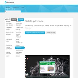
How to install You can install the SketchUp plugin directly from the Extension Warehouse. To Sketchfab.com Uploader. SketchUp to Sketchfab.com Uploader Upload your SketchUp models to the 3D (WebGL) viewing and sharing website Sketchfab When I originally wrote this extension, I had been looking quite a while for a way to share interactive 3D content from SketchUp on the web in a way that didn’t require installing a browser plugin.
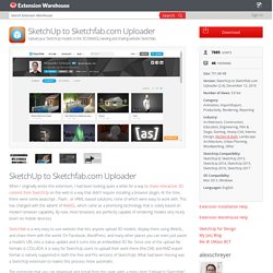
At the time, there were some Javascript-, Flash-, or VRML-based solutions, none of which were easy to work with. This has changed with the advent of WebGL, which came as a promising technology that is solely based on modern browser capability. By now, most browsers are perfectly capable of rendering models very nicely (even on mobile devices). Sketchfab Uploader Extension for SketchUp - by [as] Upload your SketchUp models to the 3D (WebGL) viewing and sharing website Sketchfab Description.
![Sketchfab Uploader Extension for SketchUp - by [as]](http://cdn.pearltrees.com/s/pic/th/sketchfab-uploader-extension-154586167)
Installing Ruby Plugins (Extensions) The Extension Warehouse You can download extensions from the Extension Warehouse, which is an online repository of extensions/plugins.
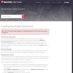
To get started, open SketchUp and click Window > Extension Warehouse. After signing into your Google Account (learn more), you can search for a specific extension, or browse through categories of extensions such as 3d printing, for example. Once you find the extension you want, simply click Install and follow the instructions. Extension Manager With SketchUp 2017 we have a new and improved Extension Manager with new options. Please visit our Help Center article on the Extension Manager for further support.
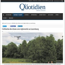
SketchUp and .rbz files It's also possible to install zipped Ruby files (.rbz) from within SketchUp. To install a SketchUp Ruby plugin script with the .rbz format: We recommend logging into your computer as an admin before installing any Ruby scripts. Windows - the default location is: Mac OS X - the default location is: L’utilisation des drones sera réglementée au Luxembourg. Réglementation des drones, mais aussi calendrier des futures élections législatives : telles sont les principales mesures prises par le gouvernement, vendredi.
Le Luxembourg réfléchit encore à légiférer sur la pratique du drone. Le Grand-Duché ne possède pas de législation spécifique à la pratique du drone.
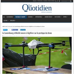
Il planche dessus. Il est relativement facile d’acquérir dans le commerce ou sur internet un drone ayant les capacités de voler assez haut dans le ciel et d’un poids assez important, mais ce n’est pas pour autant qu’il est légal de le faire voler dans le ciel luxembourgeois. Pour le moment, l’utilisation de systèmes d’aéronefs sans pilotes (drones) au Luxembourg est soumise au droit commun général. Les systèmes d’aéronefs sans pilotes tombent sous les règles de l’air généralement applicables mais également sous le régime du travail aérien pour les activités commerciales/à but lucratif. Afin d’obtenir une autorisation de vol dans le cadre d’une pratique professionnelle, il faut introduire une demande auprès de la Direction de l’aviation civile.
L utilisation des drones sera bientôt plus stricte. Drone Deploy. God is my Co-Pilot……or is it Drone Deploy?
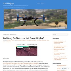
Introduction. Pix4Dmodel - Pix4D. DroneDeploy Resources: Webinars. Alex Cipriani Travel. Faire un don Alex Cipriani Travel Loading...

Working... Metadata Extraction Tool - Introduction. ExifTool by Phil Harvey. Read, Write and Edit Meta Information! Also available --> Utility to fix Nikon NEF images corrupted by Nikon software ExifTool is a platform-independent Perl library plus a command-line application for reading, writing and editing meta information in a wide variety of files. ExifTool supports many different metadata formats including EXIF, GPS, IPTC, XMP, JFIF, GeoTIFF, ICC Profile, Photoshop IRB, FlashPix, AFCP and ID3, as well as the maker notes of many digital cameras by Canon, Casio, DJI, FLIR, FujiFilm, GE, GoPro, HP, JVC/Victor, Kodak, Leaf, Minolta/Konica-Minolta, Motorola, Nikon, Nintendo, Olympus/Epson, Panasonic/Leica, Pentax/Asahi, Phase One, Reconyx, Ricoh, Samsung, Sanyo, Sigma/Foveon and Sony. ExifTool is also available as a stand-alone Windows executable and a MacOS package: (Note that these versions contain the executable only, and do not include the HTML documentation or other files of the full distribution above.)
The stand-alone Windows executable does not require Perl. Is there a free piece of software that will export metadata for a folder full of images to a table? - Photography Stack Exchange. 3Dsurvey COMPACT Package Software + DJI Phantom 4 PRO / Store / 3Dsurvey. 3Dsurvey Compact Package Solution - 3Dsurvey Software + DJI Phantom 4 PRO - NOW ONLY 4,399.00 EUR (excl. VAT) This 3Dsurvey Compact Package is ideal for anyone that seeks the best price performance in a compact and easy-to-use package solution. With an integrated DJI camera and GPS and fully featured 3Dsurvey software this package promises a huge ROI and survey-grade results (cm-grade). With a comfortable flying time of 30 minutes this will best suit the needs of small to mid-size surveying projects (5 - 10ha). DJI Phantom 4 PRO ensures that your field work never lacks the quality or quantity of captured imagery and geospatial data.
If you are after a professional yet compact and affordable solution to improve your projects' speed and cost-effectiveness, and achieve results your clients will be impressed by, this is the most comprehensive land surveying tool on the market today! What's in the Package. Comparison of photogrammetry software. Impression 3D en ligne de votre design. Amazon. Amazon.
Général_Ortho-stéréo-photogram. DroneDeploy. Agisoft-Photoscan.