

Resource Center. Current Issues Please join us in the fight to end hunger.

We will update local, state and federal advocacy opportunities, so please visit regularly to learn more about the current state of hunger and poverty in our community. View current issues from Feeding America here. Feeding America, our national association of affiliated food banks, is an excellent source for information: The U.S. The National Center for Children in Poverty (NCCP) is a public policy center dedicated to promoting the economic security, health, and well-being of America’s low-income families and children.
The Congressional Hunger Center (CHC) is a non-profit anti-hunger leadership training organization located in Washington, DC. THE GREEN SCHOOLYARD MOVEMENT: Gaining Momentum Around the World. By Sharon Gamson Danks on February 6th, 2014 First of two articles.
Click here to read part two.C&NN supports getting children outside and moving. That can take place in various environments: green schoolyards and gardens; traditional playgrounds, play structures and playing fields; private yards and wild places. No one size fits all. Incorporating natural elements into new or existing play spaces can give an extra boost to children’s physical health, psychological well-being, and their ability to learn. When you think about typical schoolyards, what image first comes to mind? Most school grounds look the same, with very little variation to reflect unique aspects of each school community, the neighborhood’s ecological or geographic context, or teachers’ preferred curricula. Children are masters at reading what Wendy Titman calls the “hidden curriculum” of school grounds, and understand the value adults place on them through the level of care given to their surroundings.
World Forum Foundation. Environmental Action Kit | Professional Collaborations | Universal Principles | Research | Resources | Advocacy Tools | Affiliate Tools | Early Childhood Program and Family ToolkitsThese are recommended and reviewed resources for connecting the World’s children with nature.
Search general resources by clicking on the following categories: Position Statements Web Sites Professional Articles Books and Videos. Www.dimensionsfoundation.org/research/documents/SkillsLaCanadaCA_10.pdf. Vm-jorum.ds.man.ac.uk/xmlui/bitstream/handle/10949/750/Items/prim_ey1_12t_3.pdf?sequence=11. Preschool Outdoor Environment Measurement Scale POEMS. The objective of the instrument is to provide a valid, reliable tool for assessing the quality of outdoor environments and their use and at the same time provide guidance to childcare professionals and site administrators to assist them in making improvements.
The instument is structured with five domains, which contain 54 assessment items scored dichotomously(present/not present). Guidance is provided for possible actions to improve environments based on the domain/item scores. POEMS was developed to serve as: Supported by: Cooperative Extension, University of North Carolina. Development team: Dr. Social and economic benefits of greenspace - Social and environmental justice. Deprived groups may experience differential access to greenspaces and associated services, which may be detrimental to their well-being.
In some cases, these deprived groups are exposed to environmental risks while they are also disproportionately more vulnerable to its effects. Background Social justice aims to give individuals and groups fair treatment and an impartial share of social, environmental and economic benefits. The concept promotes the fair distribution of advantages and disadvantages within a society, regardless of background and status. Www.cityprojectca.org/blog/wp-content/uploads/2009/04/stimulus-green-space-justice-200904294.pdf. Ccie-media.s3.amazonaws.com/nacc/wonder-213.pdf.
Sayler Park neighborhood in Cincinnati, Ohio (OH), 45233 subdivision profile. Sayler Park neighborhood in Cincinnati, Ohio (OH), 45233 subdivision profile. Census Tracts Neighborhood. Examining Poverty Patterns by Age by Neighborhood/Census Tract -- percentages interactive ranking table Based on ACS 2011 5-year estimates, 14.3 percent of the U.S. population had income below poverty level (notes).
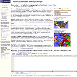
This section provides information and tools to examine poverty incidence by age and by census tract/neighborhood. Use the interactive ranking table to view, rank, compare, query national scope estimates of population by poverty status by age for areas of interest. Most data presented in the table are shown in percentages. See the related section with data shown as population rather than percentages. Subject Matter. Most data in the interactive table are based on ACS summary file Table B17001 Poverty Status in the Past 12 Months by Gender and Age.
Thematic Maps & Visual Pattern Analysis. Locating Tracts/Areas of Interest Use the ZIP-Tract Equivalence table to determine census tract codes of interest in a vicinity based on ZIP codes. Show AllFind in County: Driving Directions from 47 W Corry St, Cincinnati, Ohio 45221 to 47 W Corry St, Cincinnati, Ohio 45219. Driving Directions from 47 W Corry St, Cincinnati, Ohio 45221 to 47 W Corry St, Cincinnati, Ohio 45219. American FactFinder - Search. Cincinnati-Neighborhood-Map.jpg (JPEG Image, 1332 × 844 pixels) - Scaled (62%) Wyoming, Ohio (OH 45215) profile: population, maps, real estate, averages, homes, statistics, relocation, travel, jobs, hospitals, schools, crime, moving, houses, news. Average climate in Wyoming, Ohio Based on data reported by over 4,000 weather stations Back to the top Tornado activity: Wyoming-area historical tornado activity is above Ohio state average.
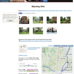
It is 148% greater than the overall U.S. average. On 4/3/1974, a category F5 (max. wind speeds 261-318 mph) tornado 8.4 miles away from the Wyoming city center killed 3 people and injured 210 people. Hyde Park neighborhood in Cincinnati, Ohio (OH), 45208 subdivision profile. Oakley neighborhood in Cincinnati, Ohio (OH), 45208, 45209 subdivision profile. Oakley neighborhood in Cincinnati, Ohio (OH), 45208, 45209 subdivision profile.
Bond Hill neighborhood in Cincinnati, Ohio (OH), 45216, 45217, 45237 subdivision profile. Walnut Hills neighborhood in Cincinnati, Ohio (OH), 45206 subdivision profile. East Westwood neighborhood in Cincinnati, Ohio (OH), 45211, 45225 subdivision profile. West End neighborhood in Cincinnati, Ohio (OH), 45203, 45214 subdivision profile. East Price Hill neighborhood in Cincinnati, Ohio (OH), 45204, 45205 subdivision profile. Avondale neighborhood in Cincinnati, Ohio (OH), 45217, 45219, 45220, 45229 subdivision profile. Cincinnati, Ohio - Map of Play. Parks. Parks Events.
Playgrounds - Cincinnati Recreation Commission. BRING DOWN THE BARRIERS! Five Causes of Nature-Deficit Disorder; Five Challenges for the New Nature Movement. About the Author Richard Louv is Co-Founder and Chairman Emeritus of the Children & Nature Network, an organization supporting the international movement to connect children, their families and their communities to the natural world.
He is the author of eight books, including "Last Child in the Woods: Saving Our Children from Nature-Deficit Disorder" and "The Nature Principle: Reconnecting with Life in a Virtual Age. " In 2008, he was awarded the Audubon Medal. By Richard Louv on August 31st, 2013 In the 21st Century, our Great Work – as Thomas Berry put it – must be the creation of a new, restorative relationship with the rest of the natural world.
Social and economic benefits of greenspace - Social and environmental justice. Salud. The Los Angeles Times recently ran a feature article on the topic of child obesity in two cities in southern California [December 28, 2011].
In the coastal town of Manhattan Beach, only 4.7% of its children were obese. Fifteen miles inland, in the town of Walnut Park, 37.0% of its children were obese. Why the difference between the two cities? One big difference is in the ethnic composition of the children. In Manhattan Beach, the healthy city, there are very few Latinos: in fact, only 7.6% of the residents are Latino. Some analysts immediately leap to a conclusion: Latino parents must not be doing a good job of managing their children’s weight. As Cantinflas would have said, “Allí está el detalle!” The communities that these families call home have an important role to play. As a result, children in largely non-Hispanic white areas of the county have 100 times the green space available to burn off calories compared to children in a largely Latino areas. I-Tree Project Profile.
Wisconsin DNR's Northeast Regional Analysis Project The Wisconsin Department of Natural Resources' 2 Northeast Regional Urban Forestry Coordinators completed the final phase of a regional analysis of street trees and canopy cover for (19) communities in the Northeast Area of Wisconsin. The final phase of this comprehensive assessment project was completed with cooperation from the communities of Fond du Lac, Marinette, Oshkosh and Shawano. The study quantified the annual ecosystem services and aesthetic benefits of public trees using i-Tree Streets. In addition, an i-Tree Canopy analysis provided communities with current canopy cover estimates and an assessment of potential canopy cover for future monitoring and goal setting.
Fox Valley Metro Area i-Tree Streets and Canopy Analysis The second phase highlighted the benefits that community trees provide Fox Valley area residents including the following: Green Bay Area i-Tree Streets and Canopy Community Analysis Contact Information. Environmental Assessment of Public Recreation Spaces (EAPRS) Tool. PEDS20112953 204..213 - AAP_report_12_26_2011.pdf.