

Landslide Hazards Program. Disasters. Landslide Hazards Program. Geological Survey: Landslide Susceptibility Mapping in Maine. Current Geologic Site of the Month A Summary of the 2017 State of Maine’s Beaches Report Maine Geological Survey Geology Web Maps Now Available The Maine Geological Survey now has many our of popular PDF map series available in an interactive web map.

See What's New? For a description. Updated Surficial Geology Handbook Now Available The popular Surficial Geology Handbook for Southern Maine, first published in 1978, has been significantly updated by Woodrow Thompson. Software. BMTPC. Attenuation Modelling, Flood Risk Management and Ecosystem Service. Ofr93-641. U.S.
Geological Survey Open File Report 93-641 This report is also available in pdf, it is 1.3MB. Floods are common and costly natural disasters When rivers overflow their banks, or flood, they can cause damage to property and crops. Floods are common and costly natural disasters. Floods usually are local, short-lived events that can happen suddenly, sometimes with little or no warning. Weather patterns can determine when floods occur Floods can occur at any time, but weather patterns have a strong influence on when and where floods happen. Very large floods happen very seldom The size, or magnitude, of a flood is described by a term called recurrence interval. The magnitude of floods can be altered if changes are made in a drainage basin. Flood plains normally are dry Flood plains are lands bordering rivers and streams that normally are dry but are covered with water during floods.
Zoning restrictions limit flood damage. Clay Hole, Cedar Falls (PnP), Cedar Iowa, US. Clay Hole, Cedar Falls (PnP) IA, Cedar River, Clay HolePhoto of Steve Weliver by Ty Graham taken March '03 @ 2200 Gauge Information River Description This playspot is named after the "Clay Equipment Co.
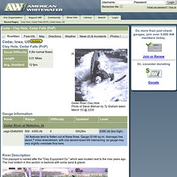
" which was located next to the river years ago. The river bottom in this section is bedrock with some sand & gravel. All of the Clay Hole features are created by an old "beautification" dam. We have removed all rebar, head-banging rocks and trash on river left out to the "D" hole. Landslide Susceptibility along the Sea to Sky Highway - Methods. Data The data used in this project consisted of Digital Elevation Models (DEMs), road and stream networks, and building and points of interest data.
A comprehensive list of the data used is shown below: Road, stream, building, and points of interest data were sourced from Canmap Streets Version 7.2, 2001, DMTI Spatial Inc., refer to for more information. 30m Spatial Resolution DEMs were obtained from the Canadian Digital Elevation Data, Level 1. DEMs provided from this data product are derived from 1:50,000 NTS map sheets.
Map sheets 92: G/6, G/7, G/10, G/11, G/14, and G/15 were used for analysis in this project encompassing an area from North Vancouver to Whistler. Web - Landslide Susceptibility. Breifne Area (North West Ireland) Landslides Susceptibility Mapping The implementation of a methodology for systematic production of landslide susceptibility maps hasn’t been embraced yet in Ireland.
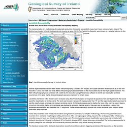
The Bréifne Area, located in North West Ireland and covering an area of 2129.7km2 within the Republic, was chosen as a suitable test area for this purpose. Map 1. Landslide susceptibility map for bedrock slides Several digital datasets available were tested: orthophotography, Landsat ETM+ imagery, and Digital Elevation Models (DEM) at 20 and 50m resolution.
Landslides mentioned in the literature were analysed using 3D orthophotography to recognize its signature and to identify elements that would assist the classification of similar events. A total of 52 landslides were visited and described during fieldwork carried out to verify the methodology. The literature review and the fieldwork observations reveal that conditioning factors triggering landslides differ depending on the landslide type. Remote Sensing Techniques Applied to Landslide Studies. By Eileen M.
Brennan. Landslide Risk Management Services. Landslide hazard zonation mapping Landslide Research and Risk Management Division of NBRO has implemented a landslide hazard zonation mapping programme within the 10 landslide prone districts of Kalutara, Galle, Hambantota, Nuwara Eliya, Matale, Kandy, Kegalle, Ratnapura, Matara and Badulla.
The maps which display the distribution of the severity of landslide hazard potential in a given area, were intended to be used with associated guidelines as a decision making tool for development of central highlands of the country. Kedarnath Disaster: Facts And Plausible Causes - CLIMATE HIMALAYA. Current Science: Recent climate changes have had significant impact on high-mountain glacial environment.
Rapid melting of snow/ice and heavy rainfall has resulted in the formation and expansion of moraine-dammed lakes, creating a potential danger from dammed lake outburst floods1. On 16 and 17 June 2013, heavy rains together with moraine dammed lake (Chorabari Lake) burst caused flooding of Saraswati and Mandakini Rivers in Rudraprayag district of Uttarakhand (Figure 1a). Prolonged heavy down pour on 16 and 17 June 2013 resembled ‘cloud burst’(except for amount of precipitation of 100mm/h) type event in the Kedarnath valley and surrounding areas that damaged the banks of River Mandakini for 18km between Kedarnath and Sonprayag, and completely washed away Gaurikund (1990masl), Rambara (2740masl) and Kedarnath (3546masl) towns. The roads and footpath between Gaurikund and Kedarnath were also damaged. Figure 2. Figure 3. Figure 4. Event 1 Event 2. Bin 2.3 Heavy rainfall induced landslides. Rainfall induced landslides — Geomorphology Research Group @ CNR IRPI Perugia.
2013 Monsoon Floods in Nepal and India: What happened and what could have been done? While the world is waking up to the news of the horrific scale of the recent flood disaster in the Mahakali basin of Nepal and Uttarakhand in India, several questions are being asked: what kind of climatic events led to this disaster?
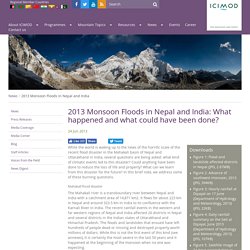
Could anything have been done to reduce the loss of life and property? What can we learn from this disaster for the future? In this brief note, we address some of these burning questions. Mahakali flood disaster The Mahakali river is a transboundary river between Nepal and India with a catchment area of 14,871 km2. Figure 1. Intense rainfall events The monsoon rains usually hit Central Nepal around 15 June and Far Western Nepal around 20 June. Figure 2. Figure 3. Figure 4.