

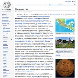
Immanuel Velikovsky. Mesoamerica. Mesoamerica and its cultural areas.
Pirate Treasure on Roatan Island - Part One. Daryl Friesen leaves the jungles of Central America for the sunny beaches of the Caribbean.
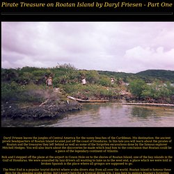
His destination: the ancient pirate headquarters of Roatan Island located just off the coast of Honduras. In this tale you will learn about the pirates of Roatan and the treasures they left behind as well as some of the forgotten excavations done by the famous explorer Mitchell Hedges. You will also learn about the discoveries he made which lead him to the conclusion that Roatan could be a piece of the legendary continent of Atlantis. Rob and I stepped off the plane at the airport in Coxon Hole on to the shores of Roatan Island, one of the bay islands in the Gulf of Honduras. We were assaulted by taxi drivers all wanting to take us to the west end, a place which we were told in broken Spanish is the place where all gringos are supposed to go. Arawak peoples. The Aruwaks people are one of the tribes of indigenous peoples of the Caribbean.
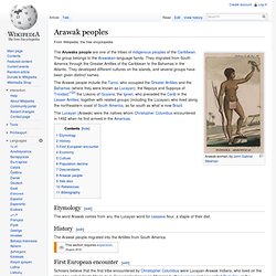
The group belongs to the Arawakan-language family. They migrated from South America through the Greater Antilles of the Caribbean to the Bahamas in the Atlantic. They developed different cultures on the islands, and several groups have been given distinct names. Research Magazine – The University of Alabama » ‘Rubber People’: The Americas’ First Civilization. By Chris Bryant One of the world's leading Olmec experts, Diehl published this book in 2004.
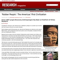
Considering Dr. Richard A. Jordan: Mesoamerican Chronology. This chronology is designed to accompany Michael D.
Coe's two books The Maya (6th edition, 1999) and Mexico (4th edition, 1994), on which it is largely based. It differs from Coe in some ways, and errors are my responsibility. Your corrections are invited. Thanks. Olmec alternative origin speculations. San Lorenzo Tenochtitlán Colossal Head 6, a 3-meter-high Olmec sculpture with lips and nose said to resemble African facial features.
Olmec alternative origin speculations are explanations that have been suggested for the formation of Olmec civilization which contradict generally accepted scholarly consensus. These origin theories typically involve contact with Old World societies. Although these speculations have become somewhat well-known within popular culture, particularly the idea of an African connection to the Olmec, they are not considered credible by the vast majority of Mesoamerican researchers. Graham Hancock. Graham Hancock (born 2 August 1950) is a British writer and journalist.
Hancock specialises in unconventional theories[1] involving ancient civilizations, stone monuments or megaliths, altered states of consciousness, ancient myths and astronomical/astrological data from the past. One of the main themes running through many of his books is a posited global connection with a "mother culture" from which he believes all ancient historical civilizations sprang.[2] Biography[edit] Works[edit] Hancock sees himself as a journalist who asks questions based upon observation and as someone who provides a counterbalance to what he perceives as the "unquestioned" acceptance and support given to orthodox views by the education system, the media, and by society at large.[3] Prior to 1990 his works dealt mainly with problems of economic and social development.
Orion correlation theory[edit] BBC Horizon controversy[edit] Ivan van Sertima. Ivan Gladstone Van Sertima (26 January 1935 – 25 May 2009) was a Guyanese-born associate professor of Africana Studies at Rutgers University in the United States.[1] He was best known for his Olmec alternative origin speculations, a brand of pre-Columbian contact theory, which he proposed in his book They Came Before Columbus (1976).
While his Olmec theory has "spread widely in African American community, both lay and scholarly", it was mostly ignored in Mesoamericanist scholarship, or else dismissed as Afrocentric pseudohistory to the effect of "robbing native American cultures". [n 1] Early life[edit] Van Sertima was born in Karina Village, Guyana, when Guyana was still a British colony; he retained his British citizenship throughout his life. In doing field work in Africa, he compiled a dictionary of Swahili legal terms in 1967.[3] View topic - Olmec remains. 05.01.96 - Ancient Honduran Village Shows Olmec Ties. 3000-Year-Old Dwelling Site Yields Pottery Style of Distant Mexican Gulf Coast by Gretchen Kell.
Izapa. View of the ruins of Izapa Izapa is a very large pre-Columbian archaeological site located in the Mexican state of Chiapas; it was occupied during the Late Formative period.
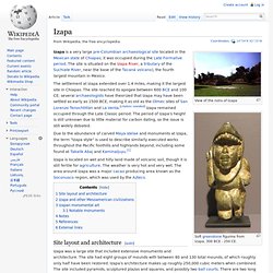
The site is situated on the Izapa River, a tributary of the Suchiate River, near the base of the Tacaná volcano), the fourth largest mountain in Mexico. The settlement at Izapa extended over 1.4 miles, making it the largest site in Chiapas. The site reached its apogee between 600 BCE and 100 CE; several archaeologists have theorized that Izapa may have been settled as early as 1500 BCE, making it as old as the Olmec sites of San Lorenzo Tenochtitlán and La Venta. [citation needed] Izapa remained occupied through the Late Classic period. Due to the abundance of carved Maya stelae and monuments at Izapa, the term "Izapa style" is used to describe similarly executed works throughout the Pacific foothills and highlands beyond, including some found at Takalik Abaj and Kaminaljuyu.[1] Site layout and architecture[edit]
The Olmecs. The Olmecs The Olmecs: An African Presence in Early America [Excerpt from a larger article] By Paul A. Pre-Columbian trans-oceanic contact hypotheses. For the prevailing model(s) describing the geographic origins and early migrations of humans in the Americas see Settlement of the Americas. Claims of pre-Columbian trans-oceanic contact relate to visits to, the discovery of or interaction with the Americas and/or indigenous peoples of the Americas by non-American people (e.g. from Africa, Asia, Europe, or Oceania), prior to the arrival of Christopher Columbus in the Caribbean in 1492. Such proposals are often based on archaeological finds, cultural comparisons, comments in historical documents, and narrative accounts that seem to be about trans-oceanic voyages. Artifacts Comparisons between ancient Mesoamerica and China. Olmec Ritual symbols (St. Andrew's Cross?) Shang Ritual Symbols Liangzhu Ritual Symbols. Garifuna language. Since colonial times and until as recent as the latter half of the 20th century the language was known to non-Garifuna communities as Carib or Black Carib and Igñeri.
Parts of Garifuna vocabulary are split between men's speech and women's speech, i.e. some concepts have two words to express them, one for women and one for men. Moreover, the terms used by men are generally loanwords from Carib while those used by women are Arawak. Olmec Shang Dynasty Linguistics Writing Script Origins Similarities Transoceanic Contact Mystery Bronze Age Mariners Professor Michael Mike Xu Central Oklahoma University Ancient Shang Olmec Writing Likeness Chinese Language Scholar Han Ping Chen Oracle B.
Michael Xu of Central Oklamoma University is really shaking things up in ancient archaeological and epigraphrical circles these days, he’s been proving (but with much pushback from many of his colleagues) that most of the characters of the ancient Shang dynasty writing system of China are the same as of the ancient Olmec script of Central America, with the majority of the 146 characters of the Olmec script being identical to Shang characters, such for the words: sun, mountain, artist, water, rain, sacrifice, health, plants, wealth, and earth. As Betty J. And those advanced civilizations in Central (and South) America are rightly thought to have begun circa 2000 B.C., not 10000 B.C. (when the “experts” say the Ice Age ended), so if the settlers from China to the Americas all arrived by foot, when the sea level was lower, what did they do for all those supposed 8,000 years before they started building in Central America, just stand around twiddling their thumbs?
Do see. Effect of a change in sea level on worldwide topography. Yonaguni Monument. Sunken formations. Masaaki Kimura. The Morien Institute - Exclusive illustrated interview with Professor Masaaki Kimura about the underwater pyramid structures discovered off Yonaguni-Jima, Japan. Japan's Ancient Underwater "Pyramid" Mystifies Scholars. RELICS OF LOST CITY FOUND IN HONDURAS - Prof. Saville Brings Back Treasure Trove of Vanished Civilization. BOWLS 3,000 YEARS OLD Beautiful Pottery and Jewelry Found - - A Metropolis Long Before Columbus Arrived. - View Article. Transy professor gets grant to search for 'lost city' in Honduras.
A Lexington archaeologist has received a grant from the National Geographic Society to advance his search for a "lost city" in Honduras. Bimini-cay sal 2006. File:Fixed gulf map.png. Untitled. Proof of Theory - 1.09 Mercator’s submarine islands off Brazil and in the Caribbean. Mercator’s 1569 map shows several submerged or semi-submerged plateaus and islands off the eastern coast of Brazil and in the Caribbean (Figure 1.62a).
The islands marked F and G represent Vila Dos Remédios and St Helena, respectively, and island I appears to be a small islet that is presently barely visible above sea level. Critically, though, are the island groups A and H, which seem to represent a plateau that is partially flooded, with scattered islets visible above sea level. There are corresponding submarine plateaus on the actual ocean floor, suggesting that Mercator had source maps or map descriptions from a time when the sea level was low enough for these plateaus to be partially exposed. Islands B to E likewise have corresponding submarine ‘islands’, which could (arguably) only have been visible above sea level many thousands of years ago. Figure 1.62a.
Figure 1.62b. Figure 1.63a Maps of the Caribbean, Mercator (top), NASA Topography (bottom), download a HIRES image here.