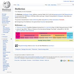

Statherian. The period is characterized on most continents by either new platforms or final cratonization of fold belts.

"Statherian Period". GeoWhen Database. Archived from the original on May 12, 2006. Retrieved January 5, 2006. James G. Continental shelf. The continental shelf is an underwater landmass which extends from a continent, resulting in an area of relatively shallow water known as a shelf sea.

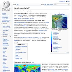
Much of the shelves were exposed during glacial periods and interglacial periods. The shelf surrounding an island is known as an insular shelf. Under the United Nations Convention on the Law of the Sea, the name continental shelf was given a legal definition as the stretch of the seabed adjacent to the shores of a particular country to which it belongs. Geographical distribution[edit] The global continental shelf, highlighted in cyan Though the continental shelf is treated as a physiographic province of the ocean, it is not part of the deep ocean basin proper, but the flooded margins of the continent.[5] Passive continental margins such as most of the Atlantic coasts have wide and shallow shelves, made of thick sedimentary wedges derived from long erosion of a neighboring continent.
Topography[edit] Sediments[edit] Biota[edit] See also[edit] Craton. The word craton was first proposed by the Austrian geologist Leopold Kober in 1921 as Kratogen, referring to stable continental platforms, and orogen as a term for mountain or orogenic belts.

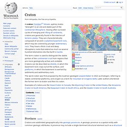
Later authors shortened the former term to kraton and then to craton. Examples of cratons are the Slave Craton in Canada, the Wyoming Craton in the United States, the Amazonia Craton in South America, the Kaapvaal Craton in South Africa, and the Gawler Craton in South Australia. Provinces[edit] Cratons are subdivided geographically into geologic provinces.
A geologic province is a spatial entity with common geologic attributes. Structure[edit] Cratons have thick lithospheric roots. An associated class of inclusions called eclogites, consists of rocks corresponding compositionally to oceanic crust (basalt) that has metamorphosed under deep mantle conditions. Formation[edit] Earth's surface was probably broken up into many small plates with volcanic islands and arcs in great abundance. See also[edit] Columbia (supercontinent) Following its final assembly at ~1.8 Ga, the supercontinent Columbia underwent long-lived (1.8–1.3 Ga), subduction-related growth via accretion at key continental margins,[3] forming a 1.8-1.3 Ga great magmatic accretionary belt along the present-day southern margin of North America, Greenland, and Baltica.[3] It includes the 1.8-1.7 Ga Yavapai, Central Plains and Makkovikian Belts, 1.7-1.6 Ga Mazatzal and Labradorian Belts, 1.5-1.3 Ga St.
Francois and Spavinaw Belts, and 1.3-1.2 Ga Elzevirian Belt in North America; the 1.8-1.7 Ga Ketilidian Belt in Greenland; and the 1.8-1.7 Transscandinavian Igneous Belt, 1.7-1.6 Ga Kongsberggian-Gothian Belt, and 1.5-1.3 Ga Southwest Sweden Granitoid Belt in Baltica.[3] Other cratonic blocks also underwent marginal outgrowth at about the same time.
Jump up ^ Rogers, J.J.W. and Santosh, M., 2002, Configuration of Columbia, a Mesoproterozoic supercontinent.