

Hawaii Volcano Eruption Update: Current Hawaii Island Lava Flows. Lava Viewing at Kalapana The exciting volcanic activity continues to evolve on Kilauea Volcano in Hawaii Volcanoes National Park.

On March 5, 2011 several miles downslope from the summit, a new fissure erupted with a curtain of fire that rose up to eighty feet high. This eruptive phase cannot be accessed by the public, however the rangers at the Hawaii Volcanoes National Park visitors center are sharing the latest videos and photographs from this site and others around the park. Meanwhile, a short drive from the park visitors center, the glow at the summit crater, Halemaumau continues to grow and send up voluptuous clouds of steam. Many are awaiting to see if a subterranean pond of lava will soon spill out onto the crater floor.
Dramatic steam and gas has been pluming from a vent in the crater wall since March 11, 2008, representing the first eruption in Halemaumau since 1982. Excellent viewing is still possible most days from the Thomas A. Lava Flow from Hawaii's Kilauea Volcano Speeds Up. An oozing lava flow from Hawaii's Kilauea volcano picked up speed over the weekend, prompting local authorities and residents to prepare for possible evacuations on the Big Island.
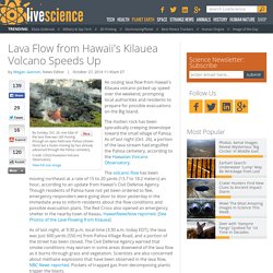
The molten rock has been sporadically creeping downslope toward the small village of Pahoa. As of last night (Oct. 26), a portion of the lava stream had engulfed the Pahoa cemetery, according to the Hawaiian Volcano Observatory. The volcanic flow has been moving northeast at a rate of 15 to 20 yards (13.7 to 18.2 meters) an hour, according to an update from Hawaii's Civil Defense Agency. Though residents of Pahoa have not yet been ordered to flee, emergency responders were going door to door yesterday in the immediate area to inform residents about the flow conditions and possible evacuation plans. The Red Cross also opened an emergency shelter in the nearby town of Keaau, HawaiiNewsNow reported. Get a close (online) look at Hawaii lava flow.
A breakout of lava burns through vegetation on the outskirts of Pahoa on Hawaii’s Big Island on Thursday afternoon.

(USGS / Hawaiian Volcano Observatory photo) With lava oozing toward homes and businesses in a village on Hawaii’s Big Island, tourists (and islanders) want to see the flow of molten rock. But legally you can’t. For public safety, and for the privacy of those whose buildings are threatened in the village of Pahoa, the land where the lava has flowed is closed to the public. The lava has traveled more than a dozen miles so far from its Kilauea Volcano source, mostly on remote, state-owned forestland. However, if you want to know more about the lava you can get detailed descriptions, photos and maps of what’s called the June 27th flow (from the day it started) and where it’s projected to go from several websites. A view of the flow over Pahoa’s Cemetery Road/Apaʻa Street on Oct. 29. What's Going on With the Volcano? - Hawai'i Volcanoes National Park. Satellite Image of Area Around Flow Front Courtesy USGS Hawaiian Volcano Observatory This map uses a satellite image acquired in March 2014 (provided by Digital Globe) as a base to show the area around the front of the June 27th lava flow.
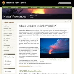
The area of the flow on November 1, 2014, at 11:00 AM is shown in pink, while widening and advancement of the flow as mapped on November 3 at 11:30 AM is shown in red. The latitude and longitude of the front of the narrow finger of lava advancing toward Pāhoa was 19.49590, -154.95256 (Decimal Degrees;WGS84). The dotted blue lines show steepest-descent paths in the area, calculated from a 1983 digital elevation model (DEM). Full resolution map (opens in new window) HVO Kilauea Status. HAWAIIAN VOLCANO OBSERVATORY CURRENT STATUS REPORTU.S.
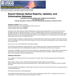
Geological Survey Tuesday, November 4, 2014 5:12 PM HST (Wednesday, November 5, 2014 03:12 UTC) KILAUEA VOLCANO (VNUM #332010) 19°25'16" N 155°17'13" W, Summit Elevation 4091 ft (1247 m)Current Volcano Alert Level: WARNINGCurrent Aviation Color Code: ORANGE. Hawaii Volcanoes National Park, Hawaii, the Big Island. Hawaii Volcanoes National Park Quick Facts Name: Hawaii Volcanoes National Park What: Massive park home to one of the world’s most active volcanoes Where: 45 minutes south of Hilo More Info: (808) 985-6000, www.nps.gov/havo Watch the landscape change before your very eyes at Hawaii Volcanoes National Park.

Located 30 miles southwest of Hilo, this is the home of Kilauea volcano, one of the most active volcanoes on earth. The chance to witness the primal process of creation and destruction make this park one of the most popular visitor attraction in Hawaii and a sacred place for Native Hawaiians. Founded in 1916, the Park encompasses 333,000 acres from the summit of Maunaloa to the sea. Kilauea is sometimes called "the world's only drive-in volcano.
" Kilauea Visitor CenterOpen daily: 7:45 am to 5 pmBegin your visit at the Kilauea Visitor Center where you can watch an hourly film from 9 am to 4 pm to introduce you to the park. Thomas A. Be prepared on your visit.