

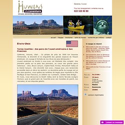
Scotland's Great Trail leaflet.pdf. Huwans - clubaventure - Etats-Unis - Terres insolites : des parcs de l'ouest américains à San Francisco. Etats-Unis Terres insolites : des parcs de l'ouest américains à San Francisco Californie, Arizona, Utah...
Par où commencer l'organisation d'un voyage aux USA ? Cette page vous permet d'avoir une vue d'ensemble des différentes étapes, dans l'ordre, pour organiser par vous-même votre voyage aux USA, et compile tous les conseils pour bien préparer votre circuit sans commettre de grosses erreurs.

Organiser par vous-même votre voyage est bien entendu le top des différentes options permettant de découvrir les États-Unis : on visite ce que l'on veut, comme on veut, quand on veut, dans l'ordre que l'on veut. Une telle organisation n'est pas insurmontable ! Grâce à internet, vous avez accès à une quantité d'informations impressionnante pour pouvoir organiser dans les moindres détails votre voyage. Vous pouvez réserver les hôtels ou les campings, commander vos billets d'avion, louer un véhicule... en 3 clics de souris. USA Parcs Ouest Las Vegas : La ruée vers l'Ouest Américain. Vol Paris / Las Vegas.
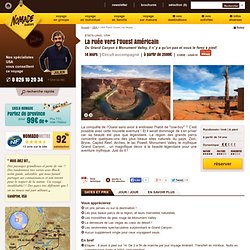
Accueil par votre guide local et transfert à l'hôtel.Les lumières de la “ville qui ne dort jamais” rougeoient à des kilomètres à la ronde dans l’obscurité du désert. à l'hôtel J2 et J3 : LAS VEGAS - ZION NATIONAL PARK Nous quittons Las Vegas en milieu de matinée et peu à peu le désert aride du Mojave. Route vers le parc national de Zion en longeant la Virgin River qui nous mène au vaste et vertigineux plateau rouge du Colorado. Sous tente 2,5 heures Nous reprenons la route pour rejoindre Bryce Canyon, un des plus beaux canyons des Etats-Unis. Sous tente 5,5 heures Nous faisons nos sacs et partons vers notre prochaine destination: en chemin, nous empruntons la célèbre Highway 12, puis traversons les dunes de sable pétrifiées avant d’arriver à Capitol Reef. Route pour Moab et le parc national de Canyonlands.
Sous tente 1 heure sous tente 6 heures Matinée libre sur Moab. Sous tente J10 et J11 : LAC POWELL - GRAND CANYON NATIONAL PARK sous tente 3,5 heures / 10 km 250 m 250 m. Long-distance trails in the United States. Appalachian trail. Where can I get maps?
The Appalachian Trail Conservancy and its member clubs publish the official guidebooks and maps for the Appalachian Trail, available for purchase online at the Ultimate A.T. Store, by phone at 1-888-AT STORE and at the ATC visitor centers. Do I need a permit? The Appalachian Trail is open for all to enjoy. No fees, memberships, or paid permits are required for walking on the Trail. Where can I camp? More than 250 backcountry shelters are located along the Appalachian Trail at varying intervals, as a service to all A.T. users. Where are the restrooms? Few and far between. Can I bring my dog? Dogs are permitted along most of the Trail, but they impose additional responsibilities on hikers who bring them along. Can I ride a bike or horse on the A.T.? Generally, no. Are bears and snakes a problem? The problem with snakes and bears is that you won't see them often. Can I carry a gun?
How safe is it? In an emergency, how do I get help? Backbone Trail. The Backbone Trail is a long distance trail extending 67.79 miles[1] (109.10 km) across the length of the Santa Monica Mountains in the U.S. state of California.
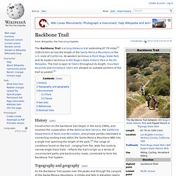
Its western terminus is Point Mugu State Park and its eastern terminus is Will Rogers State Historic Park in Pacific Palisades. The trail is open to hikers throughout its length; mountain bicyclists and horseback riders are allowed on suitable portions of the trail as posted.[2] History[edit] Topography and geography[edit] The Backbone Trail as it passes through Mishe Mokwa. As the Backbone Trail passes over the peaks and through the canyons of the Santa Monica Mountains, it climbs and falls in elevation nearly constantly.
Scenic views of Ventura County are seen from the six-mile loop trail. Parts of the trail lie within the city limits of Los Angeles and Malibu, California; the rest sits in unincorporated areas of Los Angeles County and Ventura County. River to River Trail. The River to River Trail is a 160 mile (256 km)-long hiking trail that serves Shawnee National Forest in far southern Illinois.
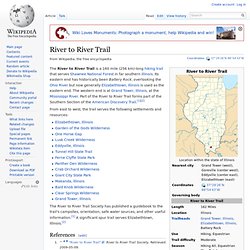
Its eastern end has historically been Battery Rock, overlooking the Ohio River but now generally Elizabethtown, Illinois is used as the eastern end. The western end is at Grand Tower, Illinois, at the Mississippi River. Batona Trail. History[edit] In 1960, Dale Knapschafer, suggested a trail be built linking Wharton and Lebanon State Forests.
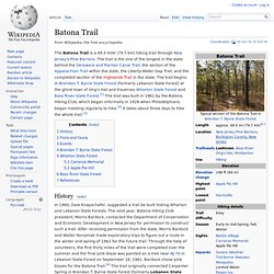
The next year, Batona Hiking Club president, Morris Bardock, contacted the Department of Conservation and Economic Development in New Jersey for permission to construct such a trail. After receiving permission from the state, Morris Bardock and Walter Korszniak made exploratory trips to figure out a route in the winter and spring of 1961 for the future trail. Through the help of volunteers, the first thirty miles of the trail were completed over the summer and the final pink blaze was painted on a tree near NJ 70 in Lebanon State Forest on September 16, 1961.
Bardock chose pink blazes for the Batona Trail.[4] The trail originally connected Carpenter Spring in Brendan T. In 2012 the trail was rerouted in two areas. Flora and fauna[edit] Although the Pine Barrens, as the name suggests, are mainly flat pine forests, there is a large variety of plants and animals along the trail. Bienvenue sur balades.ch.