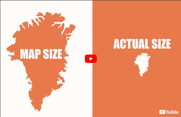


http://www.youtube.com/watch?v=KUF_Ckv8HbE
Related: 2. PLANET EARTH- LOCATING PLACES AND SCALES • CartographieAprès avoir vu ces 15 cartes, vous ne regarderez plus jamais le monde de la même façon La raison pour laquelle certains pays semblent plus gros ou plus petits que d’autres est le résultat de la projection de Mercator. En 1569, le cartographe flamand Gerardus Mercator a conçu une carte qui pouvait être utilisée pour la navigation, mais son système avait un inconvénient: il déformait la taille des objets selon leur position relative à l’Équateur. Pour montrer à quel point notre perception de la grosseur des pays est erronée, ipnoze s’est servi du site web thetruesize.com pour déplacer des territoires à différents endroits. Plus d’info: thetruesize.com | Source: BoredPanda
Top 10 des cartes pour se rendre compte de la VRAIE taille des pays, ça change tout Les Etats-Unis, la Chine et l'Inde par rapport à l'Afrique Oui, l'Antarctique c'est un peu grand France VS Royaume-Uni France VS Australie (tout de suite on fait moins les malins) L'Islande n'est pas bien grande par rapport à la France (mais c'est beau) On ne se rend pas compte comme ça que le Groenland est si grand Eh ouais Etats-Unis = Australie Et Etats-Unis = Une bonne partie de l'Europe La même pour la Russie Brésil VS Inde Bon, au cas où vous ne l'auriez pas compris, la France c'est vraiment minus minus. Pour bien te marrer, même en voyage, c'est Sokodo qu'il te faut. Top 14 des cartes de France vue autrement, c'est vrai que ça change On vous avait déjà donné notre vision du découpage de la France avec les cartes de France des préjugés, ou celles des artistes. Voici quelques nouvelles cartes qui ont le mérite d'être honnêtes et réalistes. Le redécoupage en 14 régions Pour les noms on n'est pas complètement sûr...
Les plus beaux portulans Gallica vous propose de découvrir des documents évocateurs des explorations et des voyages au long cours, les portulans. Ces cartes marines enluminées, réalisées sur parchemin, ont été essentielles pour la maîtrise des mers, mais ont également diffusé les représentations des nouveaux territoires découverts par les Européens à partir du XIVe siècle. De ces cartes anciennes, peu ont survécu jusqu’à aujourd’hui: la Bibliothèque nationale de France en possède la plus riche collection du monde, soit plus de 500 documents conservés principalement au département des Cartes et plans, et disponibles sur Gallica. Les premiers portulans ont été élaborés au XIIIe siècle, et concernent la mer Méditerranée ; parmi eux, le plus ancien serait la Carte pisane, datée de la fin du siècle, et présente dans les collections de la BnF depuis 1840.
40-cartes-du-monde-insolites-changer-vision-du-monde Des cartes du monde insolites Que vous soyez doué en géographie ou que vous sachiez à peine localiser les pays voisins de la France, vous allez voir que la vision du monde est bien subjective. Ces cartes inhabituelles vont complètement chambouler vos notions de géographie. Il y a quelques centaines d’années le monde connu s’arrêtait aux frontières de l’Europe et de l’Asie. Avec les conquêtes et les progrès technologiques, nos ancêtres ont fini par tracer tant bien que mal les frontières de ce qu’ils pensaient être les continents de notre planète.
Maps With Me: la meilleure application de Cartes Hors-Ligne ? (Vidéo) De nombreuses applications de cartes hors-ligne existent sur le Google Play, cependant la majorité d’entre elles ne concernent qu’un pays ou qu’une ville. Avec Maps With Me, nous avons accès aux cartes du monde entier, pas moins de 345 pays sont maintenant disponibles ! Pourquoi nous vous conseillons cette application aujourd’hui ? Tout simplement car elle a été testée par nos soins durant plus de trois mois à l’étranger. Le résultat ? Bluffant, la plupart du temps !
Michel Foucher et la subjectivité des projections cartographiques, reflets d’une certaine vision du monde L’émission culturelle de deuxième partie de soirée Ce soir ou jamais (France 3) consacrait ce mardi 7 février une partie de sa revue de presse aux représentations cartographiques du monde et ce, en lien avec l’exposition « La France en relief » tenue au Grand Palais (Paris) depuis le 18 janvier 2012[1]. Invité en compagnie de Sylvie Brunel[2], Michel Foucher[3] a exposé le caractère très subjectif des projections cartographiques, depuis celle de Gérard Mercator, géographe flamand du XVIe siècle (1512-1594), qui fausse la taille et la position des continents et des États mais qui demeure toujours un support utilisé par les départements d’État, les organisations internationales ou encore Google. Annette Ciattoni (dir.), Géographie 2de (manuel), Paris : Hatier, 2010, p. 10. Or, la projection de Peters, plus respectueuse des superficies mais non-exempte de défauts, est encore sous-utilisée[4].
2011 à la carte Tour d'horizon des meilleures cartes de 2011 par l'auteur du site anglais de datavisualisation Spatial Analysis. Des connections sur Facebook aux collaborations scientifiques, tout se cartographie ! Alors que 2011 touche à sa fin, il est bon de revenir sur cette année déterminante pour la cartographie et l’analyse spatiale. Les données géographiques se sont massivement ouvertes, et ont été rendues largement accessibles, conduisant à la production presque quotidienne de cartes inédites et intéressantes.