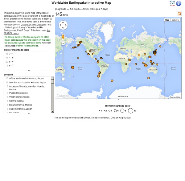


Encyclopedia of Earth Interactive Animations This is our collection of interactive rollover flash animations. Click links or scroll down to view the available interactive animations.Check out our Earth Science Animations and Videos pages. Interactive Animations General Basin and Range Dynamic Planet- Earthquakes & Volcanoes Tectonics How Are Earthquakes Located- Walk Run Activity Earthquakes Tectonic Plates Volcanoes Significant Earthquakes from 2001-2011 NEW! Pacific Northwest Pacific Northwest vs Japan Pacific Northwest vs Sumatra Subduction Zones Northwest Plate Rollover Chile vs Sumatra Subduction Rollover Reveal Pacific Northwest vs Sumatra Earthquake Depth Rollover Pacific Northwest vs Japan Earthquake Rollover Volcanoes Rollover General Significant Earthquakes from 2001-2011 Download interactive Flash animation. Dynamic Planet- Earthquakes & Volcanoes Download interactive Flash animation. How Are Earthquakes Located- Walk Run Activity Download IRIS one-pager, "How are earthquakes located?" Tectonic Plates Basin and Range Tectonics Earthquakes
Interactive Animations This is our collection of interactive rollover flash animations. Click links or scroll down to view the available interactive animations.Check out our Earth Science Animations and Videos pages. Interactive Animations General Basin and Range Dynamic Planet- Earthquakes & Volcanoes Tectonics How Are Earthquakes Located- Walk Run Activity Earthquakes Tectonic Plates Volcanoes Significant Earthquakes from 2001-2011 NEW! Pacific Northwest Pacific Northwest vs Japan Pacific Northwest vs Sumatra Subduction Zones Northwest Plate Rollover Chile vs Sumatra Subduction Rollover Reveal Pacific Northwest vs Sumatra Earthquake Depth Rollover Pacific Northwest vs Japan Earthquake Rollover Volcanoes Rollover General Significant Earthquakes from 2001-2011 Download interactive Flash animation. Dynamic Planet- Earthquakes & Volcanoes Download interactive Flash animation. How Are Earthquakes Located- Walk Run Activity Download IRIS one-pager, "How are earthquakes located?" Tectonic Plates Basin and Range Tectonics Earthquakes
U.S. and World Maps and Puzzles - Free Maps That Teach US Geography Mega Quiz 1100 varied and interesting questions about the United States. The questions encourage the player to think and make connections using a map. Printable U.S. Maps of all of the 50 U.S. states, labeled and unlabeled, for classroom and student use. Online Atlas Maps of the countries of every continent and of every continent. Print Free Maps Large or Small Free online software to print outline maps - one page to 7 feet wide. Megamaps - free maps large and small Great for classroom maps. Maps by Place: World: Print World Maps Online Atlas Continents and Regions Maps Continents Map Puzzle World Features Map Puzzle World Monuments Map Puzzle Europe: Online Map of Europe Online Atlas Maps of the Countries of Europe Europe Map Puzzle Print Maps of Europe and European Countries United States: Online Atlas maps of the United States Make Your Own USA Online Map of the United States Printable U.S. Asia: Africa: North America: Central America and the Caribbean: South America: Mexico:
Recce 3D Maps - discover the world around you Alpha History: Because the past matters The webserver at Alpha History has detected an adblocking tool, plug-in or browser extension on your computer or network. Alpha History provides free textbook-quality content for teachers and students worldwide. We rely on advertising revenue to host, maintain, improve and expand our website. It is a condition of use that visitors to Alpha History’s website do not use tools or software that prevents advertisements from loading (see terms of use, 1.4). To access the Alpha History website, please undertake one of the following steps: * Disable or deactivate your adblocking software, tool or plug-in. * Whitelist our top level domain (alphahistory.com) in your adblocking software. Thank you for your understanding. Alpha History staff
Home - Sky Rainforest Rescue Public Benefits – Senior Assistance – Government Assistance – AARP Foundation AARP Foundation is here for everyone age 50 and older who is struggling with problems of hunger, isolation, income or housing. We'll connect you to resources you may not even know are out there, and we're working side by side with trusted organizations in your community and nationwide to help you take control, move forward and feel like a good provider again. Here we've listed federal public benefits for housing, food, health care and income. Help with Your Home Low Income Home Energy Assistance Program (LIHEAP) Benefit: Pays heating and cooling bills, and some energy-related home repairs. Who can apply: People with limited income. How to apply: This varies by location. Telephone Assistance Benefit: Helps pay for the cost of basic local telephone services. Who can apply: Qualified low-income older adults. How to apply: Call your local phone company and tell the sales department that you want to apply for Link Up or Lifeline. Help Buying Nutritious Food SNAP Program
Discovering Antarctica - teaching and learning resources on Antarctica Map Puzzles - Learn U.S. and World Geography Online Map Puzzles for all computers and devices including iPad, Android, PC and Mac: We will be updating the rest of our Map Puzzles for devices soon; these still require Adobe Flash: World Continents Map Puzzle World Features Map Puzzle World Monuments Map Puzzle Quill's Quiz - 1100 QuestionUS Mega Geography Quiz U.S.
UK - Home Ari Online Kabbalah Education Center