background preloader

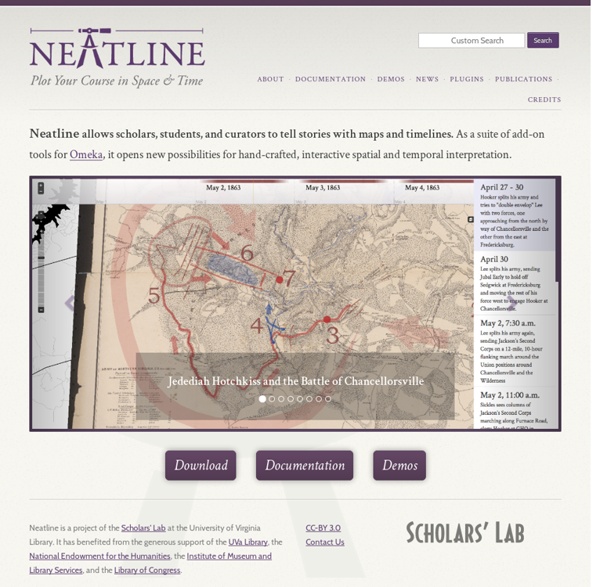
Neatline

Neatline
Related:  Mappe storicheStoria

Mémoires d'Hadrien - Entrer dans une œuvre résistante par la cartographie des lieux Outil numérique :IGN Édugéo (offre de l’Éduthèque)Niveau : expérimentation menée en classe de 1ère générale, transposable en 2de comme en 1ère technologique. Pourquoi l’entrée par la cartographie ? Au programme de 1ère générale depuis septembre 2019, Mémoires d’Hadrien apparaît souvent d’emblée comme une œuvre « résistante » dans laquelle il est difficile d’entrer. Face à cette œuvre érudite, où les éléments de reconstitution historique occupent une large place, l’une des premières difficultés est celle de la construction de l’univers de référence : une connaissance déjà relativement fine de la culture gréco-romaine ainsi que des différentes civilisations de l’Antiquité, notamment celles du Moyen-Orient, paraît nécessaire pour véritablement entrer dans ce roman. Du côté des élèves, on retrouve cette difficulté posée par l’univers de référence. Ce problème est bien entendu accentué, à l’échelle du roman, par le fait que les noms des lieux ne sont souvent plus en usage de nos jours. 1. 2.

VisualEyes David Rumsey Historical Map Collection | The Collection Medieval History Lectures: Dr. Lynn H. Nelson Please take into consideration the purpose and audience for which the lecture notes listed above were written. For a good many years, I taught a three-credit-hour freshman survey entitled Introduction to Medieval History to enrollments of room-size - generally three hundred students. During those years, the University of Kansas maintained an open enrollment policy in which all graduates from accredited Kansas high schools were admitted to the University. Since the only history courses required by the State of Kansas at the secondary level were in American History, students enrolling for this course varied widely in their knowledge of the European past. Consequently, my lectures were both basic and episodic, concentrating on major events and topics that would prepare the students for further enrollments in Humanities courses and attempting to demonstrate that the study of History could be both useful and enjoyable.

Herodotus Timemap Book 1, Ch. 1 This is the display of the inquiry of Herodotus of Halicarnassus, so that things done by man not be forgotten in time, and that great and marvelous deeds, some displayed by the Hellenes, some by the barbarians, not lose their glory, including among others what was the cause of their waging war on each other.The Persian learned men say that the Phoenicians were the cause of the dispute. These (they say) came to our seas from the sea which is called Red, and having settled in the country which they still occupy, at once began to make long voyages. TheHistoryNet: From the World's Largest History Magazine Publisher Verba Incognita: A Guide to Deciphering Latin on Maps | Worlds Revealed: Geography & Maps at The Library Of Congress This is a guest post by Kelly Bilz, Librarian-in-Residence in the Geography and Map Division. Even though Latin had fallen out of vernacular use after the fall of Rome (and began to evolve into the modern Romance languages), it lived on in its written form, becoming the lingua franca, so to speak, of scholarship. In particular, western cartographers during the Renaissance used Latin in their maps, resulting in a large collection of maps in the Geography and Map Division written in this ancient language. Seeing these polysyllabic words in a long list of search results can be disorienting; fortunately, being familiar with a couple key terms can help you navigate Latin titles with ease– without having to study Latin for eight years, as I did! Mappa totius mundi : adornata juxta observationes dnn. academiae regalis scientiarum et nonnullorum aliorum secundum annotationes recentissimas. Map by Guillaume de L’Isle and Tobias Conrad Lotter, 1775. Imperium Romano-Germanicum. Learn more:

The 11 Absolute Weirdest True Facts About The French Revolution Chronas. Carte interactive de toute l'histoire mondiale Dernière mise à jour le 15 novembre 2021 Article mis à jour en novembre 2021. Chronas est un projet fou qui devrait intéresser tous les passionnés d’Histoire. Il s’agit d’une carte collaborative et interactive de toute l’histoire mondiale. L’idée est d’y faire figurer dans une colossale frise chronologique l’ensemble des évènements, lieux et personnages historiques de la préhistoire à nos jours. Ils sont fous ces Romains… Chronas est une application web qui affiche une carte historique avec pas moins de 50 millions de points de données. Un mélange d’Open Street Map, de Wikipedia et de Google Earth. Le projet Chronas cartographie 4000 ans d’histoire mondiale (personnages historiques, évènements, cultures, religions…) sur une carte avec à chaque fois des liens vers des articles connexes de Wikipedia. Sur la carte, on peut naviguer à travers les années en utilisant un curseur en bas de l’écran qui permet de se déplacer sur la frise chronologique. Les chiffres de Chronas donnent le vertige.

Livius. Articles on Ancient History Res Obscura: The Most Wonderful Map in the World: Urbano Monte's Planisphere of 1587 At some point in 1589, a Milanese cartographer named Urbano Monte made up his mind: his self-portrait needed updating. Monte carefully crouched over the section of his map that bore his self-portrait from two years earlier — close-cropped sandy hair, a trim beard, modest clothes — and pasted a new self-portrait over it. The resulting double self-portrait (Monte at 43, hidden beneath a new portrait of Monte at 45) testifies to the persistence of male pattern baldness throughout human history. It also exemplifies Monte's astonishing attention to detail. If the two years that divide Monte's self-portraits seem to have led to some lost hair and added wrinkles, we can hardly blame him. Perhaps the most striking thing about the map is the elaborate organizational schema of the 60 sheets that comprise it. And here it is in a more familiar projection: Monte's map is quite impressive as a work of continental-scale cartography. Above all, Monte's was an ocean-oriented map.

International Newspaper Archives More and more digitized archives for historical newspapers from around the world are coming online. A large number are available for free, covering a broad swath world history, from the 1600s to modern times. Vintage newspaper archives from all over the globe are highlighted on this page (other than US and Europe archives, which are on other pages). Headlines, articles, display ads, broadsides, classifieds, sports scores, financials, the rise and fall of empires…all there for the taking. News Flash! European Newspaper Archives (see separate page) U.S. Canadian Newspaper Archives Canadian newspapers and the Second World War. British Columbia, Canada newspaper archives, from 1926 on, courtesy of the Terrace, BC library. The British Colonist, British Columbia, 1859-1860. More British Columbia, Canada papers from the Prince George newspaper project, covering 1909-1976, with more anticipated. Toronto Star, covers the past century. Manitoba, Canada Newspaper Archives, 1859-present.

Old-Maps - the online repository of historic maps - UK

Related: