

World War 2 In Color: 44 Eye-Opening Photographs. 1 of 45 U.S. troops, among the first to land during the D-Day invasion, approach the beaches of Normandy, France, likely near Saint-Laurent-sur-Mer, on June 6, 1944.Robert F.
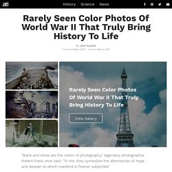
Sargent/United States Coast Guard/Galerie Bilderwelt/Getty Images 2 of 45 U.S. Navy sailors rescue a survivor from the water alongside the sunken battleship USS West Virginia amid the Japanese air raid on Pearl Harbor, Hawaii on December 7, 1941.Army Signal Corps/U.S. Första världskriget. Citat. Ett språkutvecklande upplägg till arbetsområdet "Industriella revolutionen" Språkutvecklande undervisning handlar bland annat om att det ska råda en samstämmighet mellan målet, undervisningen och bedömningsuppgiften.

En baklängesplanering är därför nödvändig. Maps to be Used for the History of Europe. Euratlas Periodis Web shows the history of Europe through a sequence of 21 historical maps, every map depicting the political situation at the end of each century.
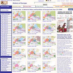
Here, on the left, are 21 mini-maps giving access to 21 full maps and to 84 quarters of maps with more detailed views of the states, provinces and main cities.Moreover, each map offers a historical gazetteer. Thus you can highlight in red each sovereign state and in green each dependent entity. See the Map Legend for more details. Navigation through the atlas is easy: on the left side of the pages, you simply need to choose a century for temporal navigation. Dailymotion tusen år till julafton 1-20. Minnesota Historical Society. Hundreds of Swedish-language newspapers were published in the United States from 1850 onward, catering to America's Swedish immigrant communities.

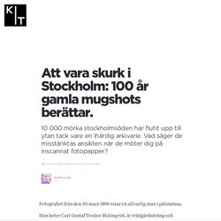
Use this online portal to learn more about these newspapers, and to search over 300,000 digitized newspaper pages from 28 different Swedish American newspaper titles published across the United States between 1859 and 2007. You can help improve the newspaper search results and create a richer experience for all users by using the Text Correction Tool and User Annotation Tool. When newspaper pages are added to the system, the pages are "read" and digital text is created by Optical Character Recognition (OCR) software. Sometimes the software "mis-reads" words on the page – leading to gaps and omissions in the search results when a user performs a search. With the Text Correction Tool, users can look for and fix mistakes in any page's digital text, which will improve search results for future users. KIT. Fotografiet från den 30 mars 1896 visar en allvarlig man i pälsmössa.
The History of Europe: 5,000 Years Animated in a Timelapse Map. If you’re an Open Culture old timer, you know the work of EmperorTigerstar–a Youtuber who specializes (to quote myself) “in documenting the unfolding of world historical events by stitching together hundreds of maps into timelapse films”.

We’ve previously featured his “map animations” of the U.S. Civil War (1861-1865), World War I (1914-1918), and World War II (1939-1945) and also the History of Rome. This week, the map animator released The History of Europe: Every Year. In ten minutes, he takes us from The Minoan civilization that arose on the Greek island of Crete (3650 to 1400 BC), down to our modern times. About 5,000 years of history gets covered before you can boil a pot of pasta. Follow Open Culture on Facebook and Twitter and share intelligent media with your friends. If you’d like to support Open Culture and our mission, please consider making a donation to our site. Related Content: Svenskens uppfinning blev världskänd – han dog utfattig. The octopuses of war: WW1 propaganda maps in pictures.
Abraham Lincoln's letter to his son's teacher. He will have to learn, I know, that all men are not just,all men are not true.But teach him also that for every scoundrel there is a hero;that for every selfish Politician, there is a dedicated leader...Teach him for every enemy there is a friend,
A 19th-Century Vision of the Year 2000. In this section of the site we bring you curated collections of images, books, audio and film, shining a light on curiosities and wonders from a wide range of online archives.
With a leaning toward the surprising, the strange, and the beautiful, we hope to provide an ever-growing cabinet of curiosities for the digital age, a kind of hyperlinked Wunderkammer – an archive of materials which truly celebrates the breadth and variety of our shared cultural commons and the minds that have made it. Some of our most popular posts include visions of the future from late 19th century France, a dictionary of Victorian slang and a film showing the very talented “hand-farting” farmer of Michigan.
With each post including links back to the original source we encourage you to explore these wonderful online sources for yourself. Download 67,000 Historic Maps (in High Resolution) from the Wonderful David Rumsey Map Collection. Stanford University’s been in the news lately, what with expanding its tuition waiver last year and now facing renewed scrutiny over its ultra-low admissions rate.
