

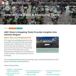
Georgia Voting Data - Tabular & Spatial. COVID-19 Data Hub. WelSTROM. Department of Housing and Urban Development. Neighborhood Atlas - Home. Atlanta Police Department. GIS For Racial Equity. Road & Traffic Data. National Transportation Dataset (NTD) - ScienceBase-Catalog. EJSCREEN: Environmental Justice Screening and Mapping Tool. Environmental Dataset Gateway. PAD-US Data Download. Georgia GIS Data Clearinghouse. Athens-Clarke - Copied. Atlanta Regional Commission - GIS Data & Maps. Latanza Adjei Vice President of Sales, Georgia Power Company Latanza Adjei is vice president of sales & marketing for Georgia Power.
In this role, she leads the implementation of the company’s top line revenue growth strategy. She is responsible for new product development, product distribution, e-commerce, sales management and energy efficiency. Adjei began her career with Georgia Power as a co-op student in 1994 and joined the company full time in 1998. Georgia Planning. DCA GIS Data DCA Map Atlas PDF maps prepared for various DCA programs and projects.
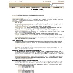
DCA Interactive Maps Page The interactive maps home page contains several resources useful to communities. Every map is interactive, you can zoom in to any area in Georgia or type in an address then click on the map to obtain more information. In the layers you can veiw and export the attribute table as a CSV file. Access DCA Rest Services Direct Map Links: Opportunity Zones and Job Tax Credits Opportunity Zones, Less Developed Census Tracts, Military Job Tax Credit Tracts, and County Tier rankings. Georgia Department of Community Affairs. Free Data Sources: Municipal Open Data Portals For 85 US Cities. BBBike extracts OpenStreetMap. Savannah Area GIS Open Data. City of Atlanta - Department of City Planning GIS. Fulton County, Georgia - Open Data. Mapping Inequality. Downloads & Data If you are citing Mapping Inequality or acknowledge the source of any of the following data, we recommend the following format using the Chicago Manual of Style.
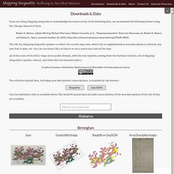
Robert K. Nelson, LaDale Winling, Richard Marciano, Nathan Connolly, et al., “Mapping Inequality,” American Panorama, ed. Robert K. Nelson and Edward L. The URL for Mapping Inequality updates to reflect the current map view, which city or neighborhood or area description is selected, any text that is open, etc. All of the scans of the HOLC maps are in public domain, with the vast majority coming from the National Archives. The collective spatial data, including area descriptions transcriptions, is available in two formats: Data for individual cities is available below. CDC's Social Vulnerability Index. Resources. ArcGISOnline BeltLine Data.
AtlantaBeltline. Skip to content ArcGIS Admin Atlanta Beltline ●Edit my profile Admin's Profile Click thumbnail to change image.
Public-nps.opendata.arcgis. National Register of Historic Places Database and Research Page. The National Register of Historic Places is the official list of the Nation's historic places worthy of preservation.
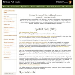
Authorized by the National Historic Preservation Act of 1966, the National Park Service's National Register of Historic Places is part of a national program to coordinate and support public and private efforts to identify, evaluate, and protect America's historic and archeological resources. Web based map with address search The map prefers the Google Chrome browser over Internet Explorer or Firefox. Download the - National Register of Historic Places Public Dataset spatial data (links to NPS IRMA Portal - link may not work with Firefox browser, but does work with IE Explorer and Chrome) The download link is about halfway down the page under the "holdings" section.
Users should be aware that many points and polygon boundaries require some level of correction. This dataset represents the contents of the available coordinates for unrestricted National Register properties. GNAHRGIS Public. NOAA: Digital Coast - Data Access Viewer. Digital Coast Data. GCAMP. GCAMP Map Built using ESRI's Web App Builder, the Georgia Coastal and Marine Planner (GCAMP) Map contains custom tools designed to make utilization of GCAMP data easy, useful and informative.

GCAMP Map Application users can perform custom queries on various datasets, view data charts, draw and measure features, turn layers on and off, adjust layer transparency, view attribute tables, identify features, change basemaps, view animations of time enabled data and print custom maps. GCAMP Energy Map Built using ESRI's Web App Builder, the Georgia Coastal and Marine Planner (GCAMP) Energy Map contains custom tools designed to make utilization of GCAMP data easy, useful and informative.
GCAMP Energy Map users can perform custom energy-specific queries on various datasets, view data charts, draw and measure features, turn layers on and off, adjust layer transparency, view attribute tables, identify features, change basemaps, view animations of time enabled data and print custom maps. SSURGO Downloader. Attributes Key fields from nine commonly used SSURGO tables were compiled to create the 173 attribute fields in this layer.
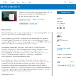
Some fields were joined directly to the SSURGO Map Unit polygon feature class while others required summarization and other processing to create a 1:1 relationship between the attributes and polygons prior to joining the tables. Attributes of this layer are listed below in their order of occurrence in the attribute table and are organized by the SSURGO table they originated from and the processing methods used on them. Map Unit Polygon Feature Class Attribute Table The fields in this table are from the attribute table of the Map Unit polygon feature class which provides the geographic extent of the map units. Area Symbol Spatial Version. FEMA Floodmaps. FEMA_Search All products. Fema flood zone definitions. Road & Traffic Data.
GA Dept of Community Affairs (DCA) - GIS Data. DCA GIS Data DCA Map Atlas PDF maps prepared for various DCA programs and projects.
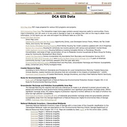
DCA Interactive Maps Page The interactive maps home page contains several resources useful to communities. Every map is interactive, you can zoom in to any area in Georgia or type in an address then click on the map to obtain more information. In the layers you can veiw and export the attribute table as a CSV file. Access DCA Rest Services Direct Map Links: Opportunity Zones and Job Tax Credits Opportunity Zones, Less Developed Census Tracts, Military Job Tax Credit Tracts, and County Tier rankings. GA Dept of Community Affairs (DCA) - Open Data. Multi-Resolution Land Characteristics (MRLC) Consortium. TNM Download. Users can find products in the following steps.
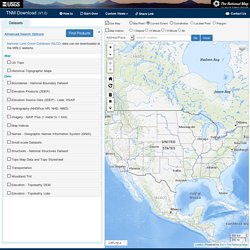
(Tutorial Videos) A. Find Products Select Datasets Users can select one or more datasets. When the checkbox next to the dataset name is checked, more options appropriate for each dataset are displayed under "Product Search Filter". B. Open the product list by clicking "results" next to the product count. C. Users can save selected products in a CSV file or save download URLs in a text file from the Cart. D. The National Map. USGS: National Hydrography Dataset. Data-algeohub.opendata.arcgis. USGS/EROS Center. ERS/USDA Data Sets. The resource you are looking for might have been removed, had its name changed, or is temporarily unavailable.
No worries! There are options: Go to our Home Page to see all the new features and information. Try our Topics page to look through the many subject areas and related products that ERS provides. Our Publications and Data pages will help you locate a particular product. If you are still having problems, please leave us some Feedback. Open Data - Dept of Homeland Security. National Wetlands Inventory. USDA:NRCS:Geospatial Data Gateway. Web Soil Survey (USDA & NRCS)
ReferenceUSA. EnviroMapper for Envirofacts. GIS Data Depot. Florida Geographic Data Library and Map Server. Map Gallery. Online. ArcGIS. Earthdata. National Register of Historic Places - Data.gov. Geospatial Data Resources. Twelve state public agencies joined the Space Data Infrastructure Program for the State of São Paulo, IDE-SP, , whose main objective is to consolidate an integrated network of geospatial databases of government instances.The information is from Companhia Paulista de Planejamento Metropolitano (Emplasa), manager of IDE-SP, which expects to have a total of 30 accessions in the second half of 2018.
"IDE-SP has been showing its benefits, with the organization, systematization, standardization and dissemination, in a more agile and secure way, of geospatial information, as established by the National Spatial Data Infrastructure (INDE)", emphasizes the director-president of Emplasa, Luiz José Pedretti.He explains that since the establishment of Decree 61.486 / 2015, the SD-SP has centralized the access to geospatial data of the various public institutions, integrating the state collection and promoting the dissemination of this information.
Home — Opendatasoft. Mapping Inequality. Downloads & Data If you are citing Mapping Inequality or acknowledge the source of any of the following data, we recommend the following format using the Chicago Manual of Style. Robert K. Nelson, LaDale Winling, Richard Marciano, Nathan Connolly, et al., “Mapping Inequality,” American Panorama, ed. Robert K. Nelson and Edward L. The URL for Mapping Inequality updates to reflect the current map view, which city or neighborhood or area description is selected, any text that is open, etc. All of the scans of the HOLC maps are in public domain, with the vast majority coming from the National Archives. :NRCS:Geospatial Data Gateway:Home. <p><img src="images/warning.jpg" alt="warning.jpg" style="float:left"/><span class="lgtext" > JavaScript is currently disabled on this browser. The Geospatial Data Gateway requires client side JavaScript in order to function. Please enable JavaScript before proceeding.
</span></p> The Geospatial Data Gateway (GDG) provides access to a map library of over 100 high resolution vector and raster layers in the Geospatial Data Warehouse. It is the One Stop Source for environmental and natural resources data, at any time, from anywhere, to anyone. ReferenceUSA: Off-Campus Login. National Storm Surge Hazard Maps - Version 2. Contents Introduction to the Hazard Maps This national depiction of storm surge flooding vulnerability helps people living in hurricane-prone coastal areas along the U.S.
East and Gulf Coasts, Puerto Rico, U.S. Virgin Islands (USVI), Hawaii, and Hispaniola to evaluate their risk to the storm surge hazard. These maps make it clear that storm surge is not just a beachfront problem, with the risk of storm surge extending many miles inland from the immediate coastline in some areas. What's New with November 2018 update to Version 2 Reprocessed Puerto Rico at an improved grid cell size Added USVI, Hawaii, and Hispaniola to Story Maps and data download No updates at this time for U.S. GIS & GPS Resources for Landscape Management and Urban Forestry. CropScape - NASS CDL Program. Sea Level Rise Data Download. Sanborn Fire Insurance Maps for Georgia Towns and Cities, 1884-1941 Collection Items - Digital Library of Georgia. Sanborn® Fire Insurance Maps.
PAD-US Data Overview. << Back to Protected Areas Lands in PAD-US are mainly open space/resource lands owned in fee by agencies and non-profits. Conservation easements suitable for distribution in the public domain are also included. The current data set includes the “GAP Status Codes” of these lands, indicating how they are being managed for conservation purposes. Portfolio – NGDA Portfolio Community. Response.restoration.noaa.gov. National Shoreline. Smart Location Mapping.