

Parts of Sydney's north evacuated amid major flood risk as wild weather set to continue. Parts of Sydney's north-west have been ordered to evacuate overnight amid a major flooding risk in low-lying areas of the Hawkesbury-Nepean River.
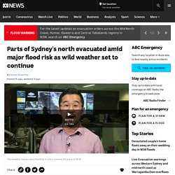
The NSW SES has received 6,000 calls for help so far, with 640 overnightTwo bushwalkers were rescued in the Blue Mountains after they were trappedThe flood crisis will likely continue until Thursday as the trough moves south The NSW State Emergency Service (SES) is ordering anyone in low lying areas of Agnes Banks, Pitt Town Bottoms, Pitt Town North, Cornwallis, Grono's Point on the Hawkesbury and low-lying areas of North Richmond to evacuate. Another order was issued for Freeman's Reach along the Hawkesbury. The SES said moderate flooding is taking place along the Hawkesbury at North Richmond and Windsor, but the river level is expected to exceed the major flood level (10.5 metres) on Sunday morning, with further rises possible.
Statewide a total of 640 calls for help were made overnight, with 66 of those being flood rescues. Warragamba Dam overflows for first time in years amid NSW 'extreme weather event' Sydney's main water source, Warragamba Dam, has spilled over for the first time since 2016, as rivers in Australia's largest city swell amid a downpour.
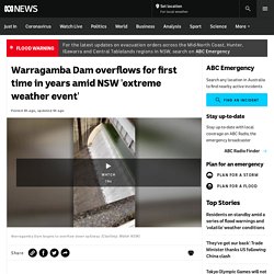
Water began cascading over the dam wall about 4.00pm Saturday, not long after authorities warned much of Greater Sydney to brace for flooding. NSW's coastline has been pummelled by a days-long rain event that the Bureau of Meteorology (BoM) has warned will continue into next week. Several areas have sustained record falls, and while the dam — which is about 70 kilometres from Sydney's CBD — also spilled over in 2012 and 2013, the last major flooding event was in 1990. An evacuation order was issued for Picton, about 40km away from the dam, just over an hour after it started overflowing. Authorities are particularly worried about the situation in the nearby Hawkesbury-Nepean valley, which the NSW State Emergency Service (SES) says has one of Australia's highest flood-danger levels.
North Queensland coastal communities to be hit with gale force winds and rain from Tropical Cyclone Niran. Tropical Cyclone Niran is expected to intensify off the north Queensland coast this morning, but will likely head further out to sea.
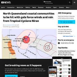
TC Niran remains a category two system and is almost stationaryIt is sitting 330 kilometres north-east of Cairns and is expected to move out to seaCoastal communities are still being warned of gale force winds and rain The cyclone remains a category two system and is almost stationary, around 330 kilometres north-east of Cairns. A warning zone is still in place from Cape Flattery to Innisfail. Cyclone Niran has been menacing the coast for days now, causing flash flooding and heavy rain. The SES has dealt with over 100 call-outs since Sunday in Cairns, where residents erected tarpaulins to repair leaking roofs ahead of more wild weather. Tropical low in Coral Sea off north Queensland may brew into a cyclone. A tropical low is set to develop in the north-west Coral Sea off north Queensland over the weekend and is likely to intensify into a cyclone.
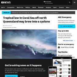
Key points: Rainfall in the north-east is dependent on the development of the tropical low or cycloneShowers and thunderstorms will increase in the north-east and central coast from late FridayConditions in the south-east will heat up during the week Bureau of Meteorology (BOM) forecaster Kimba Wong said it was not clear where the system might sit as it intensified or what its direction of movement would be. "Atmospheric conditions are ripe for tropical cyclone development," she said.
"It will very much depend on how far it is offshore — the interaction with land can be quite a significant impediment. "But there is quite a high chance we'll see that development over the next week. " Tropical cyclone watch declared for Gulf communities, system expected to strengthen. A cyclone watch is in place for Gulf of Carpentaria communities between Aurukun and Karumba, including Mornington Island, as a tropical low moves slowly towards the Queensland coast.
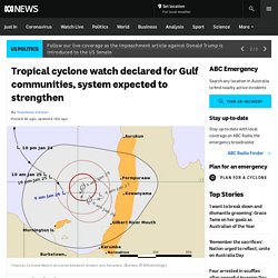
A cyclone watch is in place for communities between Aurukun and KarumbaThe BOM expects it to form into a category two cyclone by Wednesday night or ThursdayHeavy rainfall of up to 200 millimetres per day over several days is possible The latest advice from the Bureau of Meteorology (BOM) said the low was expected to develop into a tropical cyclone — to be called Lucas — on Wednesday.
A severe weather warning has been issued for damaging winds, with peak gusts of up to 100 kilometres per hour possible about the western Cape York Peninsula coastal areas between Weipa and Pormpuraaw today. The damaging wind gusts may extend to Thursday Island and to inland areas of Cape York Peninsula, depending on the movement and intensity of the tropical low. BOM warns Tropical Cyclone Kimi due to make landfall in Far North Queensland tonight. Far North Queensland authorities say they are prepared for the second tropical cyclone to hit the state this summer, with Cyclone Kimi predicted to make landfall in the area around Cardwell this evening.
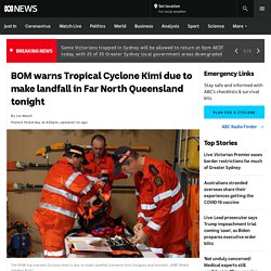
Key points: A warning has been issued from Port Douglas to LucindaDestructive wind gusts up to 150 kilometres per hour are predicted Residents have also been warned of heavy rainfall, abnormally high tides and flash flooding Premier Annastacia Palaszczuk said it was important for locals to stay up to date with current alerts as the cyclone could change course. "The bureau will be giving you updates every three hours and, of course, cyclones are a little bit unpredictable and they will move, of course, during the course of today," she said. Tropical Cyclone Imogen delivers falls of more than 200mm to Queensland Gulf communities.
More than 1,000 people have been without power in Queensland's Gulf of Carpentaria since 3:00pm on Sunday after Tropical Cyclone Imogen travelled through the region overnight.
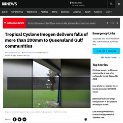
Key points: Tropical Cyclone Imogen crossed land at about 9:00pm last night, just north of Karumba, in the Gulf of CarpentariaThe system is expected to drop widespread rain over the coming daysNormanton airport recorded 259mm overnight, with 186mm in three hours TC Imogen crossed land just north of Karumba about 9:00pm, dumping plenty of rain on townships. Victoria hit by severe thunderstorms, producing heavy hail and flash flooding. Homes have been damaged by hail and flash flooding in Victoria's south-west as ferocious storms sweep across the state.
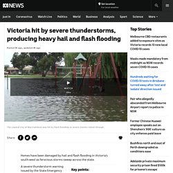
Emergency authorities warn storms moving across the state could produce life-threatening flash floodingThe SES was called to 91 jobs over a six-hour window in the Warrnambool areaThe Bureau of Meteorology predicts the weather front will continue to move east into Saturday evening A severe thunderstorm warning issued by the State Emergency Service warned "damaging winds, heavy rain, large hailstones and life-threatening flash flooding" were likely. The agency warning Victorians to be aware of floodwater, debris, damaged buildings, downed trees and fallen powerlines. Emergency crews were called to 91 jobs over a six-hour window in Warrnambool, including whole houses which had been flooded and some building damage. Warrnambool has received 47 millimetres of rain since 9:00am today, while Mildura in the north-west received 12mm in the 30 minutes before midday and large hail. At least four people dead as Tropical Cyclone Yasa leaves trail of destruction in Fiji.
The death toll from a category five cyclone that tore through northern Fiji has risen to four, as emergency crews work to assess the full extent of the damage from one of the year's strongest storms.
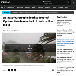
Key points: The deaths of two men come after two people, including a baby, were confirmed as casualtiesOne resident says everybody was "astonished with fear" as Tropical Cyclone Yasa hit her villageMore than 16,000 people are still living in evacuation centres across Fiji. The term has been used a lot over the past few days, so what exactly is a' king tide'? - ABC News. The term "king tide" has been used in high rotation as the east coast has experienced wild weather and battering waves over the past few days but it is not technically a scientific term.
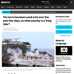
Key points: "King tide" is a term widely used to describe particularly high tides but it is not a technical scientific definitionSpring and neap tides are the terms for highest and lowest tides of the month as dictated by the rotation of the Sun, Moon and EarthWeather and climate factors can push tides to well beyond what they would have been if purely dictated by astronomical effects The tides are governed by a delicate play between the movement of the Sun, Earth and Moon as well as local weather, currents, climate and waves. No matter what they are called, there has been a fair bit at play behind the damaging waves over the past few days. Queensland BOM forecast predicts more cyclones than usual this year due to La Niña warming Coral Sea - ABC News.
More than four tropical cyclones are likely to form in the Coral Sea this summer, the Bureau of Meteorology (BOM) has predicted. The BOM has briefed the Queensland Cabinet on the cyclone season outlook, with the La Niña weather pattern expected to bring higher rainfall, above-average flooding and more tropical cyclones than last summer. Senior meteorologist Laura Boekel said while she could not give specific numbers, more than four cyclones were predicted to form in the Coral Sea this season, as well as one to two in the Gulf of Carpentaria. "One to two of those [could be expected to] cross the coast … and with the La Nina, more likely than not, we'll see an increase in those numbers," she said.
She said BOM predictions did not extend to the severity of the cyclones, but that Queensland was facing a "different" La Niña event to the one that caused devastating flooding in 2011. NT councils say lack of coastal cyclone shelters puts Indigenous communities at risk - ABC News. Regional councils in the Northern Territory say a lack of funding and focus on building cyclone shelters is leaving coastal Aboriginal communities exposed to danger and displacement. Key points: NT regional councils are calling for more coastal cyclone shelters A multi-million-dollar shelter that was to be built in Borroloola by this month, has been delayedCyclone Trevor evacuations cost the Territory and Commonwealth governments $4.5 million last year "At the moment, the NT Government is not taking this very seriously," Matthew Ryan, Mayor of West Arnhem Regional Council, said.
Councillor Ryan said he had been lobbying for a new cyclone shelter to be built in the remote Indigenous community of Maningrida, 500 kilometres east of Darwin, for several years. "The NT Government should listen to the community's voices, and as a council that advocates on behalf of the community, we are carrying this message from the community, we're not making this stuff up," he said. 'Catastrophic' south-east Queensland storms lead to thousands of insurance claims, homes deemed 'unliveable' - ABC News. Homes in south-east Queensland pummelled by enormous hailstones on Saturday have been deemed "unliveable" with insurers warning residents to beware of "disaster chasers" preying on vulnerable households. Key points: Insurers are warning residents of storm-damaged properties to be on alert for scammersMore than 8,500 claims have been lodged since the weekend's stormsThe SES is working to clear the backlog of requests for help.
Vietnam tackles Typhoon Molave's deadly aftermath, searches through landslide destruction as new storm threatens region - ABC News. Rescue teams have been searching for more signs of life after a series of deadly landslides in central Vietnam unleashed by heavy rains from Typhoon Molave. Key points: Molave is the most powerful storm to hit Vietnam in 20 yearsTyphoons have already killed at least 160 people in central Vietnam this yearAnother potential typhoon is forecast to reach the hard-hit region next week Helicopters, soldiers and search dogs have been deployed to look for dozens of people feared dead following at least five mudslides in a region battered by weeks of intense weather and the worst floods in years. Molave has killed close to 40 people since it arrived in Vietnam two days ago, although many people were rescued on Thursday, including three fishermen found in the sea by a cargo vessel and 33 people pulled from a tiny village buried by earth.
"The typhoon has left extremely huge damage," Deputy Prime Minister Trinh Dinh Dung told a cabinet meeting on Friday. Ninth typhoon barrelling toward Vietnam. Queensland storms forecast again, but now there's a risk of fires - ABC News. South-east Queensland could see a third consecutive day of storms, after a number of "intense cells" battered parts of the region again yesterday. Persistent heavy rain, strong winds and damaging hail cut power to more than 5,000 homes and caused flash flooding in some areas. As the storms swept through, more than 80,000 lightning strikes were recorded by Energex and 18 power lines were torn down. Senior Meteorologist Felim Hanniffy said the system was lingering today and may bring another wave of wild weather.
'Carbon copy' storms to ramp up in Queensland's south-east - ABC News. Cold air funnel spotted over Warwick as storms hit southern Queensland - ABC News. Meet the Darwin family whose cyclone survival bus means they're prepared for whatever La Niña delivers - ABC News. As the Bureau of Meteorology warns of an increased number of cyclones this season, there is one Darwin family who is ready for whatever emergency nature throws at them. Kununurra counts 'catastrophic' cost after freak storm slams WA town's airport - ABC News. Kununurra aviation operators are assessing the damage after an intense storm flipped planes and damaged buildings in the West Australian town yesterday afternoon.
Buildings partially collapse after another night of raging seas on the NSW Central Coast - ABC News. Satellite images reveal Cyclone Harold's path of destruction in Vanuatu. Posted about 3 hours agoSat 11 Apr 2020, 5:33am. Ten years on, the great Perth hail storm of 2010 remains WA's most expensive natural disaster. Updated about an hour agoSun 22 Mar 2020, 1:37am Monday March 22, 2010, started like any ordinary early autumn day — it was warm, the sun was out, winds were light. But something extraordinary was brewing in those seemingly calm skies and it had even the most experienced forecasters on edge. Severe cyclones are spreading further south and it could mean tens of billions in damages. Updated about 2 hours agoFri 6 Mar 2020, 2:16am The chance of a devastating category four cyclone hitting Brisbane, the Gold Coast and northern NSW, causing tens of billions of dollars in damage, is higher than ever, according to Australia's largest general insurer.
Ex-tropical cyclone Esther hits Victoria, bringing heavy rain, flooding and damaging winds. Updated 15 minutes agoThu 5 Mar 2020, 12:12am. BOM says ex-cyclone Esther could re-intensify as it loops across the north bringing heavy rains - ABC Rural - ABC News. 'Raging' floodwaters unexpectedly inundate Gascoyne region after Ex-Tropical Cyclone Damien - ABC Rural - ABC News. At about 10:00pm on Wednesday night, David Hammarquist was sitting on his verandah and noticed floodwaters rising quickly. Kimberley family lucky to survive after freak storm batters remote community. Ex-tropical Cyclone Uesi passes straight over Lord Howe Island, damaging buildings and ripping down trees. Tropical Cyclone Uesi set to hit Lord Howe Island, bringing 120 kph gale-force winds and large swells.
Edible-nest swiftlet — famous for bird's nest soup — potentially sighted during cyclone in Australian first. Tropical Cyclone Uesi to bring more severe weather to NSW, properties at Collaroy threatened. Cyclone Uesi set to bring heavy swells to Queensland's east coast by Friday. Cyclone Debbie rebuild continues for 'heartbroken' north Queensland residents. Tropical Cyclone Damien brings flooding, gale-force winds and storm surges as it tracks inland. Cyclonic system to bring more heavy rain to northern Queensland. Early cyclones bring relief, and even a near-record soaking, to dry far north Queensland farmers - ABC Rural - ABC News. 'Like a mini cyclone': Trees, powerlines down as Top End lashed by storm cell. Cyclone Oma could approach southern Queensland coast from Thursday, BOM says.
More storms on the way in central and south Queensland as cyclone brews. Wild winter weather sees Perth beaches eroded, as destructive winds, thunderstorms forecast. Tropical Cyclone Oma could cross the southern Queensland coast, BOM says. Cyclone watch for Queensland cancelled as TC Oma weakens. Cyclone Oma is not the first cyclone to threaten Brisbane. The Madden-Julian oscillation is one reason cyclones are steering clear of WA in 2019. One year on from Cyclone Marcus, a Darwin tree-planting scheme promises not to repeat past mistakes. Sydney cleans up after super cell storms with giant hail as flight cancellations continue. Tropical Cyclone Trevor forms off Far North Queensland coast. Cyclone Trevor strengthens to category three as it nears Far North Queensland coast. Tropical Cyclone Trevor continues across Far North Queensland as category-two system. Gulf fisherman thought he 'was going to die' in Cyclone Trevor nightmare at sea - ABC Rural - ABC News.
Mass evacuations for NT coastal communities as Cyclone Trevor approaches. Cyclone Veronica forms off WA coast, with warning 'strong system' set to reach Pilbara. Cyclone Vance remembered 20 years after the category five system devastated Exmouth. Cyclone Trevor continues to intensify off Northern Territory's western peninsula coast, amid mass evacuation. Cyclone Idai death toll rises past 300 as video reveals extent of devastation. Utes packed to the brim as coastal residents flee Cyclone Trevor. Cyclone Trevor barrelling towards Territory coast as a category four system. Cyclone Veronica leaves Port Hedland residents preparing for imminent impact. Cyclone Veronica approaches WA's Pilbara with damaging storm surge sparking evacuation calls. Cyclone Vance remembered 20 years after the category five system devastated Exmouth. Cyclone Trevor's destructive eye slams Northern Territory coastline with 250kph winds.
Port Hedland could be in the eye of Cyclone Veronica for up to eight hours, authorities warn. Cyclone Trevor creates wind gusts as violent as Cyclone Tracy before downgrading to tropical low. Northern Territory's Barkly region braces for Tropical Cyclone Trevor deluge. Cyclone Veronica could impact Australian economy. Twin cyclones delivering heavy rain to parched outback cattle stations - ABC Rural - ABC News. Cyclone Veronica flooding hits pastoralists in Pilbara as land stricken by drought is inundated. Cyclone Trevor's damage to Iron Range rainforest in Cape York could last decades, researchers fear.
Cyclone a 'high chance' off WA, could hit Pilbara or Kimberley weeks after Veronica, BOM warns. Dozens killed as Cyclone Fani hits Bangladesh and India. Greek storms kill six as 'extremely unusual' weather prompts state of emergency. BOM weather warning issued for dangerous winds and blizzards in NSW, Vic and SA. Cyclones Trevor and Veronica loom over northern coasts stirring up a storm of questions. Cyclone Tracy survivors struggle with trauma 45 years on from one of Australia's worst disasters. Potential Tropical Cyclone Claudia expected to form on Saturday. Cyclone Damien intensifies off WA coast as Karratha braces for impact on Saturday.