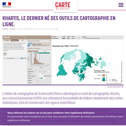

Mooc SciencesPO "Lire une carte" Khartis, le dernier né des outils de cartographie en ligne. L’Atelier de cartographie de SciencesPo Paris a développé un outil de cartographie, Khartis, qui a réussi la prouesse d’offrir aux utilisateurs la possibilité de réaliser simplement des cartes statistiques, tout en conservant une rigueur scientifique.

Créé en 1995, l’Atelier de cartographie de SciencePo est spécialisé dans la visualisation de l’information, notamment géographique. Il assure des missions d’enseignements, d’accompagnement à la recherche, propose son expertise auprès d’organisations internationales, participe à des projets éditoriaux ou encore s’inscrit dans des projets muséographiques. En 2016, l’atelier de cartographie lance officiellement Khartis : un outil de fabrique cartographique interactive. Certes ce n’est pas le premier outil de cartographie statistique en ligne, cependant, Khartis se distingue par sa volonté d’accompagner l’utilisateur dans le processus de création de sa carte de A à Z. Khartis est un projet OpenSource. Carte IGN (niveaux de gris) - Géoportail. MANUEL DE GÉOGRAPHIE HISTORIQUE DE LA FRANCE. ScapeToad - cartogram software by the Choros laboratory.
The History of Cartography, the "Most Ambitious Overview of Map Making Ever," Now Free Online. Worth a quick mention: The University of Chicago Press has made available online -- at no cost -- the first three volumes of The History of Cartography.

Or what Edward Rothstein, of The New York Times, called "the most ambitious overview of map making ever undertaken. " He continues: People come to know the world the way they come to map it—through their perceptions of how its elements are connected and of how they should move among them. Compare Map Projections.
5.%20Cartographier%20le%20Monde. Une introduction à Scribble Map. GeoRezo, le Portail de la Géomatique et des SIG (Systèmes d'Information Géographique)
Sketchmap.co.uk. Map Maker.