

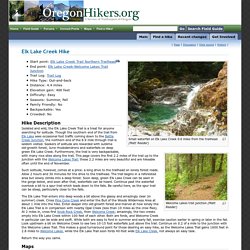
Deschutes River from Macks Canyon Hike - Hiking in Portland, Oregon and Washington. Elk Lake Creek Hike - Hiking in Portland, Oregon and Washington. Small waterfall on Elk Lake Creek 0.6 miles from the trailhead (Matt Reeder) Welcome Lakes trail junction (Matt Reeder) Start point: Elk Lake Creek Trail Northern Trailhead End point: Elk Lake Creek-Welcome Lakes Trail Junction Trail Log: Trail Log Hike Type: Out-and-back Distance: 4.4 miles Elevation gain: 400 feet Difficulty: Easy Seasons: Summer, Fall Family Friendly: No Backpackable: Yes Crowded: No Hike Description Such solitude, however, comes at a price: a long drive to the trailhead on lonely forest roads.
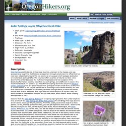
Allow 2 hours and 30 minutes for the drive to the trailhead. Alder Springs-Lower Whychus Creek Hike - Hiking in Portland, Oregon and Washington. Canyon ramparts, Alder Springs Trail (bobcat) View down into the Whychus Canyon from the Alder Springs Trail (bobcat) Bee on green-banded mariposa lily (Calochortus macrocarpus), Alder Springs Trail (bobcat) Deschutes River below the confluence with Whychus Creek (bobcat) Dry waterfall, Alder Springs Trail (bobcat) The hike to the Whychus-Deschutes confluence (bobcat) Description Alder Springs used to be one of those local favorites, unknown to the masses, and was accessed by a rough trail that followed an easement through private land.
Wade the creek here and come to the grassy flats that offer several campsites. Fees, Regulations, etc. Access road gated December 1st - March 31st Dogs on leash Creek ford required Maps Trip Reports. U.S. National Wilderness Preservation System Map.
Munra pt. Top Ten Hikes in the Pacific Northwest. Many of the hikes within national forests require a park pass.
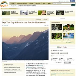
Pick one up at a ranger station or one of the many outdoor shops. advertisement 10. Big Quilcene Trail to Marmot Pass10.6-mile round-trip in Buckhorn Wilderness, Olympic Peninsula, WAIn case you haven't heard, the Olympic Peninsula isn't exactly dry. Yet not all rainfall falls equally, and the 10.6-mile round-trip hike along Big Quilcene Trail cuts through what could be the driest portions of the Buckhorn Wilderness, a spectacular 44,258-acre expanse of steep ravines and tumbling creeks. 9. 8. 7. 6. Fifty Classic Climbs of North America. Fifty Classic Climbs Of North America is a climbing guidebook and history written by Steve Roper and Allen Steck.[1] It is considered a definitive piece of climbing literature, known to many climbers as simply "The Book",[2] and has served as an inspiration for more recent climbing books, such as Mark Kroese's Fifty Favorite Climbs.[3] Though much of the book's contents are now out of date, it is still recognized as a definitive text which goes beyond the traditional guidebook.
The first edition was published in 1979, by Sierra Club Books in the United States and in Great Britain by the now defunct Diadem Books. This was followed by a paperback printing by Random House in 1981. Two subsequent editions (with the same content) were published by Sierra Club Books in 1982 and 1996. Between 1979 and 1999 it sold nearly thirty thousand copies, a considerable achievement for a climbing guide book.[2] No one person has yet climbed all fifty routes. The Fifty Classics[edit] Western Canada[edit] Mountain Climbing in the Northwest. The previous year's sun-dried grasses on Windy Point high above the John Day Fossil Beds National Monument await spring warmth to green up.

Ah, the freedom of the hills: the mantra of the mountaineer. But remember, it's only free if you don't screw up and trigger a risky helicopter evacuation at public expense. Oregon and the Northwest have had more than enough of these situations. We don't need to see another rescue on TV (over and over and over), or read about it in the newspaper. So, if you intend to climb a big mountain, first learn the ropes (take a mountaineering course from the Mazamas), get well-equipped (drop a couple thou at REI) and, most important, bring along your brain (and use it).
With the possible exception of Mount St. Oregon has only a dozen or so snowy volcanoes, so Beaver State mountaineers soon run out of worthy local peaks to climb. (top) A hiker tests a hand hold, practicing moves that may be needed to climb more difficult peaks as summer progresses. 1. 2. 3. 1. 8 Great Hikes in the Pacific Northwest. Wildflower expert Don Jacob Jacobson leads a group on a 5 hour hike from Coyote Wall to Major Creek in the Catherine Creek area to view wildflowers.
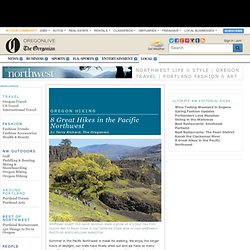
PHOTO BY ROSS WILLIAM HAMILTON Summer in the Pacific Northwest is made for walking. We enjoy the longer hours of daylight, our trails have finally dried out and we have so many beautiful places to go. Our roads take us to many of those places, but to see the best of the best we need to get out and hike. And sometimes not very far. The Coast FLORAS LAKE BEACHHike level: Easy Floras Lake is a sizeable dunes lake, popular for windsurfing because of predictable afternoon "breezes" -- which may feel like a hurricane on some days. Map by Vanessa Duff Drive: Head for Boice-Cope County Park, 15 miles south of Bandon and three miles west of U.S. 101 (the turn is just south of Langlois).