

NATS AUP. Metashape Python scripts. ZEN UAV. AirMap - Home. UK Mil AIP. What is my elevation? Chicago Convention. ORS4 1297 - use of observer in congested areas. Footpath Maps: free online ordnance survey map and public footpath finder app UK. Global Drone Regulations Database. What is my elevation? Who owns England? Land ownership map. CAP1763 ANO 2019 amendment order. EG ENR 2 2 - Other Regulated Airspace. Airfield restrictions - Dronesafe. National Flight Planning Map. AirMap - Home. EG GEN 2 3 chart symbols. Google Maps - Find GPS coordinates, longitude, latitude, altitude. Drone Operations Software. BBC Four - The Sky at Night, Death Star, The Carrington Event. Global Drone Regulations Database. Low flying military aircraft: Find out about low flying in your area. Contact the Ministry of Defence (MOD) for information about low flying military aircraft in your area.
Low flying in England, Wales and Scotland Contact the Low Flying Complaints and Enquiries Unit to complain or enquire about low flying in your area. Low Flying Complaints and Enquiries Unit RAF Wittering Peterborough PE8 6HB To make a complaint, send the following information: your name full address and postcode telephone number date and time of the problem location of the problem type of aircraft, if known a brief description of your complaint You should get a response within 20 days. Your complaint can be investigated by the Defence Flying Complaints Investigation Team if it’s about serious injuries or damage. Enquiries about horse riding Call the low level advisory service if you want to ride a horse and are worried about low flying aircraft.
Low flying in Northern Ireland Policy Legacy (FOI Team) HQ 38 (Irish) Bde and Northern Ireland Garrison Thiepval Barracks British Forces Post Office 825. SkyDemon Light. Addressing the world. XC Weather. CAP1687 ANO 2018 Amendment Order guidance. CAP382: Occurrence Reporting Scheme. CAP 393: The Air Navigation Order 2016 and Regulations.
This work sets out the current Air Navigation Order and amendments to it made by the Air Navigation (Amendment Orders 2017 and 2018, as shown in the text of the Order, together with Regulations made under the Order (excluding the Civil Aviation Authority Regulations which are made under section 7 of the Civil Aviation Act 1982), namely:
CAP 722: Unmanned Aircraft System Operations in UK Airspace - Guidance. CAP 722, Unmanned Aircraft System Operations in UK Airspace – Guidance, is intended to assist those who are involved in all aspects of the development of UAS to identify the route to certification, outline the methods by which permission for aerial work may be obtained and ensure that all requirements are met by the UAS industry.
The document highlights the safety requirements that have to be met before a UAS is allowed to operate in the UK. Please note: Changes to the Air Navigation Order 2016, effective from 30 July 2018 will require the renumbering of all articles quoted in CAP722, as well as expanding the specific content of some regulations. Details of the amendment to ANO 2016 can be found in CAP 1687. CAP 722 is currently being updated to reflect the changed regulations. Information about the assessment process for NQEs, along with details about the scope and privileges of the CAA approval can be found in Information Notice 2017/08. View File:Open document in new window. National Flight Planning Map. Magic Map Application. The SeaMonkey® Project. Find Accident and emergency services services. Cookies on the NHS website We've put some small files called cookies on your device to make our site work.
We'd also like to use analytics cookies. These send information about how our site is used to services called Adobe Analytics, Hotjar and Google Analytics. We use this information to improve our site. Let us know if this is OK. Skip to main content If you have recently travelled from China or are looking for information on the coronavirus outbreak please go to our page on coronavirus or the information on GOV.UK. Airfield Cards. CALCMAPS - Map Tools. EU Aviation Safety Reporting: Home. Airdata UAV - Flight Data Analysis for Drones. Maps showing rights of way. No Fly Drones. Drone Safety Map. UAV Forecast - K Index (Solar Weather) IE-on-Chrome - Run Skydemon Light in Chrome. Windy: Wind map & weather forecast. DJI – Unlocking. Last Updated: April 28, 2018 Thank you for your interest in the DJI Unlock Feature provided by SZ DJI Technology Co., Ltd. and its affiliates (“DJI”, “we,” or “us”).
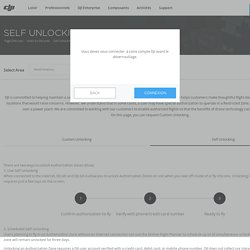
By applying for the Unlock Feature, you acknowledge that you have read, understood, and agreed to be bound by the following terms and conditions, DJI UAS Products Terms of Use, the DJI Go 4 App Terms of Use, the DJI Go App Terms of Use , the DJI Privacy Policy and the DJI Website Terms of Use (together, these “Terms”). If you are not eligible or do not agree to any of these Terms, then you may not apply or use the Unlock Feature. Please read the information disclosed below carefully, as we have established specific information practices and disclaimers for the Unlock Feature that may differ from the rest of the Terms. About Unlock Feature Information Practices To apply for the unlock feature, you will be required to provide us with some information about yourself and your intended flight location, including: i.
Disclaimers. BBC Weather. AIS - Home. Google My Maps - personalised maps. Bing Maps - free Ordnance Survey layer. The Photographer's Ephemeris - Web App.