

British Antarctic Survey - Homepages. The USGS Water Science School: All about water! USGS Home Contact USGS Search USGS The USGS Water Science School The USGS Water Science School Welcome to the U.S.
Geological Survey's (USGS) Water Science School. We offer information on many aspects of water, along with pictures, data, maps, and an interactive center where you can give opinions and test your water knowledge. Com.post.ability. Bounty Main. Recycle Reuse. Water Solutions. Water Research. GEO - Group on Earth Observations. Global geospatial community to convene in Geneva on May 5-9 Geospatial Media and Communications, in partnership with the Group on Earth Observations (GEO) and SwissTopo, will host the Geospatial World Forum on 5-9 May 2014 in Geneva.
The conference will convene representatives of the geospatial commercial sector and government/policy end users. A program titled, "Geospatial Industry Forging Ties with GEOSS" will be held on Monday, 5 May, and the GEO Appathon 2014 will kick off on Wednesday, 7 May. Find more information here. First Copernicus satellite, Sentinel 1A was launched successfully! The ability of European citizens, policymakers and service providers to access key environmental data on a routine basis will take a major step forward following the launch of ESA's Sentinel-1A satellite. The launch can be viewed here 10th GEO IGWCO COP Meeting.
Water in situ. SCIENCE. New Earth Space. Weather. Oceana Currents. Humane Ecology. New Ecology. Land Water BioMass. One World. Earth Paradigm. Science On a Sphere. Playlist Builder ..
/ftp_mirror/atmosphere/lightning/media/thumbnail_small.jpg Annual Lightning Flash Rate Map dataset.php? Id=6 Annual Lightning Flash Rate Map Description Before scientists had satellites to detect and measure lightning frequency, it was thought that there were globally 100 lightning flashes per second, an estimate that dates back to 1925. It is clear from this map that the distribution of lightning flashes around the world is uneven. Notable Features. Natural History. Emerging Trends. The International Association of Hydrogeologists - IAH / AIH. Scripps Institution of Oceanography, UC San Diego. Resource Collections - BioEd Online. Earth Science Picture of the Day. Microbial Life - Educational Resources. Teaching and learning about the diversity, ecology and evolution of the microbial world; discover the connections between microbial life, the history of the earth and our dependence on micro-organisms.
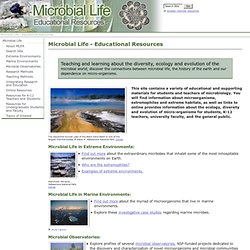
The expansive Sunset Lake of the Black Sand Basin is one of the largest thermal bodies of water in Yellowstone National Park. Details This site contains a variety of educational and supporting materials for students and teachers of microbiology. You will find information about microorganisms, extremophiles and extreme habitats, as well as links to online provides information about the ecology, diversity and evolution of micro-organisms for students, K-12 teachers, university faculty, and the general public. Microbial Life in Extreme Environments: Mammoth Terraces, Yellowstone National Park. Microbial Life in Marine Environments: Pancake ice in Ross Sea, Antarctica.
Find out more about the myriad of microorganisms that live in marine environments. Earth...Just A Click Away. The Leader In Online Imagery - Aerial Photos & Satellite Images. Climate Change: Vital Signs of the Planet. Climate Change, Deforestation, Biomes and Ocean Currents, Plankton, Endangered Species - Earth Web Site. Click for more detail Thermohaline Change Evidence is growing that the thermohaline current may be slowed or stopped by cold fresh water inputs to the Arctic and North Atlantic oceans.

This could occur if global warming is sufficient to cause large scale melting of arctic sea ice and the Greenland ice sheet. Such a change in the current may be gradual (over centuries) or very rapid (over a few years). Either would cause planet wide changes in climate. This effect may be part of what starts and stops the ice ages. "Diatoms (a kind of phytoplankton) are estimated to "scrub" roughly as much CO2 from the atmosphere each year as all the world's rainforests. "Net primary productivity is the mass of plant material produced each year on land and in the oceans by photosynthesis using energy from sunlight. Biodiversity is the variety of life found at all levels of biological organization, ranging from individuals and populations to species, communities and ecosystems. Ecology and Society. DESERTEC Foundation: Start. AFE - Association for Fire Ecology. Marine Geophysical Research. Ocean Color Image Archive Page. NOTE: All SeaWiFS images presented here are for research and educational use only.
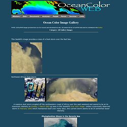
All commercial use of SeaWiFS data must be coordinated with GeoEye Category: All Gallery Images This SeaWiFs image provides a view of a Dust storm over the Red Sea. Northwest African Dust Storm A massive dust storm erupted off the northwestern coast of Africa over this past weekend and seemd to be at its maximum intensity on Sunday, 2 March 2003 as seen in this SeaWiFS true color image. Views Our Perpetual Ocean. Ocean Color Image Gallery. Smithsonian Ocean Portal. Earth and Space Research (ESR) HOME PAGE. Outreach and education at ESR. NASA Earth Observatory : Home. Eyes on the Earth. Earth. Earth Earth is a complex, dynamic system we do not yet fully understand.
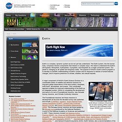
The Earth system, like the human body, comprises diverse components that interact in complex ways. We need to understand the Earth's atmosphere, lithosphere, hydrosphere, cryosphere, and biosphere as a single connected system. Earth's position on chosen date with respect to equinoxes, solstices and cross-quarters in chosen year, 2001-2020. European Geosciences Union. Welcome to the USGS - U.S. Geological Survey. Plate Tectonics The Tectonic Globe™ The Plate Tectonic Globe™ The Plate Tectonic Globe™ is a globe unlike any other currently on the market.
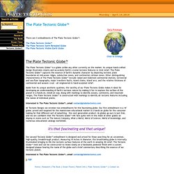
Pangaea & Plate Tectonics. Mineralogy Database. Mineralogy Database - Mineral Collecting, Localities, Mineral Photos and Data. Geology.com: News and Information for Geology & Earth Science. UCAR Community Programs (UCP) StatPlanet Map Maker ? Interactive Mapping & Visualization Software. Heat Maps. An international partnership to understand precipitation and its impact on humankind. Extreme Ice Survey.