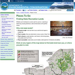

Rainforest Portal. NYS Forests & Recreation. Skip to main navigation (Photo: Geo Rittenbyer) Whether you're looking for a scenic spot for a picnic, or planning a week-long camping adventure, state-owned lands are the perfect choice.

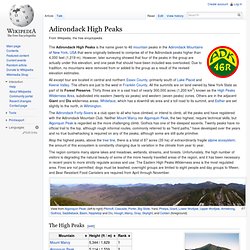
Why visit state lands? The price is right--most are free to use, and the rest require a modest fee.They're nearby--there are state lands in every county in New YorkThey're diverse--sandy beaches, vast forests, shimmering lakes, rocky peaks and much more.They're accessible--state lands accommodate a wide spectrum of interests and abilities. Click on any region of the map below to find state land near you, or where you plan to visit. Map showing state-owned recreation lands. The Adirondack High Peaks Facts. Where The Wild World of the Adirondacks Opens Before Your Eyes. Index.html. ADK time lapse project - FALL. Adirondack High Peaks. The Adirondack High Peaks is the name given to 46 mountain peaks in the Adirondack Mountains of New York, USA that were originally believed to comprise all of the Adirondack peaks higher than 4,000 feet (1,219 m).

However, later surveying showed that four of the peaks in the group are actually under this elevation, and one peak that should have been included was overlooked. Due to tradition, no mountains were removed from or added to the group as a result of the revised elevation estimates. All except four are located in central and northern Essex County, primarily south of Lake Placid and Keene Valley. The others are just to the west in Franklin County. All the summits are on land owned by New York State as part of its Forest Preserve. Atop the highest peaks, above the tree line, there is a total of 87 acres (35 ha) of extraordinarily fragile alpine ecosystem; the amount of this ecosystem is constantly changing due to variation in the climate from year to year. Table of the major 4000 meter summits of the United States. Topographic elevation is the vertical distance above the reference geoid, a precise mathematical model of the Earth's sea level as an equipotential gravitational surface.
Topographic prominence is the elevation difference between the summit and the highest or key col to a higher summit. Topographic isolation is the minimum great circle distance to a point of higher elevation. This article defines a significant summit as a summit with at least 100 meters (328.1 feet) of topographic prominence, and a major summit as a summit with at least 500 meters (1640.4 feet) of topographic prominence. An ultra-prominent summit is a summit with at least 1500 meters (4921.3 feet) of topographic prominence. There are 130 ultra-prominent summits in the United States. Catskill Mountain 3500 Club. Until fairly recently it was the only hiking organization with a specific Catskill focus.

Membership[edit] 3500 Club summit canister, shown prior to change in color and removal of exterior text requested by NYSDEC. Members record their climbs on a tally sheet and then submit them to the Club's membership chair when they have completed their last required peak. This is mostly done on the honor system; however sometimes the tally sheets are cross-checked against the logs kept in the canisters the club maintains at the summits of the 13 peaks that lack a trail to the summit.
As of late 2005[update] there are 1,599 regular members and 626 winter members. History[edit] The Club traces its origins to the early 1950s, when Dan Smiley, a descendant of the founders of Mohonk Mountain House and his fellow birders were trying to track down the elusive Bicknell's Thrush, then considered an unimportant subspecies of the gray-cheeked thrush. Their goal was not to bag peaks but simply to find the thrush.
Four-thousand footers. The term Four-Thousand Footers (or "4ks") refers to a group of forty-eight mountains in New Hampshire at least 4,000 feet (1,219 meters) above sea level.

To qualify a peak must also meet a more technical criterion of topographic prominence important in the mountaineering sport of "peak-bagging". The AMC also maintains a list of New England 4000-Footers, all falling within Vermont, New Hampshire, and Maine. Northeast 111. This list includes 115 peaks but is still referred to as the "Northeast 111" because that name predates the additions of Galehead Mountain and Bondcliff in New Hampshire, as well as Mount Redington and Spaulding Mountain in Maine, due to later surveys determining they do indeed rise to 4,000 feet (1,219.2 m) and satisfy topographic prominence requirements.

See also[edit] External links[edit] Catskill High Peaks including Slide and Hunter Trails. The Adirondack Forty-Sixers. Arches National Park - Arches National Park.