

Knewra salt mine: Inside mine so large it has a mosque and electric railway. World's second largest salt mine has 18 working levels and 40 kilometres of tunnelsSalt mine in Pakistan boasts a mosque made from salt, an electric train and an asthma clinic offering salt therapiesMine history dates back to 320 BC, following its discovery by Alexander the Great's troops By Olivia Williams Published: 22:21 GMT, 21 April 2013 | Updated: 12:00 GMT, 22 April 2013 The Khewra salt mine, the second largest in the world, is a warren of 40 kilometers of tunnels housing an illuminated mosque made from salt rock, an electric train and even an asthma clinic.
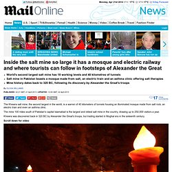
The mine 100 miles south of Pakistan's capital Islamabad is the largest and oldest salt mine in the country, drawing up to 250,000 visitors a year. Khewra was discovered back in 320 BC by Alexander the Great's troops, but trading started in Mughal era in the sixteenth century. Scroll down for video The main tunnel at ground level was developed during British rule by Dr. Cave photos by Peter Gedei over 25-year odyssey. By Nick Enoch Published: 14:59 GMT, 9 January 2013 | Updated: 15:12 GMT, 9 January 2013 While many of us would think twice before exploring the dark, dangerous caverns of the Earth's crust, for one fearless man, it is the perfect environment - and his greatest love.
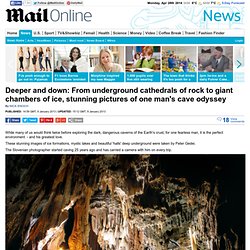
These stunning images of ice formations, mystic lakes and beautiful 'halls' deep underground were taken by Peter Gedei. The Slovenian photographer started caving 25 years ago and has carried a camera with him on every trip. Kostanjevika jama cave in Slovenia is one of the stunning scenes photographed by Peter Gedei Mr Gedei lives and works in Ljubljana and has been a member of Speleo Club Zeleznicar since 1987. The Slovenian photographer started caving 25 years ago and has carried a camera with him on every trip. Making a descent in Habeekovo brezno cave (left), and inside Kacna jama (right) one of the most famous Slovenian caves. Booming Ice Chasm: Underground chamber beneath Rocky Mountains has giant ice slides that never melt. 140 metre deep cave is beneath the Rocky MountainsCrystal clear ice makes explorers feel they are flying, while unique acoustics make it almost impossible to converse By Mark Prigg Published: 12:25 GMT, 10 December 2012 | Updated: 14:09 GMT, 10 December 2012 These are the stunning images which capture the breathtaking beauty of a new world discovered in an ice chasm beneath the Rocky Mountains.
The cave, called Booming Ice Chasm, was named for it's incredible acoustics - as falling rocks crash and 'boom' when they tumble down the 140 metre deep cave. The crystal clear ice is several meters thick - and explorers say navigating across it makes them feel like they are flying. Adam Walker inside a newly found cave, called Booming Ice Chasm, beneath the Rocky Mountains. The cave has unique acoustics as falling rocks crash and boom when they tumble down the 140 metre deep cave, making it hard to converse. Mail on Sunday Man is first to be pictured in Britain's biggest hole (look carefully at the very centre)
Journalist David Rose descends hundreds of feet below ground into the Frozen Deep at Cheddar Gorge, SomersetExplorers smash through boulders to find previously undiscovered chamberIt features country's longest stalactite column which stands at 20ft tall By David Rose Published: 22:13 GMT, 29 December 2012 | Updated: 10:09 GMT, 16 January 2013 By the gloomy light of our caving headlamps, it looks like a geological rubbish dump: a brown, muddy chaos of shadowy crevices and boulders – some the size of buses – that fell from the roof.
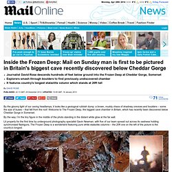
Welcome to The Frozen Deep, the biggest cave chamber in Britain, which has recently been discovered below Cheddar Gorge in Somerset. Underworld wonder! The stunning network of chambers and caves beneath Papua New Guinea mountains. By Anna Edwards Published: 04:28 GMT, 15 November 2012 | Updated: 09:18 GMT, 15 November 2012 It's an adventure that demands explorers spend their time in the cold, wet and dark.
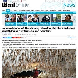
But for those who persevere, the results are certainly worth it. A French-Swiss team have made it their mission to explore a huge network of chambers and sinkholes beneath the Nakanai Mountains of New Britain, in Papua New Guinea. And for those who thought it was just the lush mountains and forest of the country that were beautiful, think again. Hamza River. Hamza River (Portuguese: Rio Hamza) is an unofficial name[1] for what seems to be a slowly flowing aquifer in Brazil, approximately 6,000 kilometres (3,700 mi) long.
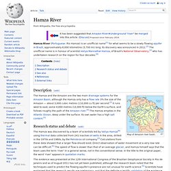
Its discovery was announced in 2011.[2] The unofficial name is in honour of scientist Valiya Mannathal Hamza, of Brazil's National Observatory,[3] who has undertaken research on the region for four decades.[4] Description[edit] Map of Amazon river basin. Research status and debate[edit] The Hamza was discovered by a team of scientists led by Valiya Hamza[6] using thermal data collected from 241 inactive oil wells in the area, drilled in the 1970s and 1980s, by the Petrobras oil company.[3] Calculations from these data showed that a larger flow should exist. See also[edit] References[edit] External links[edit] Brazilian Geophysical Society (SBGf)