

Edpuzzle. Jet Stream. What Is a Jet Stream? Are you ready to take flight?

Today in Wonderopolis, we're headed up, up, and way high in the sky. How high? We're traveling several miles up into the atmosphere to go sailing on a river of wind. What are we talking about? The jet stream, of course! A jet stream is a thin current of air that's several thousand miles wide and several thousand miles long. The winds in a jet stream are caused by differences in temperature between two large air masses that border the tropopause. As colder air tries to move toward the warmer air, winds form. How fast do the winds in a jet stream usually move? Jet streams were first discovered in the 1920s by a Japanese meteorologist named Wasaburo Ooishi. Research and knowledge about jet streams increased during World War II, as pilots noticed variations in winds as they flew between North America and Europe.
5th Grade Weather Final Version Web. Weathering and Weather - a Kit by Ashley Green. Earth System: El Nino. Climate Time Machine. Discovery Education. My NASA Data. Purpose Check out this hands-on demonstration of the El Niño Effect, trade winds, and upwelling provided by NASA's Jet Propulsion Lab Credit: JPL's Sea Level Program Learning Objectives Model changes in the Pacific Ocean during the El Nino EventAnalyze changes of sea surface temperatureCommunicate arguments based on evidence Essential Questions.
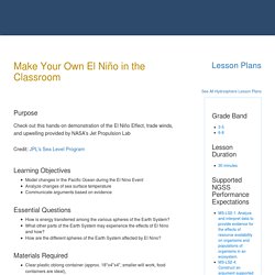
Erika Hoornaert El Nino and La Nina. NOAA SciJinks – All About Weather. Hide SubjectsBrowse by Subject Gallery of Clouds Gallery of clouds back.
NOAA SciJinks – All About Weather. Interactive Weather Maker. NOAA SciJinks – All About Weather. The Short Answer: Gases move from high-pressure areas to low-pressure areas.
And the bigger the difference between the pressures, the faster the air will move from the high to the low pressure. That rush of air is the wind we experience. Wind is a part of weather we experience all the time, but why does it actually happen? The air will be still one day, and the next, powerful gusts of wind can knock down trees. NOAA SciJinks – All About Weather. All clouds are made up of basically the same thing: water droplets or ice crystals that float in the sky.

But all clouds look a little bit different from one another, and sometimes these differences can help us predict a change in the weather. Here’s a list of some of the most common cloud types you might spot in the sky: High Clouds (16,500-45,000 feet) Cirrus Cirrus clouds are delicate, feathery clouds that are made mostly of ice crystals. Cirrostratus Cirrostratus clouds are thin, white clouds that cover the whole sky like a veil. Cirrocumulus Cirrocumulus clouds are thin, sometimes patchy, sheet-like clouds. Mid-level Clouds (6,500-23,000 feet) Altocumulus Altocumulus clouds have several patchy white or gray layers, and seem to be made up of many small rows of fluffy ripples. Altostratus Altostratus clouds are gray or blue-gray mid-level clouds composed of ice crystals and water droplets. Nimbostratus Nimbostratus clouds are dark, gray clouds that seem to fade into falling rain or snow.
NOAA SciJinks – All About Weather. 113 What Is El Niño?

The temperature of the ocean's surface has a far-reaching effect on weather. 119 SciJinks in a Snap: Lightning What is in-cloud lightning? Can it help us predict violent storms? NOAA SciJinks – All About Weather. If you’ve looked at a weather forecast on your TV, computer or phone, you’ve probably seen a weather map that looks something like this: Meteorologists at the National Weather Service use information from ground stations and weather satellites to make these maps.
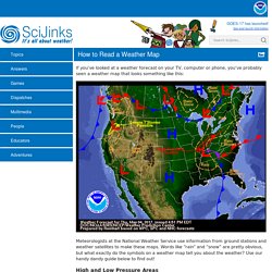
Words like “rain” and “snow” are pretty obvious, but what exactly do the symbols on a weather map tell you about the weather? Use our handy dandy guide below to find out! High and Low Pressure Areas Earth’s atmosphere is a jacket of gases that surrounds the planet. Atmospheric pressure is mainly dependent on two things: the weight of the atmosphere in a specific location and the temperature of the air.
When you're at a low elevation, you experience high atmospheric pressure because more of the atmosphere is pushing down on you. Warm air can also cause the atmospheric pressure to rise. NOAA SciJinks – All About Weather. The Short Answer: Put simply, the Coriolis Effect makes things (like planes or currents of air) traveling long distances around Earth appear to move at a curve as opposed to a straight line.
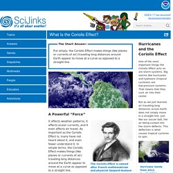
A Powerful “Force” The Coriolis Effect is named after French mathematician and physicist Gaspard-Gustave de Coriolis. It affects weather patterns, it affects ocean currents, and it even affects air travel. As important as the Coriolis Effect is, many have not heard about it, and even fewer understand it. NOAA SciJinks – All About Weather. Set the air temperature (green) and dew point (yellow)in the four different altitudes and see what type of precipitation will fall to the ground.Watch closely.
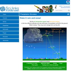
They may even change form as they fall. Legend of symbols: “Precipitation Type" WebApp Courtesy of the Cooperative Institute for Meteorological Satellite Studies (CIMSS), Copyright © 2013 by Tom Whittaker at the University of Wisconsin-Madison. NOAA SciJinks – All About Weather. Wild Weather Adventure!
Watercycle. Interactive Weather Maker. Wild Weather Adventure! Weather Report. 199,208 Plays Game size: Message preview: Someone you know has shared Weather Report - Weather Game game with you: Login to rate activities and track progress.
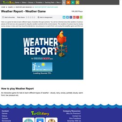
Here is a game for kids to learn different types of weather through symbols. You're smarter than the computer! Loading next level in... You have completed this level. Loading new level in.. Loading Sounds 7% How to play Weather Report An interactive game for kids to learn different types of weather - cloudy, rainy, snowy, partially cloudy, warm front, low pressure etc.