
Blog – Geospatial Historian. By Bailey Clark and Joshua MacFadyen, University of Prince Edward Island October 7, 2020 This lesson will introduce you to a geographic information system (GIS), namely ArcGIS Pro.
By following along with this lesson, you will learn how to add spatial data (maps) and attribute data to the program, and how to assign the latter to geographic locations on the former. Untitled. New, sixth edition of GIS Fundamentals are sold in softback, with access to a digital version included.
Books may be available at a student bookstore, or from XanEdu, via their webpages here. Digital versions are only provided with new copy purchases, and so hardcopy versions are not returnable to Xanedu if the shrink wrapping is removed. If you have questions, contact Patsy Forester, HigherEd@xanedu.com. Instructors may request a desk copy from the book site above. Mapping and GIS for Historians. Urban Network Analysis Toolbox for ArcGIS — City Form Lab. Download Help Forum Source Press The City Form Lab has released a state-of-the-art toolbox for urban network analysis.
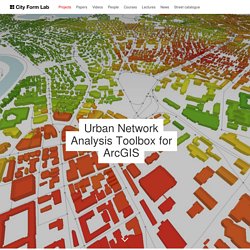
As the first of its kind, the Centrality Tools this ArcGIS toolbox can be used to compute five types of graph analysis measures on spatial networks: Reach; Gravity; Betweenness; Closeness; and Straightness. Redundancy Redundancy Tools additionally calculate the Redundancy Index, Redundant Paths, and the Wayfinding Index. The tools incorporate three important features that make them particularly suited for spatial analysis on urban street networks.
First, they can account for both geometry and topology in the input networks, using either metric distance (e.g. The tools are aimed at urban designers, architects, planners, geographers, and spatial analysts who are interested in studying the spatial configurations of cities, and their related social, economic, and environmental processes. GIS Codes for the County of Holland (1795) - GIS of the Low Countries Dataverse. Welkom bij het QGIS project! Humanities & GIS. Tutorials A Place in History: A Guide to Using GIS in Historical Research Data Archives AHDS: Arts and Humanities Data Service Includes training materials and a large number of case studies in a wide variety of subjects.
HDS: History Data Service A data warehouse located in England. Each data set is accompanied by complete metadata and ordering information. Other Resources Census Data at Stanford Information on how to find and use Census data from 1790 to the present. MapAnalyst - MapAnalyst. WATERS OF ROME: hydraulic infrastructure/aqueducts/fountains/sewers. Aquae Urbis Romae is an interactive cartographic history of the relationships between hydrological and hydraulic systems and their impact on the urban development of Rome, Italy.
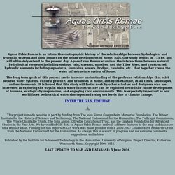
Our study begins in 753 BC and will ultimately extend to the present day. Aquae Urbis Romae examines the intersections between natural hydrological elements including springs, rain, streams, marshes, and the Tiber River, and constructed hydraulic elements including aqueducts, fountains, sewers, bridges, conduits, etc., that together create the water infrastructure system of Rome. The long term goals of this project are to increase understanding of the profound relationships that exist between water systems, cultural practice, and urbanism in Rome, and by its example, in all cities, landscapes, and environments. Published by the Institute for Advanced Technology in the Humanities, University of Virginia.
Home. The HGIS Club - Interdisziplinärer Arbeitskreis Historische Geographische Informationssysteme & Digital Humanities. Home. Has Historical GIS Arrived?: A Review of Toward Spatial Humanities. Published: 31 October 2014 What are "spatial humanities"?
Depending on whom you ask, this evolving term can refer to humanistic research that is explicitly geographical, or based on spatial databases, or uses digital methods to visualize the spatial aspects of human experience. LOKSTAT. - gegevens in oranje zijn aanklikbaar - Welkom op de website Census 1900.
Op deze site vindt u de uitslagen van algemene tellingen die op het einde van de 19de eeuw en het begin van de 20ste eeuw hebben plaatsgevonden. Start_nl. China Historical GIS. Visu beta. The Agas Map. Our new (as of the beginning of 2015) implementation of the Agas Map is based on the OpenLayers 3.0 library.
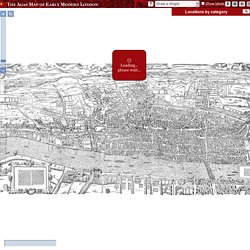
It presents the map as a zoomable, rotatable tiled image with several hundred locations plotted on it. In the default view, the locations are initially hidden; you can show them by checking checkboxes in the navigation panel which appears at the top right of the map. Locations in the navigation panel are sorted into categories; click on a category name to expand it and see all the locations. Some locations appear in more than one category. Zoom in and out using the scroll wheel on your mouse, or the zoom control at the top left. Apart from this, these are the main things you will want to do with the map: Find one or more specific locations and show them This is best done by searching in the navigation panel.
You can also search for a MoEML @xml:id value in the search box, so if you happen to know the id of a location, but not its name, you can find it quickly that way. Geographically-Integrated History. Weblectures Geomatica. Amersfoort op de Kaart. Swisstopo: swisstopo Startseite. Our Town Stories. GeoWeb 4.1.1. Erfgoed in het informatietijdperk. Erfgoed & Locatie. ORBIS: The Stanford Geospatial Network Model of the Roman World. Magis Brugge. MAGIS Kennisplatform - MAGIS. De kaart van Marcus Gheeraerts (1521-1604) is de bekendste en meest gereproduceerde historische kaart van Brugge.
Probleem bij het laden van de pagina. Discover QGIS. The Digitally Encoded Census Information and Mapping Archive. Free GIS Data sources. What Historians Want from GIS. By J.
B. "Jack" Owens An increasing number of historians, particularly those dealing with world history or the history of large geographic regions, are becoming interested in using geographic information systems for research and teaching. Historians are noticing GIS because they normally deal with processes in complex, dynamic, nonlinear systems and, therefore, demand a means to organize a large number of variables and identify those variables most likely implicated in the stability and transformation of such systems. However, GIS remains largely unknown among the vast majority of professional historians, and a significant percentage of those who believe they know about the technology think it is something they can buy with their next car so that they will not become lost.
Great Britain Historical Geographical Information System (GBHGIS) The Great Britain Historical Geographical Information System is a unique digital collection of information about Britain's localities as they have changed over time. Information comes from census reports, historical gazetteers, travellers' tales and historic maps assembled into a whole that is much more than the sum of its parts. This site tells you more about the project itself and about historical GIS. A separate website, created by funding from the UK National Lottery and extended and re-launched with funding from the Joint Information Systems Committee, makes this resource available on-line to everyone, presenting our information graphically and cartographically.
That site is called A Vision of Britain through Time and presents the history of Great Britain through places. It can be found at www.visionofbritain.org.uk. Educatief GIS portaal. Historical GIS. The AAG Historical GIS Forum provides a digital exchange center for historians, geographers, and other humanities scholars to network with each other and discuss pressing research needs and topics, such as: Challenges facing historical GIS work Best practices in GIS-based historical research Key technical issues and how to resolve them Data consistency and comparability issues Theoretical and conceptual issues in approaches to incorporating geographical data into historical research projects AAG members and non-members alike are encouraged to participate in the Forum.
If you are already an AAG member, or have attended AAG annual meetings, you may use your userID and password to subscribe to the forum. If you do not have a userID and password, you may create one here. To join the dialogue, please click here. GIS Manual: Georeferencing Images and CAD Data. Maps & GIS: useful websites. GIS and remote-sensing – University of Reading. This page includes a list of internet resources where data (including both vector mapping data and raster remote sensing data) can be obtained for inclusion in a Geographical Information System (GIS) or use with image processing software. The list has been divided into sites which allow free download of data (including sites where the University has a subscription e.g. Digimap) and ones where purchase is necessary. If data for a particular country is required, it may also be worth checking out the national survey organisation as they may have data available for purchase.
Open Source GIS. Historical gazetteer of London before the Great Fire - Cheapside; parishes of All Hallows Honey Lane, St Martin Pomary, St Mary le Bow, St Mary Colechurch and St Pancras Soper Lane. Accueil - Atlas historique de Paris. Gazetteer of Sixteenth Century Florence. FLORENTINE RENAISSANCE RESOURCES: Online Gazetteer of Sixteenth Century Florence home information object index index of streets, etc grid map full map Grid Map of Numbered Squares hide grid Brown University | STG Copyright: R. B. Mapping Medieval Chester: Mapping Medieval Chester: place and identity in an English borderland city c.1200-1500. DECIMA: The Digitally Encoded Census Information and Mapping Archive, and the Project for a Geo-Spatial and Sensory Digital Map of Renaissance Florence.
Home. [Amsterdam] — Amsterdam. Spatial History Project. The Spatial History Project at Stanford University, a part of the Center for Spatial and Textual Analysis (CESTA), is made possible by the generous funding of the Vice Provost for Undergraduate Education (VPUE), DoResearch, The Andrew W. Mellon Foundation, and The Wallenberg Foundation Media Places Initiative. The Spatial History Project at Stanford University is a place for a collaborative community of students, staff, and scholars to engage in creative spatial, textual and visual analysis to further research in the humanities.
Historical GIS Research Network. This list is not exhaustive but we aim to include all of the major historical GIS websites plus additional relevant websites. LOCATING LONDON'S PAST. Locating London's past: a geo-referencing tool for mapping historical and archaeological evidence, 1660-1800. Locating London´s Past has created an intuitive GIS interface that enables researchers to map and visualize textual and artefactual data relating to seventeenth and eighteenth-century London against a fully rasterised version of John Rocque´s 1746 map of London and the first accurate modern OS map (1869-80).
More than this, it makes these data and maps available within a Google Maps container, allowing for the analysis of the data with open source visualization tools. The interface is readily expandable to include additional data sets and maps (both modern and historic). Building on the partnerships created through the JISC funded Connected Histories project, and through a new collaboration with the Museum of London Archaeological Service (MOLA), Locating London´s Past has produced a working GIS-enabled public web environment that allows existing electronic historical data about London to be repackaged and organised around space. The project incorporates four elements.
ArcGIS. Urban Historical GIS Projects in Canada. A Place in History. Welkom op de HisGIS site! — HisGIS.