

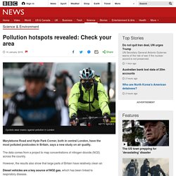
Pollution hotspots revealed: Check your area. Image copyright Getty Images Marylebone Road and Hyde Park Corner, both in central London, have the most polluted postcodes in Britain, says a new study on air quality.
The data comes from a project to map concentrations of nitrogen dioxide (NO2) across the country. However, the results also show that large parts of Britain have relatively clean air. Diesel vehicles are a key source of NO2 gas, which has been linked to respiratory disease. While this study only concentrates on NO2 pollution, scientists advise that high concentrations of NO2 are generally a good indication that other pollutant types may also be present. You can see what air quality is like in your area by entering your postcode in the search below. Sorry, your browser does not support this tool How polluted is your street? Source: MappAir100 by EarthSense If you cannot view the postcode search, please click here to reload the page. Five ways to avoid pollution. Gentrification. Europe's most densely populated square kilometres – mapped.
Unicef_Urban_Population_Map. The 100 million city: is 21st century urbanisation out of control? The 1960 street map of Lagos, Nigeria, shows a small western-style coastal city surrounded by a few semi-rural African villages.
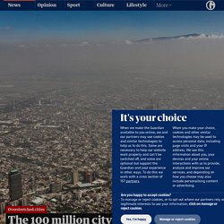
Paved roads quickly turn to dirt, and fields to forest. There are few buildings over six floors high and not many cars. No one foresaw what happened next. In just two generations Lagos grew 100-fold, from under 200,000 people to nearly 20 million. Today one of the world’s 10 largest cities, it sprawls across nearly 1,000 sq km. Revealed: London is the most unequal place in the UK - Sky News. Bill Gates - As counterintuitive as it may seem,... 7 Billion People, One Planet. Can Everyone’s Needs Be Met? Life expectancy in Britain has fallen so much that a million years of life co... Buried deep in a note towards the end of a recent bulletin published by the British government’s statistical agency was a startling revelation.
On average, people in the UK are now projected to live shorter lives than previously thought. In their projections, published in October 2017, statisticians at the Office for National Statistics (ONS) estimated that by 2041, life expectancy for women would be 86.2 years and 83.4 years for men. China's Shanghai sets population at 25 million to avoid ‘big city disease’ China’s financial hub of Shanghai will limit its population to 25 million people by 2035 as part of a quest to manage “big city disease”, authorities have said.
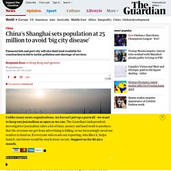
The State Council said on its website late on Monday the goal to control the size of the city was part of Shanghai’s masterplan for 2017-2035, which the government body had approved. “By 2035, the resident population in Shanghai will be controlled at around 25 million and the total amount of land made available for construction will not exceed 3,200 square kilometres,” it said. Urbanisation and prosperity.
Explicit cookie consent. STANDING in a corridor on the fifth floor of a tower block on the Aylesbury estate in south London is a miserable experience.

The wind whips along unending concrete walls that are uniformly grey and permanently damp (though the occasional vomit stain provides a splash of colour). The stairwells reek of urine and cheap disinfectant and the smell of decaying rubbish wafts from the disposal chutes. Cleaning up and repainting hardly seems likely to make a difference, except perhaps to provide a blank canvas for the next gang of graffiti artists. World population day in numbers. Five maps that quantify exactly how rammed London is. 100 Women: Football offers girls a shield in Brazil's violent favelas. Image copyright Gustavo Oliveira/WBR Photo Life in the favelas, home to almost a quarter of Rio's population, is hard.

Brazil's favelas are a battleground between heavily armed drug gangs and the police. The death toll is high, and residents fear being caught in the crossfire. On average, one Rio resident is hit by a stray bullet every seven hours. A Lane Over and a World Apart. More bikes on the road is a good thing.
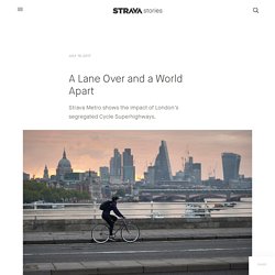
It means less cars, less noise, less pollution, and for those of us commuting on two wheels, it means consistent travel times and a couple fresh-air intermissions between work and home. Getting more bikes on the road however isn’t as easy as just painting lines on the pavement and calling it a day. The drone video that sums up global inequality.
It’s surprising how looking at something from a new angle can change people’s perspectives.
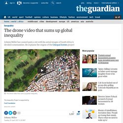
When I began the Unequal Scenes project a year ago, I had no idea that flying a drone over the townships, gated communities and golf courses of South Africa could make such an impact. Even the angle of these images seems important. People tell me the shots that look vertically down (the “nadir view”), without any horizon, are the most impactful.
Maybe it’s the heightened contrast, or maybe it’s the other-worldly feeling of detachment this view offers. Looking down from a height of several hundred metres, incredible scenes of inequality come into sharp focus. Driving from the airport in Cape Town, where I live, to the city centre, one passes densely-packed townships bordered by four-lane motorways and high wire fences that act as impenetrable barriers to human interaction. Awesome urbanisation map. Animated Map: The 20 Most Populous Cities in the World by 2100. InspireMore - This is so powerful!