
Geospatial World Forum
It is the most premium global platform for geospatial community and offers the best opportunity for learning, sharing, connecting, branding and networking with senior decision makers associated with geospatial world.
Research and Innovation Conference & Exhibition 2016 - Dublin. 2017 Excellence and Innovation Awards for Latest Geospatial Application, Technology and Policy Implementation. Location Intelligence, Analytics and Technology to empower your business - Geospatial World Forum 2017. "Get access to the most pertinent connections!

" Location is a fundamental factor in business. A number of recent studies have revealed that an average of 75 to 80 per cent of a business enterprise is identifiable via location. Seimar on Geospatial for Climate Change & Disaster Management - Using Remote Sensing, GIS, UAVs and Drones. Geospatial Information Empowering Disaster Preparedness, Response & Mitigation It is a well-known fact that Asia Pacific is the world's most disaster prone region.
In just the past decade, 40 percent of the global natural disasters happened in Asia Pacific, costing the loss of half a million lives, with additional 1.4 billion people affected. These disasters have caused economic damage of more than half a trillion dollars during the same period. UN-ESCAP predicted that if the current trends are to continue, by 2030, annual losses in the region will average 160 billion dollars per year. Governments need to rethink its approach to disasters—rather than focusing on response, greater attention should be paid to adaptation, mitigation and preparedness. GeoSmart Asia 2016 Conference - Kuala Lumpur, Malaysia - GIS, LiDAR, UAVs. Pleanary Session Topics - Geospatial World Forum 2016. Where's the Money?
[DISRUPTIVE BUSINESS MODELS] Since the past few years, geospatial industry has seen major shift in its business models largely due to global demand of cloud-based and open-interoperable solutions. Geospatial National Mapping Agencies Training Program at Geospatial World Forum 2016. Dates: 25-26 May 2016 Geospatial Information impacts every aspect of human life, underpinning a multitude of systems, software and applications that make modern living more productive, comfortable and connected.
It is crucial for planning, monitoring, management, analysis, decision making and improving overall productivity and efficiency of human living and conducting business for a number of industry verticals such as defence, governance, agriculture, mining, construction, transportation, electricity, water, mining and health. The adoption of geospatial information for various verticals have made capturing, using, integrating and storing of geospatial information much easier, faster and economical. Symposium Sponsor The extent to which geospatial information continues to positively impact society and economy will greatly depend on the strength and initiatives of geospatial content producers and ability of users in utilising the data and solutions. Geospatial Conference for Public Safety, Fire Safty and Emergency Response.
Every day, public safety agencies capture and manage massive amounts of important data.
By merging this geospatially-enabled data with analytics, agencies can pinpoint areas of concern, such as high crime, traffic accidents and disaster-prone areas. Access to large volumes of spatial data is even more important for responders. Geospatial information helps police, fire and emergency medical agencies to act fast, responding to the right place at the right time with the right information. Speakers at GeoBuiz Summit 2016, Maryland, USA. Geospatial Print Magazine and Web Portal for Latest GIS News, Video & Information! Geospatial Business Summit 2016: Business Opportunities in Europe. Geospatial World Forum 2016 : Poster Presenters. Bio Graduate student on department of Civil, Surveying and Geoinformatics Engineering, Technological Educational Institution of Central Macedonia, Serres, Greece.
Interested in Javascript development for geospatial applications concerning: Geospatial Web Services including WPS implementations, 3D Geovisualizations including animation and motion effects on 3D models, Open geospatial standards and open source geospatial software developments. Abstract An HTML tool for exploiting geospatial web services Geospatial web services (GWS) are becoming the dominant technology for data sharing and exchange between geospatial stakeholders.
In the present work we made an attempt to develop a generic end user web interface based on the specifications of selected OGC standards, with the ability to be executed locally as a simple html application. Know more about geospatial industry, business and jobs opportunities. Workshop on CityGML by Oracle - Using 3DCityDB for City Modelling.
CityGML in Practice - Using 3DCityDB on Oracle for City Modelling Date: 26 May 2016 Time: 1130-1300 hrs Target workshop audience GIS Practitioners, Project Managers, IT Architects and anyone interested in creating, maintaining and using 3D City Models Workshop duration 90 minutes.
Workshop on GeoICT by EUROGI: Technical and Societal challenges of Geospatial Policies. Technical & Societal Challenges in Implementation of Selected Policies Seen from a GeoICT Perspective Date: 25 May 2016 Time: 1300-1730 hrs Purpose of the workshop including specific learning objectives The main purposes of the workshop are: To present the EUROGI policy position papers on various topics of vital importance in the emerging future geospatial environment (Big Data, Linked Data, Internet of Things, Open Data, Promoting SMEs, Promoting Sustainable Urban and Regional Development); To facilitate discussion about the papers in the topic areas; To identify how best to promote the policy proposals set out in the papers.
Target workshop audience The main target audiences are policy and decision makers in both the public and private sectors at the European and national levels in particular; Technical people who are directly involved in the various fields covered by the policy position papers. Workshop duration. Geospatial World Forum 2016 - Venue Details. Beurs-World Trade Center Beursplein 37 3011AA Rotterdam The Netherlands Beurs-World Trade Center Rotterdam is the 'epicentre' of international business in the Rotterdam region.
The building's specific qualities, the many facilities and the global successful WTC concept make Beurs-WTC a perfect place for business events. Beurs-WTC Congress & Event Center has received a number of commendable qualifications, such as the highest possible classification, 5 Hammer Congress Accommodation, awarded by the Accredited Congress Company. Also the Gold level of sustainability qualification 'The Green Key' has been achieved. Click here for various options to reach Beurs-World Trade Centre. GeoBuiz Summit 2016: 26-27 April 2016, Maryland, US - Join the Geospatial Leaders' conference! Are you a young professional? Then you should know this! The education and job scenario is changing in the geospatial industry, and young professionals need to be ready for this!
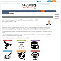
Currently there are variety of education programs related to GIS, Geomatics, Surveying, Remote Sensing, Geoinformatics and GIScience etc. These courses again vary in the kinds of degree they offer – bachelors, masters, professional as full-time, part-time, vocational and online courses. All these ultimately are aimed to lead to the professional development of the student or the young working professionals. Professional development has been a major hurdle in geospatial industry of late is what many education experts in the geospatial industry are saying. There is a change happening in the geospatial profession, in-line with the evolution happening in the industry where that is also making the end both government and private sectors face the change.
We wanted to bring together all those young geospatial professionals, looking forward to be the change. Conference program. GeoBuiz 2016. GeoBuiz 2016 Conference. GeoBuiz Conference 2016: Registration Fees. Speakers at GeoBuiz Summit 2016, Maryland, USA. GeoBuiz Summit 2016: Conference Program Schedule & Agenda. GeoBuiz Summit 2016: 26-27 April 2016, Maryland, US - Join the Geospatial Leaders' conference!
Training Programme for Geospatial Agencies. Training Programme for Geospatial Agencies Dates: 18-21 May Background Many National Geospatial Agencies (NGAs) are taking lead in carrying forward the growth story of their countries, while many others are eager to catch up and leapfrog into becoming active contributors to their societies and economies in more concrete and constructive ways. Download Brochure. Geospatial World Forum 2016 - Contact Us. Accommodation Traffic Plans, Price and Contact Details : Geospatial World Forum 2016. Geospatial World Forum 2016 - Venue Details.
Geospatial World Forum 2016 - Partners. Registration Form : Geospatial World Forum 2016 Amsterdam, The Netherlands. Register May, 2016 23-26 Rotterdam, The Netherlands (Eg: Mr, Mrs, Miss, Dr) Note: The fields marked with (*) are compulsory to be filled. I would like to attend Award Night & Gala Dinner on 25 May 2016 as well Student Regular (Euro 120) Student Speaker (Euro 120) Payment Mode * Important Note: Students are requested to bring their Identity Card. For any registration related queries kindly contact to rajesh@geospatialmedia.net Yes No.
Registration Fee Details - Geospatial World Forum 2016 Exhibition in Amsterdam, The Netherlands. Category Early bird Registration (till 29th February 2016) Regular Registration (1st March– 30th April) Late Registration (1st May onwards) Fee includes. GWF 2016 Exhibition: Develop Your Business with the Industry Leaders by participating in this expo! Once again you have an opportunity to secure a space in the platform where the largest geospatial companies, most active regional industry and many large-scale user organizations from across the globe come together to showcase their products and services. The exhibition will offer your company visibility and exposure to some of the largest and most invested users of the technology from different parts of the world. Geospatial World Forum 2016 exhibition will be THE platform for technologists, service providers and users of this domain to connect with global geospatial community. The event will provide opportunity to reach out and capture brand new customers in this rapidly changing and incredibly vital industry.
Exhibition rate: Category Rate Exhibition Space €400 per sqm SMEs Corner (display space) €2000 Please write to exhibition@geospatialworldforum.org for exhibition proposal and the latest floor plan. Why attend GWF 2016 - The best geospatial event. Speakers at Geospatial World Forum 2016, Rotterdam, The Netherlands. Plenary Speakers. Geospatial Business Exhibition & Summit 2016 Programme Schedule. GWF 2016 - Program Agenda. Guidelines for Submissions of Abstract : Geospatial World Forum 2016. Abstract and workshop proposal submissions are now closed. In case you’re interested to speak at Geospatial World Forum 2016, kindly write to Sarah Hisham at papers@geospatialworldforum.org Guidelines for Submissions of Abstracts It is recommended that the presenting author's contact details are used when submitting the abstract to avoid miscommunication regarding the abstract submission and review process.
All abstracts must be submitted in English Abstracts are limited to 250 words Do not include the abstract title or author information in the body of the abstract. If you have entered a valid email address you will receive a confirmation email confirming receipt of your submission with the access details for your submission. Your abstract will appear on conference website as submitted.
Important Dates. Plenary Speakers. Pleanary Sessions - Geospatial World Forum 2016. Where’s the Money? Geospatial World Forum Rotterdam: GIS Conference 2016 in Netherlands.