
Oceanic Procedures - SLOP - Virtual Norwegian. Strategic Lateral Offset Procedures (SLOP) ATC clearances are designed to ensure that separation standards are continually maintained for all traffic.

However, the chain of clearance definition, delivery and execution involves a series of technical system processes and human actions. Errors are very rare but they do occur. Neither pilots nor controllers are infallible. Gross Navigation Errors (usually involving whole latitude degree mistakes in route waypoints) are made, and aircraft are sometimes flown at flight levels other than those expected by the controller. This procedure provides for offsets within the following guidelines: along a route or track there will be three positions that an aircraft may fly: centreline or one or two miles right; offsets will not exceed 2 NM right of centreline; and offsets left of centreline must not be made.
Distributing aircraft laterally and equally across the three available positions adds an additional safety margin and reduces collision risk. VfrFlight - free VFR flight planner. Start FSX or P3D.

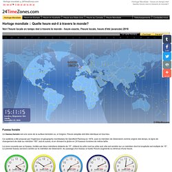
In VfrFlight select option "Connect to FSX/P3D" from menu "Tools". If connection is established, new information text appears in the main window title. At this moment, map will not be centered on your position in flight sim. You need to right click on the map and choose option "Follow FSX/P3D position". If you have more than one simulator installed on your computer, you could need to configure connection according to description in pt.6.2. VATTASTIC => Your looking glass into the world of Vatsim. Heure dans le monde - Horloge mondiale - l'heure locale - L'heure exacte. Voir l’heure locale en temps réel à travers le monde - heure exacte, l'heure locale, heure d'été (avancée) 2016 Fuseau horaire Un fuseau horaire est une zone de la surface terrestre où, à l'origine, l'heure adoptée doit être identique en tout lieu.

Ce système a été proposé par l'ingénieur et géographe montréalais Sir Sandford Fleming en 1876, avec le méridien de Greenwich comme origine des temps, la ligne de changement de date au méridien 180° (est et ouest), et en divisant le globe en 24 fuseaux horaires de même taille. La zone couverte par un fuseau, limitée par deux méridiens distants de 15°, s'étend du pôle nord au pôle sud; elle est centrée sur un méridien dont la longitude est multiple de 15°. Le premier fuseau est donc centré sur le méridien de Greenwich. Temps universel coordonné Le Temps universel coordonné (UTC) est une échelle de temps adoptée comme base du temps civil international par la majorité des pays du globe. Realtime NG - LFML. Navigraph. Fuelplanner - Advanced Fuel Planner for Microsoft Flight Simulator. SimBrief.com - Virtual Dispatching Solutions. Flightradar24. In order to save data consumption Flightradar24 web page times out after 30 minutes.
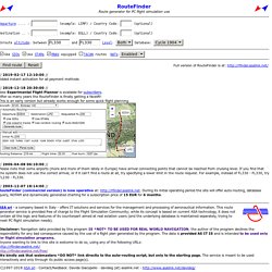
Please reload the web page to get another 30 minutes. or get a Flightradar24 Premium subscription and Flightradar24.com will not time-out again! RadarBox24.com - Airspace Live. Home - vroute premium - ultimate tool for virtual flight planning. VATroute. RouteFinder (free access area) // 2019-02-17 12:10:00 // Added instant activation for all payment methods // 2018-12-18 20:30:00 // New Experimental Flight Planner is available for subscribers.

After so many years the RouteFinder is finally getting a facelift! This is an early version but already works enough for some quick flight planning. // 2006-04-08 06:10:00 // Please note that some airports (more and more of them lately in Europe) have arrival connecting points that cannot be reached from cruising level. If you find that the system does not use the correct arrival, or if it can't find a route at all, try specifying a lower limit in the route request. // 2003-12-07 18:14:00 //RouteFinder (commercial version) is now operative at: During its initial operating period the site will offer auto-routing, database query, NOTAM and dynamically generated charting for a subscription price of 15 EUR for 6 months.
Navigraph.
Landings: Aviation's Databases: Airports: Flight Planning. IFR Route Analyzer. SkyVector: Flight Planning / Aeronautical Charts. NOP Network Operations Portal. EAD Basic - Login Page. GPS Coordinate Converter, Maps and Info. Online GPS Coordinates Converter - Decimal - Sexadecimal.