

Yellowstone Volcano: USGS Reports Deformations And 71 Earthquakes Around The Supervolcano. The United States Geological Survey (USGS) has provided September’s monthly update on the Yellowstone volcano and 71 earthquakes were registered in the area of Yellowstone National Park, which is less than half of the 207 earthquakes reported in August and only slightly less than the 99 earthquakes from July.
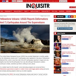
But although Yellowstone’s caldera continues to shake, scientists say there’s nothing to worry about. In a related report by the Inquisitr, some doomsday preppers are concerned that a Yellowstone supervolcano eruption in modern times could trigger global cooling and some are already advising people to stock up on winter supplies. According to the USGS, the current Yellowstone volcano alert level is “normal” and the aviation color code is “green,” indicating that there should not be any expectation of an imminent eruption. Volcano Questions & Answers - Yellowstone National Park. Q: How imminent is an eruption of the Yellowstone Volcano?
A: There is no evidence that a catastrophic eruption at Yellowstone National Park (YNP) is imminent. Current geologic activity at Yellowstone has remained relatively constant since earth scientists first started monitoring some 30 years ago. Though another caldera-forming eruption is theoretically possible, it is very unlikely to occur in the next thousand or even 10,000 years. The most likely activity would be lava flows such as those that occurred after the last major eruption. Such a lava flow would ooze slowly over months and years, allowing plenty of time for park managers to evaluate the situation and protect people. Q: How much advance notice would there be of an eruption? A: The science of forecasting a volcanic eruption has significantly advanced over the past 25 years. Yellowstone Volcano: 98 Earthquakes Revealed In Latest Report By USGS.
In the latest update of the Yellowstone volcano by the United States Geological Survey (USGS), October registered 98 total earthquakes in the Yellowstone National Park region.
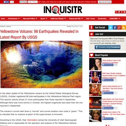
This seismic activity shows 21 more earthquakes than those reported in September. Although there was more activity in October, the highest magnitude was lower than the one reported in September. The volcano’s current alert level is “normal” and current aviation color code is “green.” This is indicates that no massive eruption of the supervolcano is imminent. Yellowstone Update: The Biggest Volcanic Eruption Ever Awaits Mankind. Monitoring Earthquakes in Yellowstone - Yellowstone Park Foundation. Monitoring Earthquakes in Yellowstone During the last several weeks, a series of small earthquakes -- what seismologists call a “swarm” -- rumbled in Yellowstone.
From January 17 to February 8 around 1,800 earthquakes, with a maximum magnitude of 3.8, were recorded in the Park. It is not unusual for Yellowstone to experience one or more earthquakes on a daily basis, but swarms sometimes involve more than 100 small earthquakes in a single day! So who monitors earthquakes in Yellowstone, and what do they have to say about this most recent swarm?
According to the University of Utah, which operates 26 seismograph stations throughout Yellowstone, this earthquake swarm was located about 10 miles northwest of Old Faithful, roughly half-way between Old Faithful and the town of West Yellowstone, Montana (see map here). Volcano Hazards Program - Yellowstone Monitoring: Monitoring.
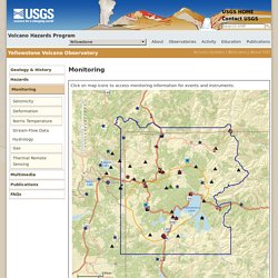
Click on map icons to access monitoring information for events and instruments. = Yellowstone National Park mh Legend Help Help Using This Page Click inside map to enable mouse wheel zoom.
4.8 earthquake rocks US Yellowstone National Park. Recent Earthquakes for Yellowstone. Yellowstone National Park Special Map Click on an earthquake on the above map (or in the list below) for more information.
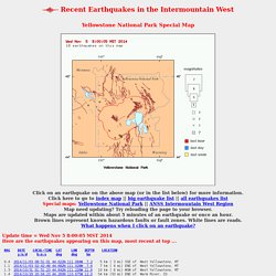
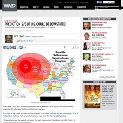
Click here to go to index map || big earthquake list || all earthquakes listSpecial maps: Yellowstone National Park || ANSS Intermountain West Region Map need updating? Try reloading the page to your browser. Maps are updated within about 5 minutes of an earthquake or once an hour. Brown lines represent known hazardous faults or fault zones. Update time = Wed Nov 5 8:00:05 MST 2014 Here are the earthquakes appearing on this map, most recent at top ... MAG DATE LOCAL-TIME LAT LON DEPTH LOCATION y/m/d h:m:s deg deg km. Prediction: 2/3 of U.S. could be devastated. Text smaller Text bigger Yellowstone volcano kill zone Every year, more than 3 million people visit one of America’s most popular tourist attractions, unaware of the tempest that lies just below the surface.
One sign of the tumult occurred this month when oil bubbled up to the surface, damaging a road in Yellowstone National Park, a result of extreme heat from the thermal activity below. “It basically turned the asphalt into soup,” the park spokesman, Dan Hottle, told USA Today. Volcano Hazards Program Yellowstone Volcano Observatory. Videos help make sense of seismic data and the history of geologic research at YellowstoneOctober 21, 2014 YVO staff contributed to a new USGS video entitled: "An Illustrated Guide to Reading a Seismogram.
" This off-beat video provides a short, introductory lesson on how the seismic plots are generated and the potential sources for "signals" on a seismogram. If you're looking for additional insight on Yellowstone geology, three video interviews were added in September. USGS Video Producer Steve Wessells conducted interviews with some of the key USGS scientists who unlocked the secrets to Yellowstone's volcanic and geothermal history. Bob Christiansen, Patrick Muffler and Bob Fournier reminisce about their early careers working at Yellowstone in the 1960s and 1970s. FAQ About a New Ash Distribution Model Applied to Yellowstone EruptionAugust 27, 2014 The likelihood of a volcanic supereruption from Yellowstone, or any other location on Earth, remains very low in any given year, yet the U.S.