

A memorial and a name - Archivists are racing to identify every Jewish Holocaust victim. SIMONE MARIENBERG, a five-month-old baby, had been born in Saint-Martin-Vésubie, a hilly village in France.
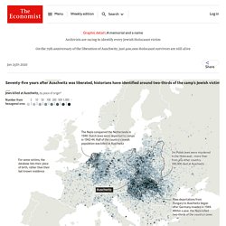
Salomon Ieoyda, who was close to 90, came from Thessaloniki in Greece. At least 40 members of the Horovitz family arrived from Hajduhadhaz in Hungary. There were more than 9,300 Davids and 14,400 Esthers. The 1.1m people killed at Auschwitz, an extermination camp in occupied Poland, were born as far away as Finland and Morocco. La Première Guerre mondiale en un documentaire interactif. A global guide to the first world war - interactive documentary. Pourquoi Arendt s’est trompée sur le cas Eichmann ou la formation d’un génocidaire - Le blog de… #Histoire #Shoah #génocide #Eichmann #Arendt #philosophie #mal #banalité_du_mal #nazisme #antisémitisme #sionisme #bureaucratie #management #administration #logistique #technocratie Avant de rejoindre le NSDAP et la SS en 1932 à l’âge de seulement 26 ans, à une époque où ce dynamique parti passe encore pour "respectable", c’est un beau jeune homme plein d’avenir, qui a eu un parcours tout à fait honorable comme représentant de commerce pour une société pétrolière.

Il doit d’ailleurs cet emploi à de la famille juive par alliance qui le recommandent auprès d’employeurs juifs qui prendront bien soin de lui. Eichmann fréquentera aussi jusqu’en 1931 un bon ami juif, il n’y a donc aucune trace à l’origine de haine pathologique ou de ressentiment à l’égard des Juifs. Il est politisé de manière assez conventionnelle pour son milieu au sein d’une droite nationaliste, conservatrice et relativement antisémite. L'extermination des Juifs. An illustrated history of the Hiroshima and Nagasaki nuclear bombings - Washington Post.
Versailles 1919/1920 : la paix manquée (2ème partie) - Jean-Pierre Rissoan. I.

LES TRAITES ET L'ILLUSION DE LA PAIX (1ère partie)Versailles 1919/1920 : la paix manquée (1ère partie) a. Une nouvelle géographie de l'Europe : La carte de 1914 / la carte de 1924 b. II. A. 1. 2. 87,545,000 Germans in Europe - Cornell University Library Digital Collections: Persuasive Maps: PJ Mode Collection. Holocaust and Related Maps — United States Holocaust Memorial Museum. The Museum’s mapping initiatives overlay key Holocaust sites and historical content from the Museum’s collections on Google Earth and other maps to enable visitors to explore Holocaust history.
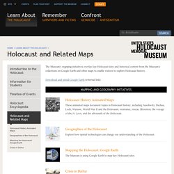
Download and install Google Earth (external link) Mapping and Geography Initiatives Holocaust History Animated Maps These animated maps document topics in Holocaust history, including Auschwitz, Dachau, Lodz, Warsaw, World War II and the Holocaust, resistance, rescue, liberation, the voyage of the St. 1914-1919 : L'étonnant itinéraire d'un Suisse au service de la France. Crazy illustrated 1914 #Europe.
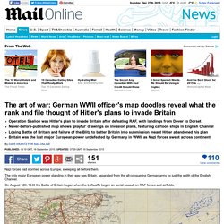
WWII map doodles reveal what rank and file thought of Adolf Hitler's plans. Nazi forces had stormed across Europe, sweeping all before them.
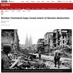
Verdun 1916 @Ed_Tallandier. Découvrez toutes nos cartes d'une bataille de légende vue des deux côtés. Bomber Command maps reveal extent of German destruction. Image copyright AP.
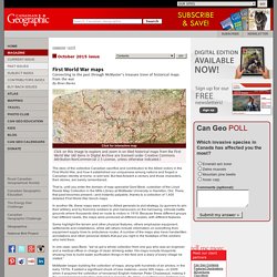
First World War maps - McMaster's map archive. Magazine / oct15 October 2015 issue Connecting to the past through McMaster's treasure trove of historical maps from the war By Brian Banks Click for interactive map.
Serial mapper sur Twitter : "War resources (1940) Les enfants juifs de FRANCE déportés de juillet 1942 à août 1944. Retour sur les origines du génocide des Arméniens. For King and Country John Henry Cartwright's Gallipoli campaign 1914-1915. This Map Shows the Full Extent of the Devastation Wrought by U-Boats in World War I. It was a foggy morning as Captain William Turner navigated the RMS Lusitania through the final and most precarious leg of its voyage from New York City to Liverpool, England.
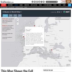
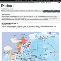
On May 7, 1915, the British ocean liner had just entered the German-declared “unrestricted submarine warfare” zone, which deemed any ship, even civilian and merchant ones, fair game for attack while within its borders. Turner, however, seemed more worried about the foreboding weather conditions overhead than any covert underwater offensive. LegendesCartographie sur Twitter : "La guerre en Asie et dans le Pacifique prenait fin il y a 70 ans. Retrouvez nos cartes dans le n°413 de L'Histoire. Asie-Pacifique, la guerre de quinze ans. L'invasion de la Mandchourie en 1931 marque le début de l'expansion du Japon qui le mène jusqu'aux Philippines.
First World War in maps. The story of D-Day, in five maps. On June 6, 1944, the Allied forces launched Operation Overlord, better known as D-Day, in which it sent tens of thousands of troops across the English Channel to invade Normandy and begin the assault to liberate Nazi-occupied Western Europe.
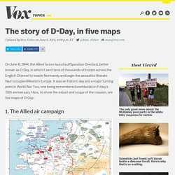
It was an historic day and a major turning point in World War Two, one being remembered worldwide on Friday's 70th anniversary. The Holocaust in Contemporary Maps. © Harrie Teunissen Leiden/Bad Arolsen May-July 2013 Harrie Teunissen and his partner John Steegh are map-collectors from Leiden in Holland. Their jointly build up collection of some 9500 maps and 1300 atlasses and travel guides, mostly from 1750 – 1950, focuses on water management, city development, ethnic relations and military conflicts.
They organise exhibitions based on this collection, like ‘The Balkans in maps, five centuries of struggle about identity’ (Leiden University Library 2003).