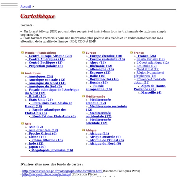


http://www.histgeo.ac-aix-marseille.fr/ancien_site/carto/
Related: Scuola • CARTES • Cartes • S.Moisan - Enseigner en HG-EMC • Image Cliparts BrushesGoogle Apps and sites Sites and Apps for Education Mappe Concettuali, Aggregatori di lezioni, Repository Thinglink Mindomo Blendspace Pearltrees OpenStreetMap Where is this? Reverse Directions Welcome to OpenStreetMap! OpenStreetMap is a map of the world, created by people like you and free to use under an open license. Hosting is supported by UCL, Bytemark Hosting, and other partners. Norkart Virtual Globe load and start page This page loads and starts a Virtual Globe with the following parameters: The Virtual Globe requires Java 1.5 or better installed on your computer, testing for Java: Your browser doesn't tell if you have Java installed or not. You can try to click here to start the Virtual Globe. If it doesn' work you should try to download and install Java first. Your browser may ask what to do with a file of type application/x-java-jnlp-file, you should specify that it should be opened by the program javaws.
Mutations des systèmes productifs en France - vol. 54 / 1-2 Sylvaine Fassier-Boulanger Des vignerons de plus en plus engagés dans des pratiques durables : l’exemple alsacien Mutations in the wine industry in France Daniel Ricard Mutations of productive systems in France: The case of bovine dairy channels Dalila Messaoudi Industrial relocation and the mutations in French production systems Antoine Grandclément Competitiveness clusters: innovation networks and production system Teva Meyer The French electronuclear industry: geographical dynamics of a privileged production system. Die französische Kernindustrie: Geographische Dynamik eines privilegierten Produktionssystems. Patricia Lejoux Companies and energy transition: the mobilities at stake in suburban areas of the french city of Lyon Die Unternehmen und der Energiewende - das Problem der Mobilität in Lyon Stadtnahen Räume.
Europe Map with Countries, Map of Europe, European Countries Map Europe HistoryEurope was first inspired by the Classical Greek culture of the 8th-century B.C.It had a powerful influence on the Roman Empire that spread to Northern and Mediterranean Europe. The Romans had a profound impact on the growth of rich culture and architecture. After the collapse of Roman Empire in the west, Byzantine Empire emerged and survived (285-1450) in the east. In Western Europe, several tribal groups assumed power, giving rise to small kingdoms. The geography of Western Europe went through a change.The Viking Age continued in Northern Europe from 8th to 13th centuries.The European colonial period, which spanned from the 16th to the mid-20th century, saw European powers establishing colonies in Asia, Africa, and the Americas.The European colonial era came to an end with revolts in Africa, India, and the Middle East.The two World Wars caused a severe damage to Europe both financially and demographically.
free.onlinemapfinder Please read carefully: By checking the box and clicking the button, you agree to install the OnlineMapFinder Homepage & New Tab and to receive future updates or upgrades released including for performance and compatibility purposes. Your use is governed by the End User License Agreement. You can uninstall the program at any time. Your information will be collected, used and disclosed in accordance with our Privacy Policy. Access Earth map street view, map street views, Florida state map with cities, maps of Texas with cities and more streetmaps. OpenStreetMap Where am I? Welcome to OpenStreetMap! OpenStreetMap is a map of the world, created by people like you and free to use under an open license. Hosting is supported by UCL, Bytemark Hosting and Imperial College London, and other partners.
ClipArt ETC: Free Educational Illustrations for Classroom Use Alphabets The Alphabets ClipArt collection offers 1,193 illustrations arranged in 43 galleries including decorative letters and numerals, complete alphabet sets, and several sign language systems. If you are looking… American History and Government The American History and Government ClipArt collection offers 2,513 illustrations arranged in 26 galleries. The images range from exploration and Colonial America, to the American Revolution and Civil… Google Street View – Explore natural wonders and world landmarks Zhoucun Ancient Town Zhoucun ancient commercial town now is national AAAA level tourism scenic spot, cradle land of Lushang culture, demonstration base of national culture industry, provincial level key cultural relic protection unit, provincial level civilized scenic spot, provincial level patriotic education base and one of top ten film shooting bases in Shandong. The total area of planning scenic spots is 4.92 sq.m, having protection area, control area and transition area.
Relief Map i Hans Braxmeier, Donaustraße 13, 89231 Neu-Ulm, mail@braxmeier.de Intention Three Geography Games Based on Google Maps and Google Earth One of the things that I emphasize to students before they embark on any kind of research or problem-solving task is to take a good long look at the information that they already have before them. To that end, I'll often request that they construct a list of what they know about a topic or problem before they begin to search. Playing one of the following three Google Maps-based games is a fun way to reinforce the concept of using prior knowledge and observations. GeoGuessr is an addictive geography game that is based on the Google Maps Street View imagery. When you visit GeoGuessr you can choose to play as a single player or you can register to challenge another player. The game is played the same way whether you choose single player or challenge mode.